Find the best fishing spots near you

Fishbrain’s interactive map and 20M+ logged catches help you discover hidden fishing gems near you. Search by location or target specific species—start reeling in your next big catch today!

Loading...
Loading...
Loading...
Loading...
A video showcasing how to find the best fishing spots in the Fishbrain app
Map

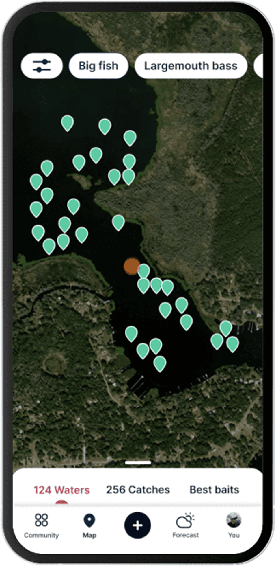
Map with fishing spots

Find fishing spots near you with Fishbrain’s interactive crowd-sourced map

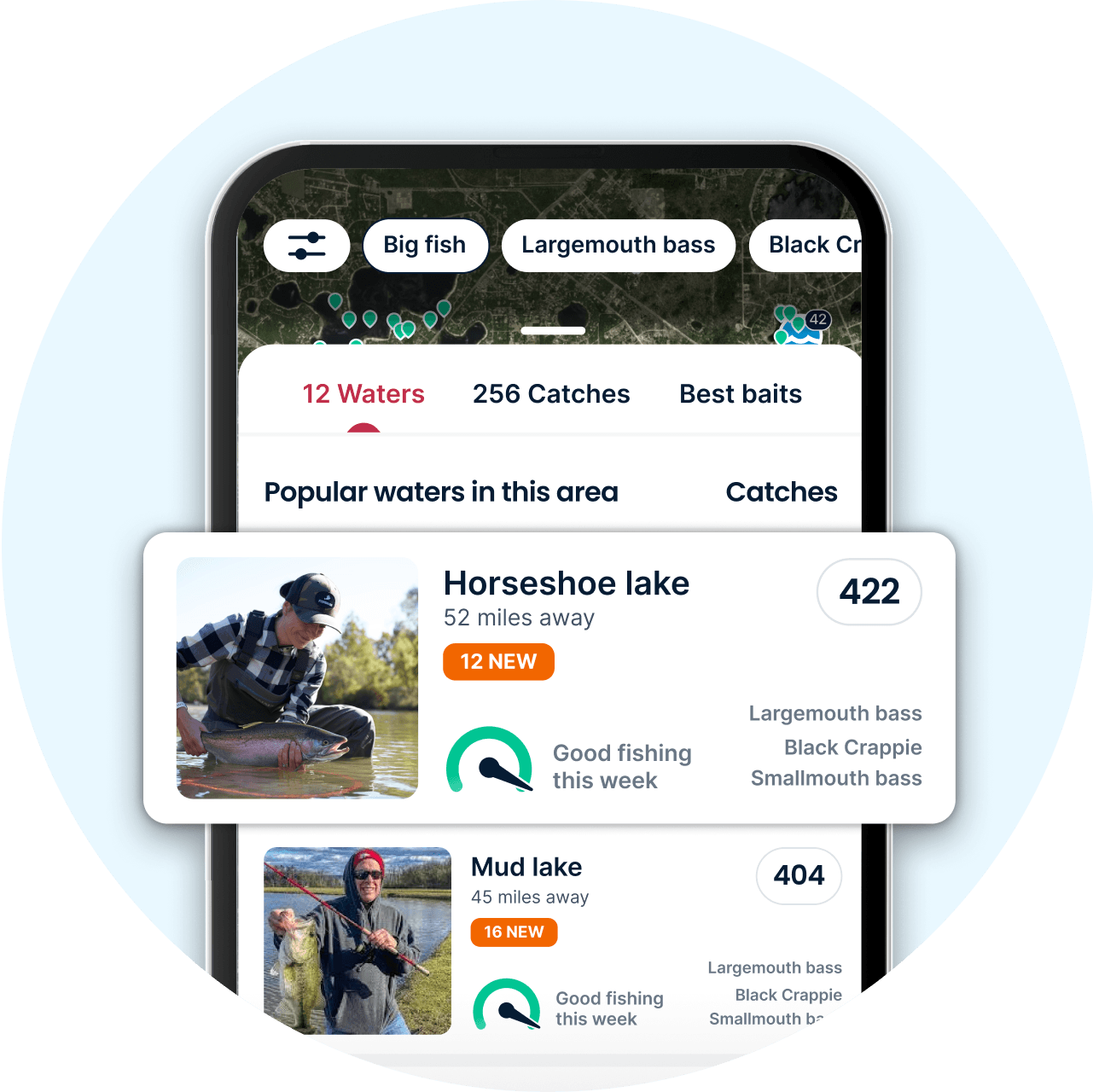
Top waters in the Fishbrain app

Top waters

Thousands of lakes, ponds, and rivers are in the palm of your hand on Fishbrain. We provide you with an intuitive list of waters sorted by distance, making it easy to find new fishing waters. You can then sort through these waters with a species filter to help narrow your search.

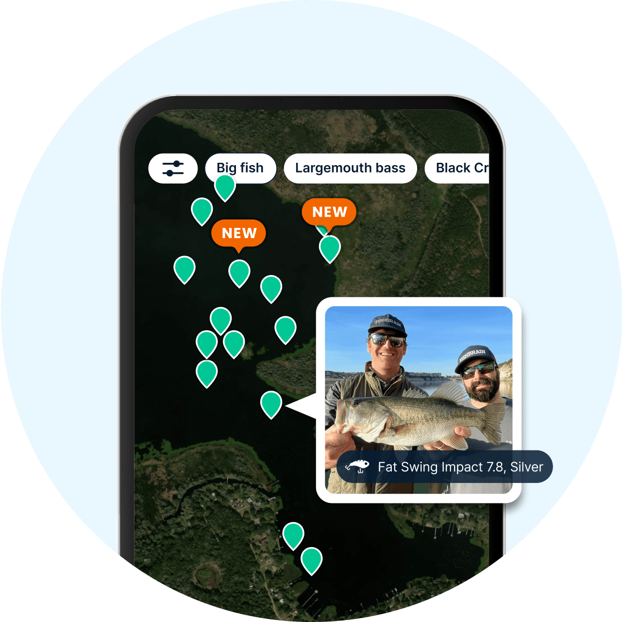
Catch locations in the Fishbrain app

Catch locations

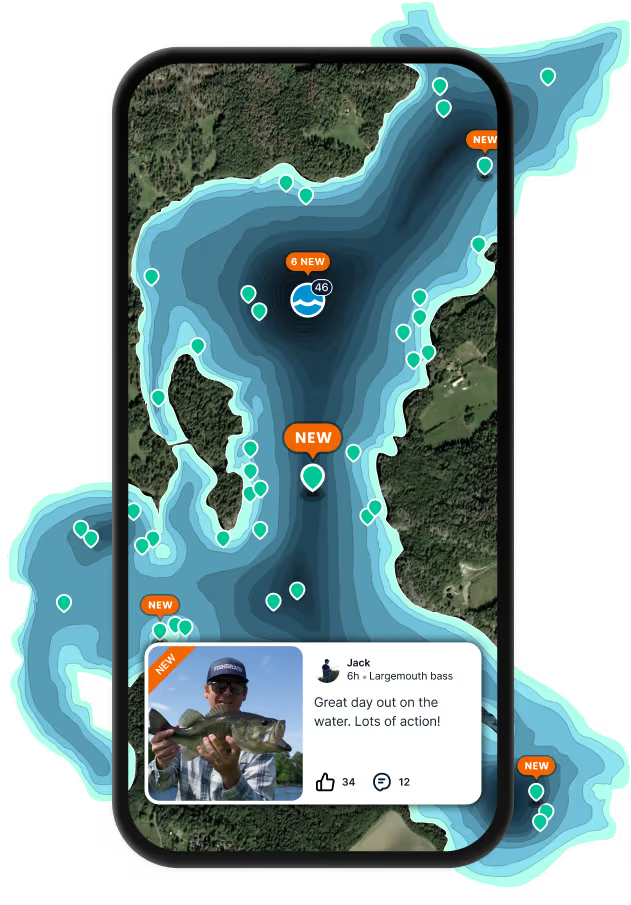
When scrolling through the map, you can navigate any water by checking the locations where Fishbrain members have successfully landed fish. Fishbrain members have the choice of sharing their catches publicly this way or keeping them private. Tap on a public location marker to quickly bring up a catch photo and catch details, like baits used, techniques, weather patterns, and more.

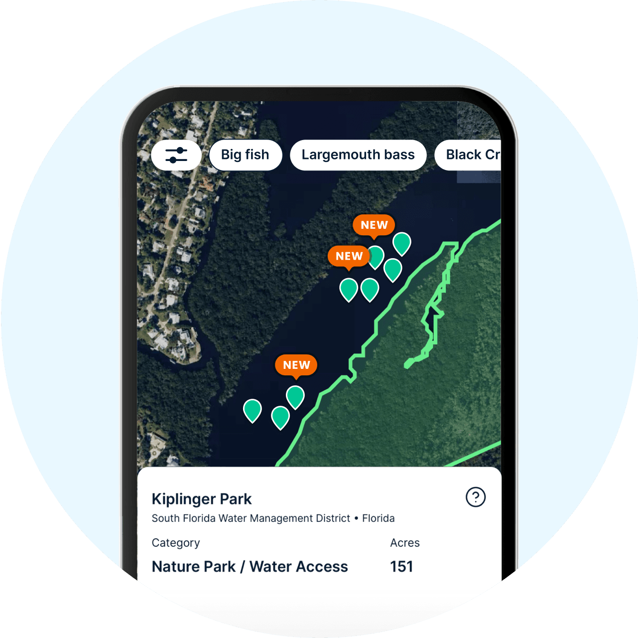
Fishing spot details in the Fishbrain app

Fishing access

A fishing spot is only great if you can legally access it. Our Parks and Government Lands layer shades areas that are federal, state, or city-owned and that could offer public access to water.

Big fish and species filters in the Fishbrain app

Big fish and species filters

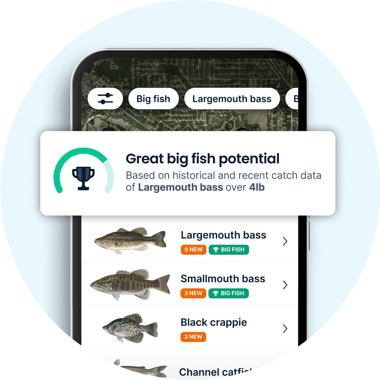
Looking for a specific species? Or maybe you’re after a new personal best. Either way, you can filter your water lists to only show the species you are after, or waters with the greatest potential to hold trophy-sized fish.

Top fish species

Loading...
Loading...Loading...Loading...Loading...Loading...
Loading...Loading...
Loading...
Loading...
Loading...
Loading...
Loading...
Loading...

Top fishing spots in the US

Fishing spots FAQ

How do I find fishing spots near me?

Open the Fishbrain map to see thousands of lakes, ponds, and rivers sorted by distance, built from more than 20 million logged catches. Filter by species or big-fish potential to narrow it down, then layer in more detail to zero in further: Garmin depth maps for structure, a private land layer, Spot Prediction for undiscovered water, and clusters of exact catch locations once you've found a promising spot. Each water also shows recent catches and a live-updated rating of how good the fishing is predicted to be right now. Most of these layers are Fishbrain Pro features.
Can I see which species are available in a specific fishing spot?

Yes. Each water has a list of species that have been caught there, ranked by number of catches logged, so you can see what's most common before you arrive.

How do I filter fishing spots by species and habitat?

Use the species filter on the map to narrow results to trout, bass, redfish, or any species logged in that area — useful whether you're bank fishing, in a kayak, or targeting a specific type of water. Species filtering is a Fishbrain Pro feature.

Does Fishbrain tell me if a spot requires a fishing license, and what the regulations are?

Yes to both. In all US states, Fishbrain shows that a license is required and links to where to buy one, and you can check regulations like size limits, bag limits, and season rules for a specific species at that water.

What's the advantage of a crowdsourced fishing map over a static one?

Most fishing map apps show fixed structure — depth, contours, terrain — the same information regardless of when or where fish are actually biting. Fishbrain's map layers that same structure with more than 20 million real, community-logged catches, so you can see where fish are actually being caught right now, not just where they theoretically could be.

Can I use Fishbrain to plan a trip to a new or unfamiliar area, including cities and coastlines?

Yes. Search any location — urban ponds and rivers included — sort nearby waters by distance, and check recent catches and species lists before you go, so you're not scouting blind on arrival.

Can I see satellite imagery or contour data to scout a spot in more detail?

Yes — Fishbrain offers multiple map layers, including an actual satellite image view and Garmin depth maps for contour and structure detail. Switch between them on the map to get the fullest picture before you go.

How can I visualize historical catch density on a specific lake?

With Fishbrain Pro, exact catch locations show as individual pins on the map, so you can see at a glance where catches cluster on a specific lake — a practical way to spot historical hotspots without separate mapping software.

App Section
Download Fishbrain and fish smarter
Unlimited access to the best fishing spot finder in the game. Get all the fishing intel you need to start catching more, and bigger, fish.

Free trial available