Map

Dyer Cove

Fishing spots, fishing reports, and regulations in

Maine, United States

5.0·17 catches

Top fish species at Dyer Cove

App Section

Check which species have trophy potential in Dyer Cove

Dyer Cove fishing reports

Loading...

Atlantic pollock

15 in · 2 lb

Loading...

Acadian Redfish

8 in · 5 oz

Loading...

Atlantic pollock

length · weight

Loading...

Atlantic pollock

20 in · 3 lb

Loading...

Atlantic pollock

length · weight

Loading...

Atlantic pollock

length · weight

Fishbrain
More catches in the app...

Continue browsing catches and catch locations in the Fishbrain app

Loading...
Loading...
Loading...

General info

Dyer Cove is a part of an ocean located in Cumberland County, Maine, United States. It is most popular for fishing Atlantic pollock, Striped bass, and Atlantic bluefin tuna.

Location

43°34′1.9″N 70°11′51.4″W
Directions

When are Striped Bass biting on Dyer Cove?

Learn what time of year and day to go fishing at Dyer Cove. Download Fishbrain today to look for new fishing spots, scout new fishing access, or prep for your next trip.

Bite time image

Fishing regulations at Dyer Cove, ME

Disclaimer: Always check local fishing regulations, water access rights and land ownership before fishing, regardless of any catches logged in that area by the Fishbrain community. Fishbrain has mapped millions of acres of government-owned land across the USA to help you identify potential fishing access, but you are responsible for ensuring compliance with all legal requirements.

Fishing regulations in Maine can change throughout the year. Make sure to check this page before fishing for the most up to date rules and regulations for the current season. Local regulations govern when you can fish, the max size of the fish you can keep, how many fish you can keep, and more.

Regulations for top species
Season open: year-round
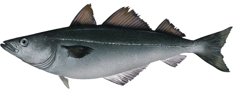
Atlantic pollock

Atlantic pollock

Regulation boundaryMaine State Waters
Additional information
No size or bag limit in Maine territorial waters. Federal Regulations may differ! To see Federal regulations tap "See Federal Regs" button below the image above.
Edibility
Very good
Synonyms
Pollachius virens
Season open: year-round
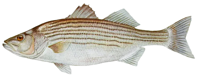
Striped bass

Striped bass

Regulation boundaryMaine State Waters
Bag limit1

The maximum number of individual fish legally harvested per harvester per day. Bag limits are only for properly licensed anglers actively harvesting the species. People who are not actively harvesting or are not properly licensed (if a license is required) may NOT be counted for the purpose of bag limits.

Min size28" (Total Length)

No person shall harvest any individual fish less than the minimum size limit.

Total length means the straight line distance from the most forward point of the head with the mouth closed, to the farthest tip of the tail with the tail compressed or squeezed, while the fish is lying on its side.

Max size31" (Total Length)

No person shall harvest any individual fish greater than the maximum size except as permitted.

Total length means the straight line distance from the most forward point of the head with the mouth closed, to the farthest tip of the tail with the tail compressed or squeezed, while the fish is lying on its side.

Restrictions & requirements

NJ No Gaff

It is prohibited for any person to gaff striped bass when fishing recreationally.

Hook & Line Only

Allowable gear: hook and line.

Additional information
Hook and line only, no gaffing of striped bass.No bait allowed when using treble hooks.It is unlawful to use multiple (more than two) barbed or barbless treble hooks on any artificial lure or fly while fishing for striped bass in territorial waters.It is unlawful to use any hook other than a non-offset circle hook when using bait. Exception: Rubber or latex tube lures may be used without a circle hook as long as they are a minimum of 8 inches long and have a single hook protruding from the end portion of the tubing where bait may be attached.Bait is defined as any marine or freshwater organism live or dead, whole or parts thereof, and earthworms, including but not limited to, night crawlers.Striped bass incidentally caught on any unapproved hook type must be returned to the water immediately without unnecessary injury.For more information, see 2023 Maine Striped Bass Regulations.
Synonyms
Morone saxatilis
Season open: August 13 - August 10
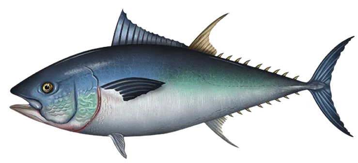
Atlantic bluefin tuna

Atlantic bluefin tuna

Regulation boundaryHighly Migratory Species
Min size27" (Curved Fork Length)

No person shall harvest any individual fish less than the minimum size limit.

Curved fork length means the length of a tuna taken in a line tracing the contour of the body from the tip of the upper jaw to the fork of the tail. The measuring tape must pass over (and touch) the pectoral fin and the caudal keel.

Special gear

HMS Tuna

Anglers with an HMS Angling permit may harvest Bigeye, Albacore, Yellowfin, Skipjack using handline, rod and reel, or speargun. Bluefin tuna may only be harvested using handline or rod and reel (no speargun).

Restrictions & requirements

Gigging

Harvest by gigging prohibited.

Snagging

Harvest of this species by snagging (snatch hooking) is prohibited.

Spears

Harvest of this species by "spearing" is prohibited. Spearing includes the catching or taking of a fish by bow hunting, gigging, spearfishing, or by any device used to capture a fish by piercing the body.

Required licenses
Atlantic Highly Migratory Species Angling Permit
Additional information
27" to <73" curved fork length: open 1. Private vessels with Highly Migratory Species Angling permits: 2 bluefin tuna measuring 27 to <73", of which only 1 may be a large school/small medium bluefin tuna (47 to <73") 2. Charter boats with Highly Migratory Species Charter/Headboat permits, when fishing recreationally: 3 bluefin tuna measuring 27 to <73", of which only 1 may be a large school/small medium bluefin tuna (47 to <73") 3. Headboats with Highly Migratory Species Charter/Headboat permits, when fishing recreationally: 6 bluefin tuna measuring 27 to <73", of which only 1 may be a large school/small medium bluefin tuna (47 to <73") > 73" curved fork length: bag limit = 1 per vessel per year provided the "trophy" category subquota in the respective region is available at the time of harvest (see below). 1. Gulf of Maine: closed 2. Southern New England: closed 3. Trophy South: closed 4. Gulf of America: closed Bluefin tuna retention limits may change throughout the season.Regularly updated information can be found on the Atlantic Bluefin Tuna Recreational Bag Limits webpage (https://www.fisheries.noaa.gov/atlantic-highly-migratory-species/recreational-atlantic-bluefin-tuna-fishery-statuses-and-bag).To confirm current limits, call 1-888-872-8862 or 1-978-281-9260.Anglers must report all recreational bluefin tuna landings. Report all recreational Atlantic bluefin tuna landings to NMFS within 24 hours by calling 1-888-872-8862 or hmspermits.noaa.gov.
Edibility
Excellent
Synonyms
Thunnus thynnus
License Icon
Local laws and licenses

Maine fishing license

Get license

Reviews of Dyer Cove

5.0
Loading...

1 ratings

5
4
3
2
1
Top reviews

Cities nearby

South Portland

6.4 miles away

Portland

8.5 miles away

Scarborough

8.7 miles away

Dunstan

9.6 miles away

Falmouth Foreside

11.6 miles away

Westbrook

11.8 miles away

Falmouth

13.2 miles away

Saco

13.4 miles away

Littlejohn Island

13.8 miles away

Cousins Island

13.8 miles away

Biddeford

14.5 miles away

Gorham

16.1 miles away

Cumberland Center

16.2 miles away

Little Falls

16.2 miles away

South Windham

16.3 miles away

Windham

19.0 miles away

North Windham

21.1 miles away

West Kennebunk

21.9 miles away

Kennebunk

22.1 miles away

Brunswick

25.6 miles away

Steep Falls

26.4 miles away

Lake Arrowhead

27.8 miles away

Sanford

29.7 miles away

Cornish

34.1 miles away

Anything missing or inaccurate?

Suggest changes to improve what we show.

Suggest changes

FAQ about Dyer Cove fishing

📍 Where is Dyer Cove located?
Dyer Cove is a part of an ocean located in Cumberland County, Maine, United States. Its coordinates are:
43°34′1.9″N 70°11′51.4″W
.
🎣 Where on Dyer Cove is it best to fish?
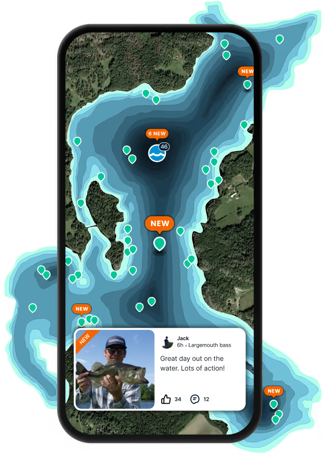
Find the best fishing spots on Dyer Cove by looking at where other anglers have caught fish. This can easily be done in the where it is also possible to see big fish potential and how good fishing is right now along with Garmin® depth maps.
🐟 What species are in Dyer Cove?
The most common species in Dyer Cove are:
📢 What are the latest Dyer Cove fishing reports?
The latest Dyer Cove fishing reports are:
🗓️ What species are in season at Dyer Cove right now?
According to fishing regulations at Dyer Cove, some of the species in season this November include: Black sea bass, Atlantic bluefin tuna, and Haddock. For full details on other species — including bag limits, minimum and maximum size limits, and seasonal closures — download the .
🪪 Do I need a fishing license to fish at Dyer Cove?

Fishing in Maine requires a valid state fishing license for anglers. Licenses include resident and non-resident, annual, short-term, and combination permits, available online or at licensed agents.

In Maine, no fishing license is required for anglers under 16. Residents 70 and older qualify for a discounted license. A few other exceptions worth knowing:

  • Free fishing days — most states designate 1–2 weekends a year where anyone can fish without a license

  • Tribal waters — tribal members fishing on tribal land operate under separate tribal regulations

  • Private ponds — landowners fishing their own water typically don't need a license

Non-residents usually pay more for a license than residents. Some species also require an extra stamp or endorsement on top of your base license.

Get license
App Section
Download Fishbrain and fish smarter
Unlimited access to the best fishing spot finder in the game. Get all the fishing intel you need to start catching more, and bigger, fish.

Free trial available

Loading...
Loading...
Loading...
Loading...