
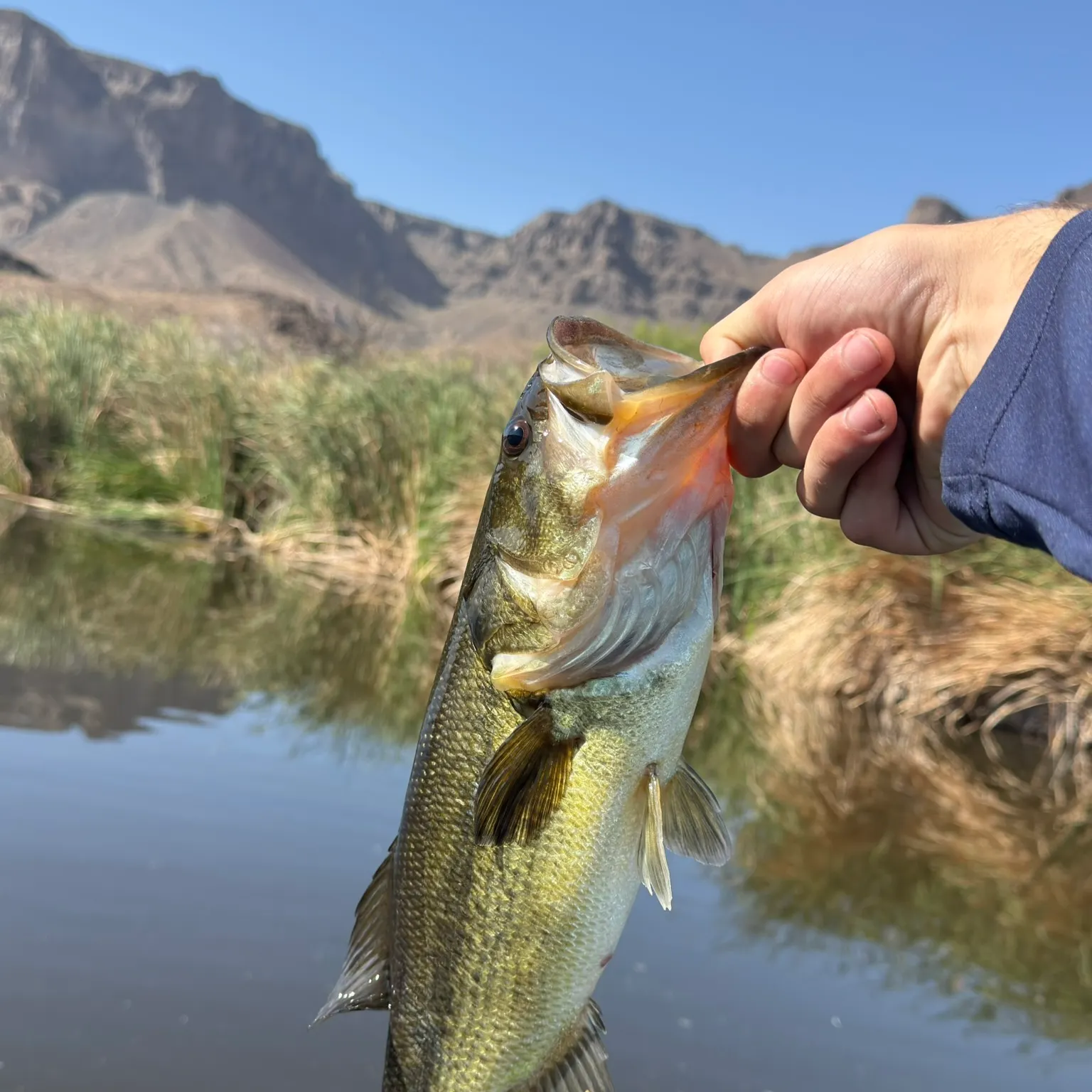
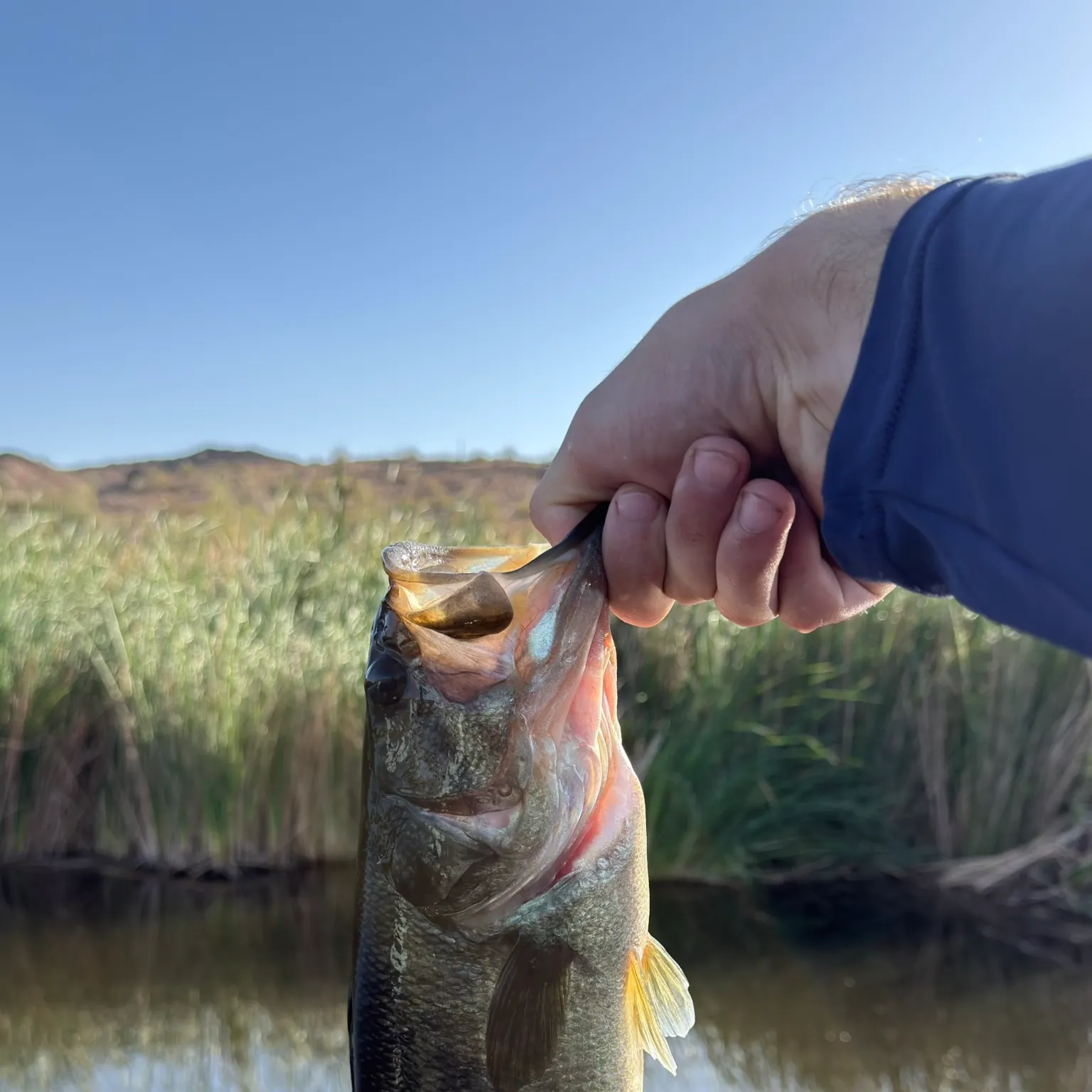
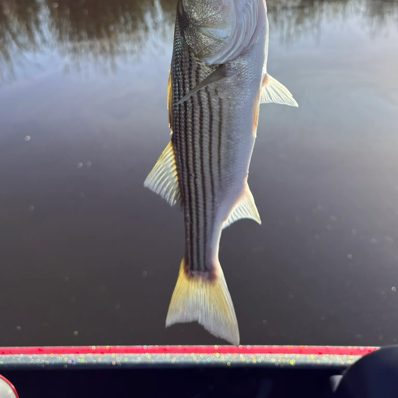
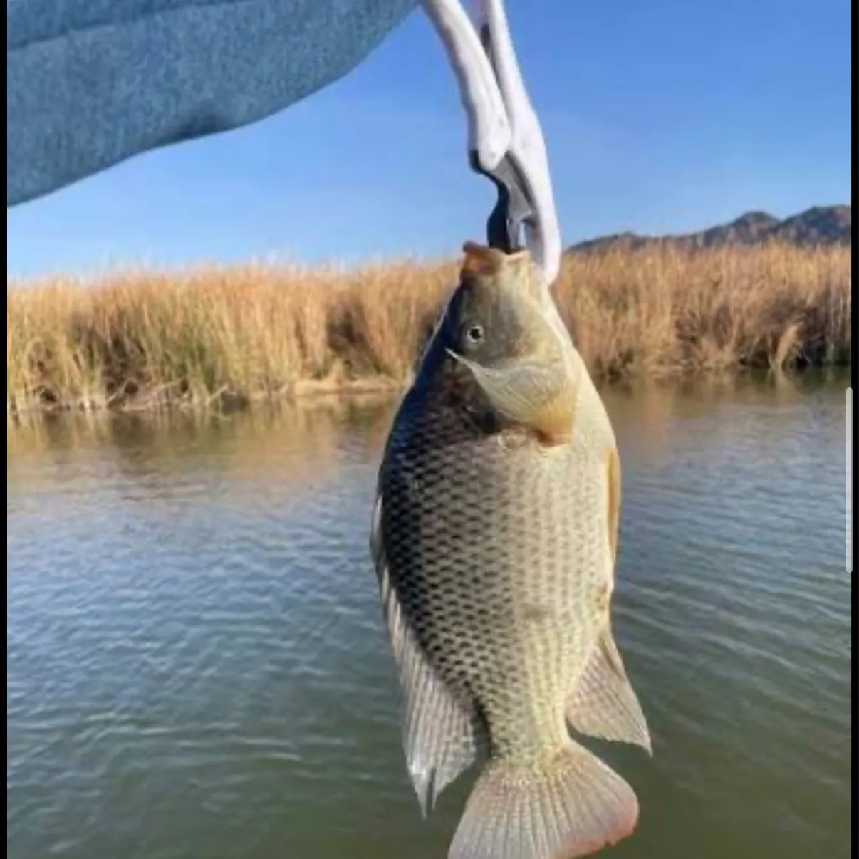
Top fish species at Bill Williams River

Check which species have trophy potential in Bill Williams River
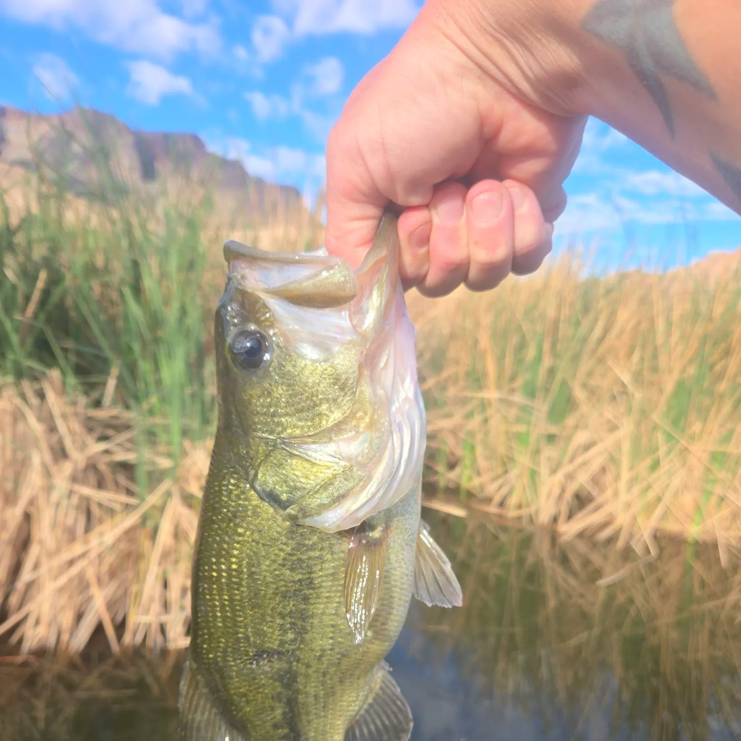
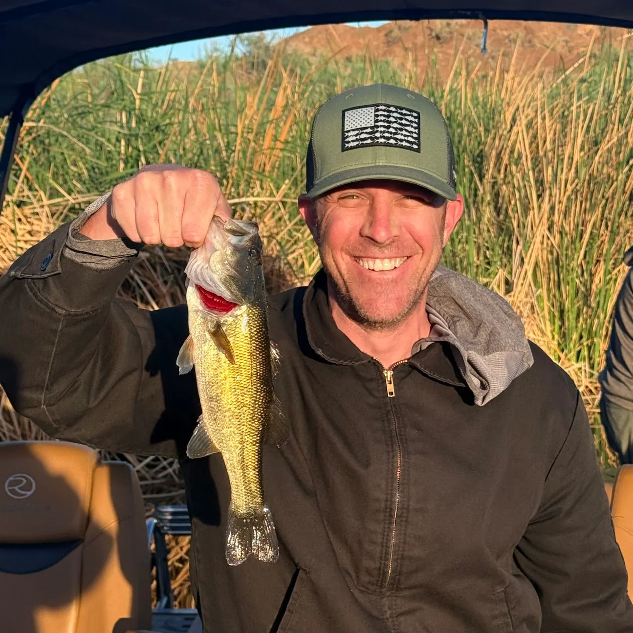
Bill Williams River fishing reports

Continue browsing catches and catch locations in the Fishbrain app
When are Largemouth Bass biting on Bill Williams River?
Learn what time of year and day to go fishing at Bill Williams River. Download Fishbrain today to look for new fishing spots, scout new fishing access, or prep for your next trip.

Fishing regulations at Bill Williams River, AZ
Disclaimer: Always check local fishing regulations, water access rights and land ownership before fishing, regardless of any catches logged in that area by the Fishbrain community. Fishbrain has mapped millions of acres of government-owned land across the USA to help you identify potential fishing access, but you are responsible for ensuring compliance with all legal requirements.
Fishing regulations in Arizona can change throughout the year. Make sure to check this page before fishing for the most up to date rules and regulations for the current season. Local regulations govern when you can fish, the max size of the fish you can keep, how many fish you can keep, and more.
Regulations for top species

Largemouth bass
Bag limit6
The maximum number of individual fish legally harvested per harvester per day. Bag limits are only for properly licensed anglers actively harvesting the species. People who are not actively harvesting or are not properly licensed (if a license is required) may NOT be counted for the purpose of bag limits.
Aggregate limit6
The maximum number of individual fish across an aggregate group of species legally harvested per harvester per day.
Special gear
AZ Methods
Hook and Line Methods• All new fishing and combo licenses allow the angler to fish with two poles or lines simultaneously. In no case are more than two lines allowed to be used at the same time.• "Angling" means the taking of fish by one line and not to exceed two hooks, by one line and one artificial lure, which may have attached more than one hook, or by one line and not to exceed two artificial flies or lures.• Fishing lines must be constantly attended and in immediate control.• The hook, fly or lure must be used in such a manner that the fish voluntarily attempts to take it in its mouth.• A single-pointed barbless hook is a fish hook with a single point, manufactured without barbs on or which barbs have been completely closed or removed. This does not include a treble hook. Regulations limiting tackle to single-pointed barbless hooks do not eliminate the angler's option for simultaneous fishing as defined. Anglers may use a single line with no more than two single hooks, as with a primary hook and a dropper hook or fly.Artificial Flies and Lures• "Artificial flies and lures" means manmade devices intended as visual attractants to catch fish. Artificial flies and lures does not include living or dead organisms or edible parts of those organisms, natural or prepared food stuffs, or chemicals or organic materials intended to create a scent, flavor, or chemical stimulant to the device regardless of whether it is added or applied during or after the manufacturing process.• Check the Special Regulations to determine if hooks must also be single- pointed barbless hook only.Other Fishing Methods• Bow and arrow, crossbow, snare, gig, spear or spear gun, or snagging are valid methods for taking common carp, buffalofish, mullet, tilapia, goldfish, and shad statewide unless a closure or Special Regulation restricts it.• Bow and arrow fishing for catfish (5 catfish daily bag limit, any combination) is valid at Apache Lake, Canyon Lake and Saguaro Lake.Capturing Baitfish and Crayfish for Bait• Live baitfish may be used only in areas approved for certain species.• Live bait may be taken by minnow trap, dip net, cast net, pole and line, handline, crayfish net or seine.• Cast nets shall not exceed a 4-foot radius (or an 8-foot diameter).• Seine nets shall not exceed 10 feet in length and 4 feet in width.• Except for sunfish of the genus Lepomis, the flesh of gamefish may not be used as bait.• Landing nets or dip nets may be used for the capture of legal baitfish or crayfish or only to land a legally hooked fish.• Any unattended traps or devices used to catch or hold aquatic wildlife or fish
Additional information
Edibility
Synonyms
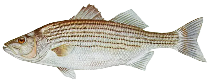
Striped bass
Bag limit10
The maximum number of individual fish legally harvested per harvester per day. Bag limits are only for properly licensed anglers actively harvesting the species. People who are not actively harvesting or are not properly licensed (if a license is required) may NOT be counted for the purpose of bag limits.
Special gear
AZ Methods
Hook and Line Methods• All new fishing and combo licenses allow the angler to fish with two poles or lines simultaneously. In no case are more than two lines allowed to be used at the same time.• "Angling" means the taking of fish by one line and not to exceed two hooks, by one line and one artificial lure, which may have attached more than one hook, or by one line and not to exceed two artificial flies or lures.• Fishing lines must be constantly attended and in immediate control.• The hook, fly or lure must be used in such a manner that the fish voluntarily attempts to take it in its mouth.• A single-pointed barbless hook is a fish hook with a single point, manufactured without barbs on or which barbs have been completely closed or removed. This does not include a treble hook. Regulations limiting tackle to single-pointed barbless hooks do not eliminate the angler's option for simultaneous fishing as defined. Anglers may use a single line with no more than two single hooks, as with a primary hook and a dropper hook or fly.Artificial Flies and Lures• "Artificial flies and lures" means manmade devices intended as visual attractants to catch fish. Artificial flies and lures does not include living or dead organisms or edible parts of those organisms, natural or prepared food stuffs, or chemicals or organic materials intended to create a scent, flavor, or chemical stimulant to the device regardless of whether it is added or applied during or after the manufacturing process.• Check the Special Regulations to determine if hooks must also be single- pointed barbless hook only.Other Fishing Methods• Bow and arrow, crossbow, snare, gig, spear or spear gun, or snagging are valid methods for taking common carp, buffalofish, mullet, tilapia, goldfish, and shad statewide unless a closure or Special Regulation restricts it.• Bow and arrow fishing for catfish (5 catfish daily bag limit, any combination) is valid at Apache Lake, Canyon Lake and Saguaro Lake.Capturing Baitfish and Crayfish for Bait• Live baitfish may be used only in areas approved for certain species.• Live bait may be taken by minnow trap, dip net, cast net, pole and line, handline, crayfish net or seine.• Cast nets shall not exceed a 4-foot radius (or an 8-foot diameter).• Seine nets shall not exceed 10 feet in length and 4 feet in width.• Except for sunfish of the genus Lepomis, the flesh of gamefish may not be used as bait.• Landing nets or dip nets may be used for the capture of legal baitfish or crayfish or only to land a legally hooked fish.• Any unattended traps or devices used to catch or hold aquatic wildlife or fish
Additional information
Synonyms
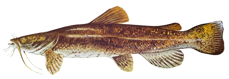
Flathead catfish
Bag limit10
The maximum number of individual fish legally harvested per harvester per day. Bag limits are only for properly licensed anglers actively harvesting the species. People who are not actively harvesting or are not properly licensed (if a license is required) may NOT be counted for the purpose of bag limits.
Aggregate limit10
The maximum number of individual fish across an aggregate group of species legally harvested per harvester per day.
Special gear
AZ Methods
Hook and Line Methods• All new fishing and combo licenses allow the angler to fish with two poles or lines simultaneously. In no case are more than two lines allowed to be used at the same time.• "Angling" means the taking of fish by one line and not to exceed two hooks, by one line and one artificial lure, which may have attached more than one hook, or by one line and not to exceed two artificial flies or lures.• Fishing lines must be constantly attended and in immediate control.• The hook, fly or lure must be used in such a manner that the fish voluntarily attempts to take it in its mouth.• A single-pointed barbless hook is a fish hook with a single point, manufactured without barbs on or which barbs have been completely closed or removed. This does not include a treble hook. Regulations limiting tackle to single-pointed barbless hooks do not eliminate the angler's option for simultaneous fishing as defined. Anglers may use a single line with no more than two single hooks, as with a primary hook and a dropper hook or fly.Artificial Flies and Lures• "Artificial flies and lures" means manmade devices intended as visual attractants to catch fish. Artificial flies and lures does not include living or dead organisms or edible parts of those organisms, natural or prepared food stuffs, or chemicals or organic materials intended to create a scent, flavor, or chemical stimulant to the device regardless of whether it is added or applied during or after the manufacturing process.• Check the Special Regulations to determine if hooks must also be single- pointed barbless hook only.Other Fishing Methods• Bow and arrow, crossbow, snare, gig, spear or spear gun, or snagging are valid methods for taking common carp, buffalofish, mullet, tilapia, goldfish, and shad statewide unless a closure or Special Regulation restricts it.• Bow and arrow fishing for catfish (5 catfish daily bag limit, any combination) is valid at Apache Lake, Canyon Lake and Saguaro Lake.Capturing Baitfish and Crayfish for Bait• Live baitfish may be used only in areas approved for certain species.• Live bait may be taken by minnow trap, dip net, cast net, pole and line, handline, crayfish net or seine.• Cast nets shall not exceed a 4-foot radius (or an 8-foot diameter).• Seine nets shall not exceed 10 feet in length and 4 feet in width.• Except for sunfish of the genus Lepomis, the flesh of gamefish may not be used as bait.• Landing nets or dip nets may be used for the capture of legal baitfish or crayfish or only to land a legally hooked fish.• Any unattended traps or devices used to catch or hold aquatic wildlife or fish
Additional information
Edibility
Synonyms


Free trial available