Top fish species at Holmes Creek

Black crappie
Black crappie
App Section

Check which species have trophy potential in Holmes Creek

Holmes Creek fishing reports

Loading...

Black crappie

length · weight

Loading...

Black crappie

length · weight

Loading...

length · weight

Fishbrain
Have you been fishing here?

Log your catch and check out other catches from the community in the Fishbrain app.

Loading...
Loading...
Loading...

General info

Holmes Creek is a stream located in Clay County, Missouri, United States. It is most popular for fishing Black crappie.

Location

39°18′12.8″N 94°22′49.5″W
Directions

Fishing regulations at Holmes Creek, MO

Disclaimer: Always check local fishing regulations, water access rights and land ownership before fishing, regardless of any catches logged in that area by the Fishbrain community. Fishbrain has mapped millions of acres of government-owned land across the USA to help you identify potential fishing access, but you are responsible for ensuring compliance with all legal requirements.

Fishing regulations in Missouri can change throughout the year. Make sure to check this page before fishing for the most up to date rules and regulations for the current season. Local regulations govern when you can fish, the max size of the fish you can keep, how many fish you can keep, and more.

Regulations for top species
Season open: year-round
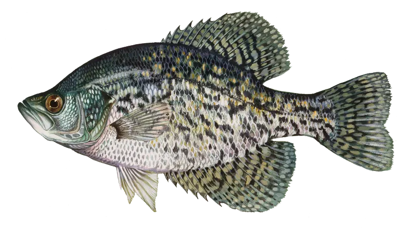
Black crappie

Black crappie

Regulation boundaryMissouri State Waters
Bag limit30

The maximum number of individual fish legally harvested per harvester per day. Bag limits are only for properly licensed anglers actively harvesting the species. People who are not actively harvesting or are not properly licensed (if a license is required) may NOT be counted for the purpose of bag limits.

Aggregate limit30

The maximum number of individual fish across an aggregate group of species legally harvested per harvester per day.

Restrictions & requirements

Gigging

Harvest by gigging prohibited.

Snagging

Harvest of this species by snagging (snatch hooking) is prohibited.

Spears

Harvest of this species by "spearing" is prohibited. Spearing includes the catching or taking of a fish by bow hunting, gigging, spearfishing, or by any device used to capture a fish by piercing the body.

MO Explosives Chemicals Poison Electricity

No one may use any explosive, poison, chemical or electrical equipment to kill or stupefy fish. Such material or equipment may not be possessed on waters of the state or adjacent banks.

MO Hand Fishing

It also is illegal to attempt to take fish by hand, with or without a hook, and to intentionally leave or abandon any commonly edible portion of any fish.

MO Spearguns

Spearguns may not be possessed on unimpounded waters or adjacent banks, and spears may not be propelled by explosives.

Additional information
Bull Shoals LakeLakewide: Ozark and TaneyDaily limit:Crappie: 15 fishLength limit:Crappie: 10" minimumFrom Powersite Dam to Highway 76: Taney Prohibited Methods: Trotlines, throwlines and limb linesFor more information please see Crappie special area restrictions Lake of the OzarksLakewide:Daily limit:Crappie: 15Length limit:Crappie: minimum 9"On the lake and its tributaries:Daily limit:Within 525 feet on the left descending bank and 977 feet on the right descending bank below Truman Dam in the U.S. Army Corps of Engineers' restricted zone:Area note: No fishing is allowed.From the downstream end of the no-fishing zone below Truman Dam to U.S. Highway 65:Prohibited methods: Trotlines, throwlines, limb lines, jug lines, snagging, snaring and grabbing are prohibited.For more information please see Crappie special area restrictions Long Branch LakeDaily limit:Crappie: 15For more information please see Crappie special area restrictions Mark Twain LakeDaily limit: Crappie: 15For more information please see Crappie special area restrictions Montrose LakeDaily Limit:Crappie: 15For more information please see Crappie special area restrictions Norfork LakeLakewide:Daily limit: Crappie: 15Length limit: Crappie: minimum 10"For more information please see Crappie special area restrictions Pomme de Terre LakeLength limits:Crappie: minimum 9"Daily limit:Crappie: 15For more information please see Crappie special area restrictions Smithville LakeDaily limit:Crappie: 30 with no more than 15 fish over nine inches.For more information please see Crappie special area restrictions Stockton LakeLength limits:Crappie: minimum 10"Daily limit:Crappie: 15For more information please see Crappie special area restrictions Table Rock LakeLakewide:Daily limit: Do not continue to snag, snare or grab for any species after taking a daily limit of 2 paddlefish.Crappie: 15Size limit:Crappie: minimum 10"For more information please see Crappie special area restrictions Thomas Hill LakeDaily limitCrappie: 15For more information please see Crappie special area restrictions Truman LakeLakewideDaily limit:Crappie: 15Size limit:Crappie: minimum 9"On the lake and its tributariesProhibited Methods: No person shall continue to snag, snare or grab for any species after taking a daily limit of 2 paddlefish.For more information please see Crappie special area restrictions Wappapello LakeDaily Limit: Crappie: 30 with no more than 15 fish over nine inches.For more information please see Crappie special area restrictions
Edibility
Excellent! Catch, Clean, Cook Black Crappie aka Speckled Perch
Synonyms
Calico bass, Pomoxis nigromaculatus, Speckled Perch
License Icon
Local laws and licenses

Missouri fishing license

Get license

Cities nearby

Kearney

3.7 miles away

Liberty

4.9 miles away

Missouri City

6.1 miles away

Excelsior Springs

7.9 miles away

Holt

10.7 miles away

Gladstone

11.4 miles away

Smithville

12.0 miles away

Lawson

12.7 miles away

Sibley

13.0 miles away

Orrick

15.0 miles away

Independence

15.0 miles away

Ferrelview

15.2 miles away

Buckner

15.5 miles away

Kansas City

15.5 miles away

Rayville

17.1 miles away

Lathrop

17.9 miles away

Plattsburg

18.5 miles away

Elmira

18.6 miles away

Edgerton

19.1 miles away

Camden

20.4 miles away

Richmond

21.9 miles away

Turney

23.3 miles away

Gower

24.2 miles away

Polo

24.9 miles away

Anything missing or inaccurate?

Suggest changes to improve what we show.

Suggest changes

FAQ about Holmes Creek fishing

📍 Where is the Holmes Creek located?
the Holmes Creek is a stream located in Clay County, Missouri, United States. Its coordinates are:
39°18′12.8″N 94°22′49.5″W
.
🎣 Where on the Holmes Creek is it best to fish?
Find the best fishing spots on the Holmes Creek by looking at where other anglers have caught fish. This can easily be done in the where it is also possible to see big fish potential and how good fishing is right now along with Garmin® depth maps.
🐟 What species are in the Holmes Creek?
The most common species in the Holmes Creek are:
📢 What are the latest Holmes Creek fishing reports?
The latest Holmes Creek fishing reports are:
🪪 Do I need a fishing license to fish at the Holmes Creek?

Fishing in Missouri requires a valid state fishing license for anglers. Resident and non-resident annual and short-term licenses are available online or from licensed vendors.

In Missouri, no fishing license is required for anglers under 16 or residents 65 and older. A few other exceptions worth knowing:

  • Free fishing days — most states designate 1–2 weekends a year where anyone can fish without a license

  • Tribal waters — tribal members fishing on tribal land operate under separate tribal regulations

  • Private ponds — landowners fishing their own water typically don't need a license

Non-residents usually pay more for a license than residents. Some species also require an extra stamp or endorsement on top of your base license.

Get license
App Section
Download Fishbrain and fish smarter
Unlimited access to the best fishing spot finder in the game. Get all the fishing intel you need to start catching more, and bigger, fish.

Free trial available

Loading...
Loading...
Loading...
Loading...