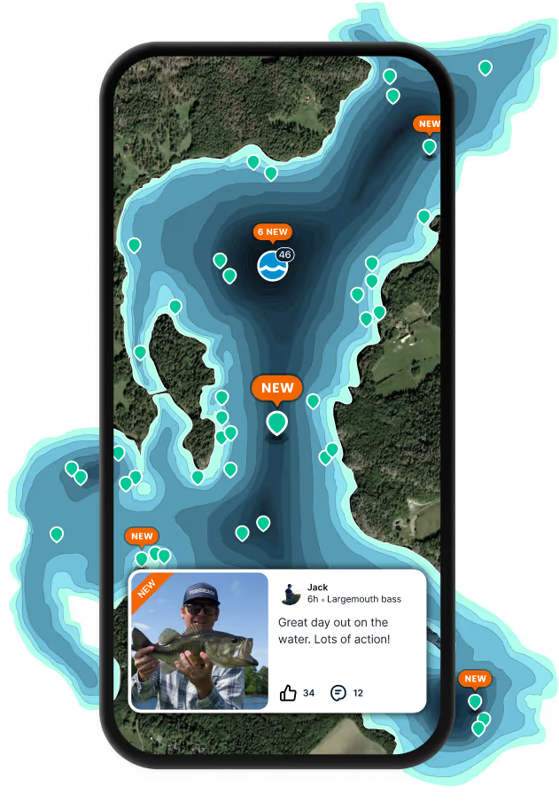
Top fish species at Oaklimeter Creek

App Section

Check which species have trophy potential in Oaklimeter Creek

Oaklimeter Creek fishing reports

Loading...

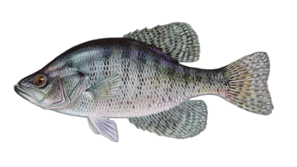
White crappie

length · weight

Loading...

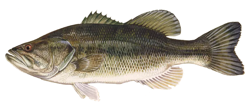
Largemouth bass

length · weight

Loading...

White crappie

length · weight

Loading...

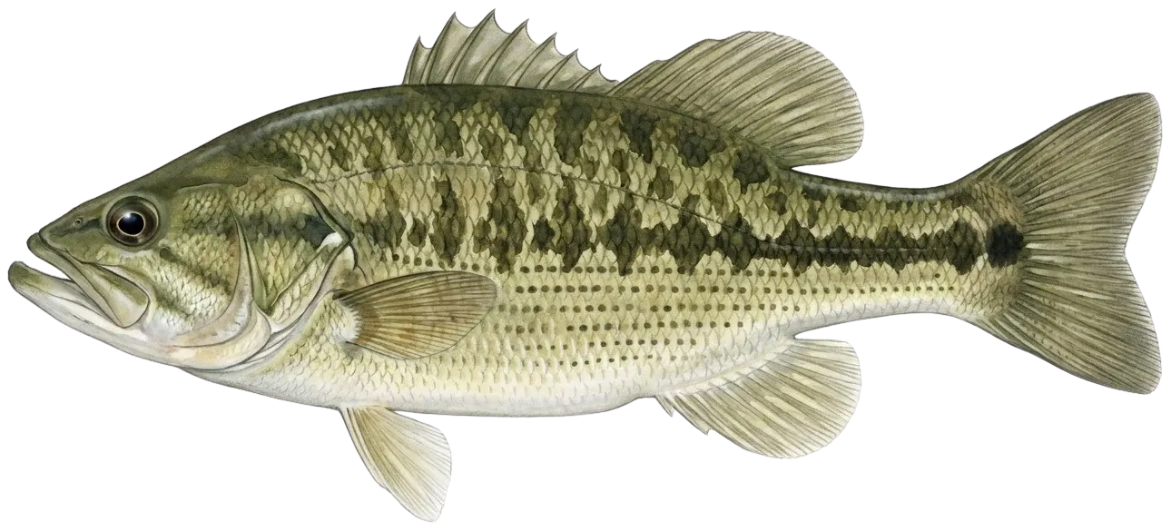
Spotted bass

length · weight

Fishbrain
More catches in the app...

Continue browsing catches and catch locations in the Fishbrain app

Loading...
Loading...
Loading...

General info

Oaklimeter Creek is a stream located in Marshall County, Mississippi, United States. It is also intersecting with Benton County, Mississippi. It is most popular for fishing White crappie, Spotted bass, and Largemouth bass.

Location

34°38′33.2″N 89°18′37.6″W
Directions

When are Largemouth Bass biting on Oaklimeter Creek?

Learn what time of year and day to go fishing at Oaklimeter Creek. Download Fishbrain today to look for new fishing spots, scout new fishing access, or prep for your next trip.

Bite time image

Fishing regulations at Oaklimeter Creek, MS

Disclaimer: Always check local fishing regulations, water access rights and land ownership before fishing, regardless of any catches logged in that area by the Fishbrain community. Fishbrain has mapped millions of acres of government-owned land across the USA to help you identify potential fishing access, but you are responsible for ensuring compliance with all legal requirements.

Fishing regulations in Mississippi can change throughout the year. Make sure to check this page before fishing for the most up to date rules and regulations for the current season. Local regulations govern when you can fish, the max size of the fish you can keep, how many fish you can keep, and more.

Regulations for top species

Season open: year-round
White crappie

White crappie

Regulation boundaryMississippi State Waters
Bag limit30

The maximum number of individual fish legally harvested per harvester per day. Bag limits are only for properly licensed anglers actively harvesting the species. People who are not actively harvesting or are not properly licensed (if a license is required) may NOT be counted for the purpose of bag limits.

Additional information
No statewide minimum size limit. The following waterbodies have modified size and creel limits for crappie (combined black crappie and white crappie): Arkabutla Lake; Tate County: 12-inch minimum size; creel limit = 15 crappie; Charlie Capps WMA Lake; Bolivar County: no minimum size; creel limit = 20 crappie; Eagle Lake; Warren County: 11-inch minimum size; creel limit = 30 crappie; Enid Lake; Yalobusha, Lafayette, and Panola Counties: 12-inch minimum size; creel limit = 15 crappie; Grenada Lake; Grenada, Calhoun and Yalobusha Counties: 12-inch minimum size; creel limit = 15 crappie; Lake Okhissa; Franklin County: 10-inch minimum size; creel limit = 10 crappie; Lake Washington; Washington County: 11-inch minimum size; creel limit = 30 crappie; Lake Monroe; Monroe County: no minimum size; creel limit = 20 crappie; Lake Mary Crawford; Lawrence County: no minimum size; creel limit = 15 crappie; Choctaw Lake; Choctaw County: 12-inch minimum size; creel limit = 10 crappie; Moon Lake; Coahoma County: 10-inch minimum size; creel limit = 30 crappie; Pickwick & Tenn-Tom Waterway (including all tributaries) Pickwick Lake to Aliceville Lock & Dam: 9-inch minimum size; creel limit = 30 crappie; Percy Quin State Park; Pike County: no minimum size; creel limit = 20 crappie; Sardis Lake; Lafayette, Marshall, and Panola Counties: 12-inch minimum size; creel limit = 15 crappie; Spillways of Arkabutla To Prichard Road Bridge, Enid To I-55, Grenada To Hwy. 51, Sardis and Sardis Lower Lake To Spaulding Creek: no minimum size; creel limit = 15 crappie; Trace State Park; Lee County: no minimum size; creel limit = 20 crappie. Creel limits for black bass, bream, crappie, striped bass, and striped bass hybrids in waters touched by the state boundary (border waters) shall be that of the adjacent state, or the Mississippi limit, whichever is greater.
Edibility
Excellent
Synonyms
Black Crappie, Pomoxis, Pomoxis annularis, Pomoxis nigromaculatus, White Crappie
Season open: year-round
Spotted bass

Spotted bass

Regulation boundaryMississippi State Waters
Bag limit10

The maximum number of individual fish legally harvested per harvester per day. Bag limits are only for properly licensed anglers actively harvesting the species. People who are not actively harvesting or are not properly licensed (if a license is required) may NOT be counted for the purpose of bag limits.

Aggregate limit10

The maximum number of individual fish across an aggregate group of species legally harvested per harvester per day.

Additional information
No statewide minimum size limit. Slot Length Limit: all fish on or between the slot length must be returned to the water immediately upon capture and may not be in possession on the designated waters. All fish shorter than the lowest length limit and all fish longer than the highest length limit may be kept not to exceed the legal daily creel limit. The following waterbodies have modified size and creel limits for black bass (i.e., largemouth, spotted, and smallmouth bass): Aberdeen Lake; Monroe County: 14-inch minimum size; creel limit = 10 black bass; Charlie Capps WMA Lake; Bolivar County: no minimum size; creel limit = 5 black bass; Columbus Lake; Lowndes, Monroe, and Clay Counties: 14-inch minimum size; creel limit = 10 black bass; Choctaw Lake; Choctaw County: slot length 16 to 20-inches; creel limit = 10 black bass (1 over 20-inches); Davis Lake; Chickasaw County: slot length 18 to 22-inches; creel limit = 10 black bass (1 over 22-inches); Eagle Lake; Warren County; 16-inch minimum size; creel limit = 10 black bass; Lake Bill Waller; Marion County: slot length 18 to 22-inches; creel limit = 15 black bass (1 over 22-inches); Lake Bogue Homa; Jones County: 15-inch minimum size; creel limit = 5 black bass; Lake Calling Panther; Copiah County: 20-inch maximum size; creel limit = 10 black bass (1 over 20-inches); Lake Claude Bennett; Jasper County: no minimum size; creel limit = 30 black bass; Lake Jackson; Washington County: no minimum size; creel limit = 5 black bass; Lake Jeff Davis; Jeff Davis County: slot length 18 to 24-inches; creel limit = 15 black bass (1 over 24-inches); Lake Lamar Bruce; Lee County: slot length 18 to 24-inches; creel limit = 10 black bass (1 over 24-inches); Lake Mary Crawford; Lawrence County: slot length 16 to 22-inches; creel limit = 10 black bass (1 over 22-inches); Lake Monroe; Monroe County: slot length 18 to 24-inches; creel limit = 10 black bass (1 over 24-inches); Lake Okhissa; Franklin County: slot length 18 to 22-inches; creel limit = 10 black bass (1 over 22-inches); Lake Washington; Washington County: 15-inch minimum size; creel limit = 5 black bass; Leroy Percy State Park; Washington County: no minimum size; creel limit = 5 black bass; Malmaisson WMA Lakes; Grenada County: 15-inch minimum size; creel limit = 2 black bass; Moon Lake; Coahoma County: no minimum size; creel limit = 5 black bass; Natchez State Park; Adams County: slot length 18 to 22-inches; creel limit = 7 black bass (1 over 22-inches); Neshoba County Lake; Neshoba County: slot length 16 to 20-inches; creel limit = 10 black bass (1 over 20-inches); North Abutment Campground Lake at Grenada; Grenada County: 15-inch minimum size; creel limit = 2 black bass; Pascagoula River; George and Jackson Counties: 12-inch minimum size; creel limit = 10 black bass; Paul B. Johnson State Park; Forrest County: slot length 18 to 22-inches; creel limit = 10 black bass (1 over 22-inches); Percy Quin State Park; Pike County: slot length 16 to 22-inches; creel limit = 7 black bass (1 over 22-inches); Pickwick Lake; Tishomingo County: 15-inch minimum size; creel limit = 10 black bass; RecCon Lake; Bolivar County: no minimum size; creel limit = 2 black bass; Ross Barnett Reservoir; Madison, Rankin, Leake, Hinds, and Scott Counties: 14-inch maximum size; creel limit = 7 black bass; Trace State Park; Lee County: slot length 14 to 22-inches; creel limit = 10 black bass (1 over 22-inches); Wolf/Broad Lake; Yazoo and Humphreys Counties: 12-inch maximum size; creel limit = 5 black bass. Creel limits for black bass, bream, crappie, striped bass, and striped bass hybrids in waters touched by the state boundary (border waters) shall be that of the adjacent state, or the Mississippi limit, whichever is greater.
Edibility
Very good
Synonyms
Micropterus punctulatus
Season open: year-round
Largemouth bass

Largemouth bass

Regulation boundaryMississippi State Waters
Bag limit10

The maximum number of individual fish legally harvested per harvester per day. Bag limits are only for properly licensed anglers actively harvesting the species. People who are not actively harvesting or are not properly licensed (if a license is required) may NOT be counted for the purpose of bag limits.

Aggregate limit10

The maximum number of individual fish across an aggregate group of species legally harvested per harvester per day.

Additional information
No statewide minimum size limit. Slot Length Limit: all fish on or between the slot length must be returned to the water immediately upon capture and may not be in possession on the designated waters. All fish shorter than the lowest length limit and all fish longer than the highest length limit may be kept not to exceed the legal daily creel limit. The following waterbodies have modified size and creel limits for black bass (i.e., largemouth, spotted, and smallmouth bass): Aberdeen Lake; Monroe County: 14-inch minimum size; creel limit = 10 black bass; Charlie Capps WMA Lake; Bolivar County: no minimum size; creel limit = 5 black bass; Columbus Lake; Lowndes, Monroe, and Clay Counties: 14-inch minimum size; creel limit = 10 black bass; Choctaw Lake; Choctaw County: slot length 16 to 20-inches; creel limit = 10 black bass (1 over 20-inches); Davis Lake; Chickasaw County: slot length 18 to 22-inches; creel limit = 10 black bass (1 over 22-inches); Eagle Lake; Warren County; 16-inch minimum size; creel limit = 10 black bass; Lake Bill Waller; Marion County: slot length 18 to 22-inches; creel limit = 15 black bass (1 over 22-inches); Lake Bogue Homa; Jones County: 15-inch minimum size; creel limit = 5 black bass; Lake Calling Panther; Copiah County: 20-inch maximum size; creel limit = 10 black bass; Lake Claude Bennett; Jasper County: no minimum size; creel limit = 30 black bass; Lake Jackson; Washington County: no minimum size; creel limit = 5 black bass; Lake Jeff Davis; Jeff Davis County: slot length 18 to 24-inches; creel limit = 15 black bass (1 over 24-inches); Lake Lamar Bruce; Lee County: slot length 18 to 24-inches; creel limit = 10 black bass (1 over 24-inches); Lake Mary Crawford; Lawrence County: slot length 16 to 22-inches; creel limit = 10 black bass (1 over 22-inches); Lake Monroe; Monroe County: slot length 18 to 24-inches; creel limit = 10 black bass (1 over 24-inches); Lake Okhissa; Franklin County: slot length 18 to 22-inches; creel limit = 10 black bass (1 over 22-inches); Lake Washington; Washington County: 15-inch minimum size; creel limit = 5 black bass; Leroy Percy State Park; Washington County: no minimum size; creel limit = 5 black bass; Malmaisson WMA Lakes; Grenada County: 15-inch minimum size; creel limit = 2 black bass; Moon Lake; Coahoma County: no minimum size; creel limit = 5 black bass; Natchez State Park; Adams County: slot length 18 to 22-inches; creel limit = 7 black bass (1 over 22-inches); Neshoba County Lake; Neshoba County: slot length 16 to 20-inches; creel limit = 10 black bass (1 over 20-inches); North Abutment Campground Lake at Grenada; Grenada County: 15-inch minimum size; creel limit = 2 black bass; Pascagoula River; George and Jackson Counties: 12-inch minimum size; creel limit = 10 black bass; Paul B. Johnson State Park; Forrest County: slot length 18 to 22-inches; creel limit = 10 black bass (1 over 22-inches); Percy Quin State Park; Pike County: slot length 16 to 22-inches; creel limit = 7 black bass (1 over 22-inches); Pickwick Lake; Tishomingo County: 15-inch minimum size; creel limit = 10 black bass; RecCon Lake; Bolivar County: no minimum size; creel limit = 2 black bass; Ross Barnett Reservoir; Madison, Rankin, Leake, Hinds, and Scott Counties: 14-inch maximum size; creel limit = 7 black bass; Trace State Park; Lee County: slot length 14 to 22-inches; creel limit = 10 black bass (1 over 22-inches); Wolf/Broad Lake; Yazoo and Humphreys Counties: 12-inch maximum size; creel limit = 5 black bass. Creel limits for black bass, bream, crappie, striped bass, and striped bass hybrids in waters touched by the state boundary (border waters) shall be that of the adjacent state, or the Mississippi limit, whichever is greater.
Edibility
Very good Catch, Clean, Cook Largemouth Bass by BlueGabe
Synonyms
Micropterus nigricans
License Icon
Local laws and licenses

Mississippi fishing license

Get license

Cities nearby

Waterford

8.4 miles away

Abbeville

14.6 miles away

Ashland

15.2 miles away

Red Banks

19.6 miles away

New Albany

19.6 miles away

Oxford

23.1 miles away

Mount Pleasant

24.7 miles away

Ecru

25.8 miles away

Byhalia

26.6 miles away

Tula

28.3 miles away

Independence

28.6 miles away

Taylor

30.1 miles away

Rossville

30.5 miles away

Saulsbury

30.8 miles away

Pontotoc

31.9 miles away

Randolph

32.9 miles away

Collierville

35.6 miles away

Williston

35.8 miles away

Como

36.9 miles away

Olive Branch

37.5 miles away

Coldwater

37.9 miles away

Germantown

40.5 miles away

Hernando

41.3 miles away

Southaven

43.5 miles away

Anything missing or inaccurate?

Suggest changes to improve what we show.

Suggest changes

FAQ about Oaklimeter Creek fishing

📍 Where is the Oaklimeter Creek located?
the Oaklimeter Creek is a stream located in Marshall County, Mississippi, United States. It is also intersecting with Benton County, Mississippi. Its coordinates are:
34°38′33.2″N 89°18′37.6″W
.
🎣 Where on the Oaklimeter Creek is it best to fish?
Find the best fishing spots on the Oaklimeter Creek by looking at where other anglers have caught fish. This can easily be done in the where it is also possible to see big fish potential and how good fishing is right now along with Garmin® depth maps.
🐟 What species are in the Oaklimeter Creek?
The most common species in the Oaklimeter Creek are:
📢 What are the latest Oaklimeter Creek fishing reports?
The latest Oaklimeter Creek fishing reports are:
🗓️ What species are in season at the Oaklimeter Creek right now?
According to fishing regulations at the Oaklimeter Creek, some of the species in season this November include: Red grouper, Gag grouper, Atlantic bluefin tuna, Lane snapper, and Grey triggerfish. For full details on other species — including bag limits, minimum and maximum size limits, and seasonal closures — download the .
🪪 Do I need a fishing license to fish at the Oaklimeter Creek?

Fishing in Mississippi requires a valid state fishing license for anglers. Licenses include resident and non-resident, annual and short-term, available online or at authorized retailers.

In Mississippi, no fishing license is required for anglers under 16 or residents 65 and older. A few other exceptions worth knowing:

  • Free fishing days — most states designate 1–2 weekends a year where anyone can fish without a license

  • Tribal waters — tribal members fishing on tribal land operate under separate tribal regulations

  • Private ponds — landowners fishing their own water typically don't need a license

Non-residents usually pay more for a license than residents. Some species also require an extra stamp or endorsement on top of your base license.

Get license
App Section
Download Fishbrain and fish smarter
Unlimited access to the best fishing spot finder in the game. Get all the fishing intel you need to start catching more, and bigger, fish.

Free trial available

Loading...
Loading...
Loading...
Loading...