
Top fish species at Laurel Run
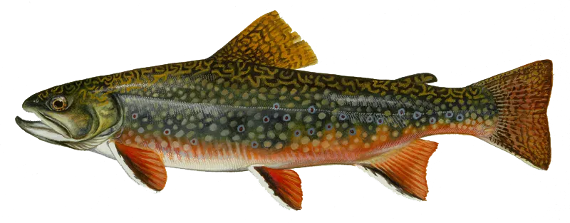

Check which species have trophy potential in Laurel Run
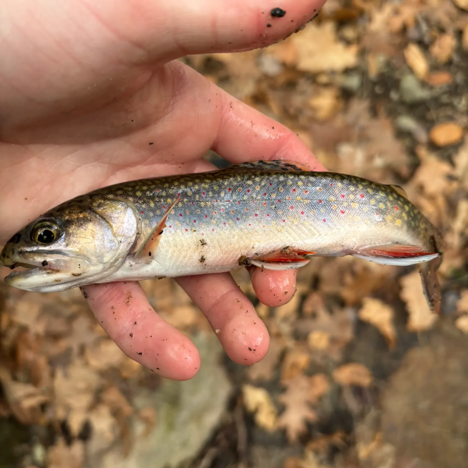
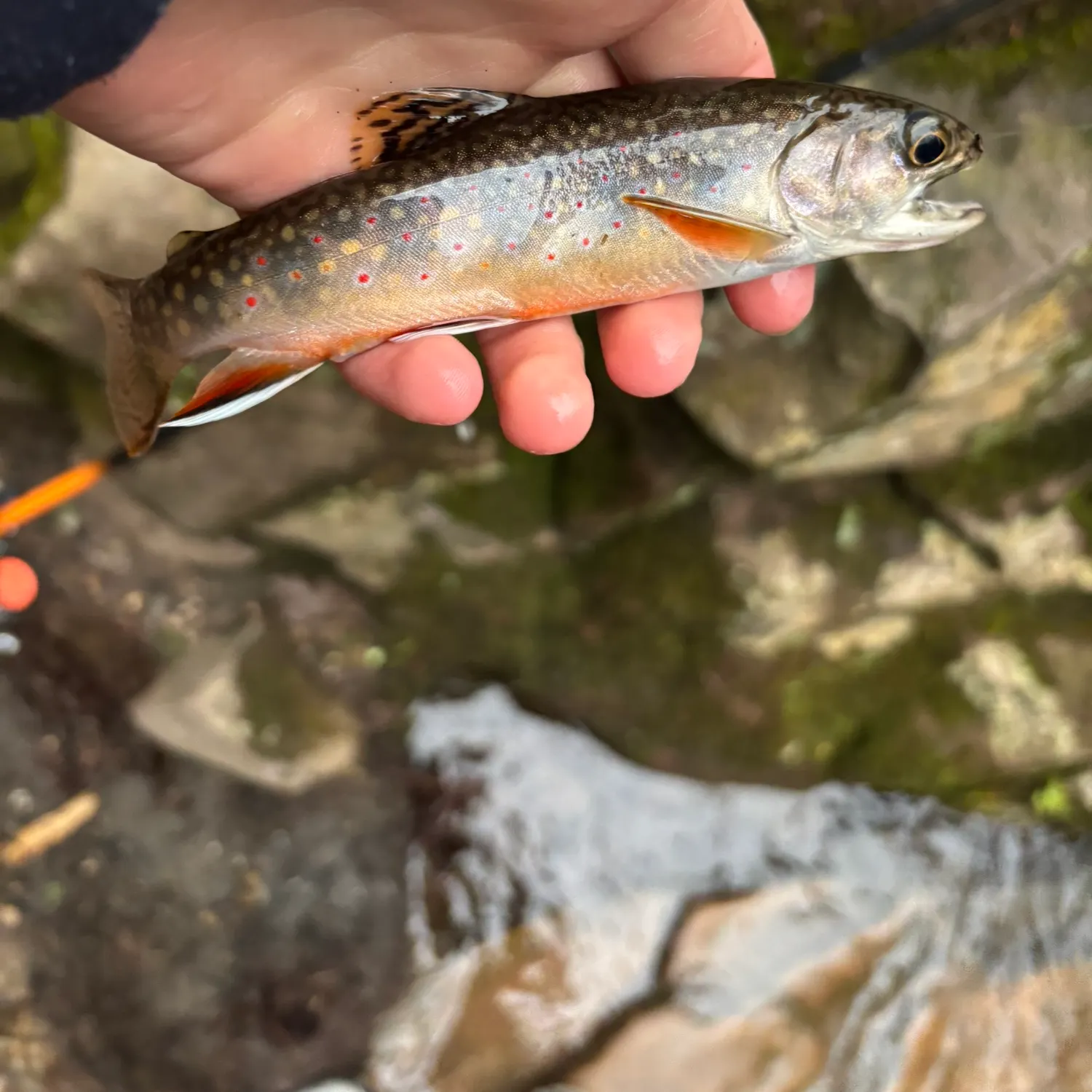
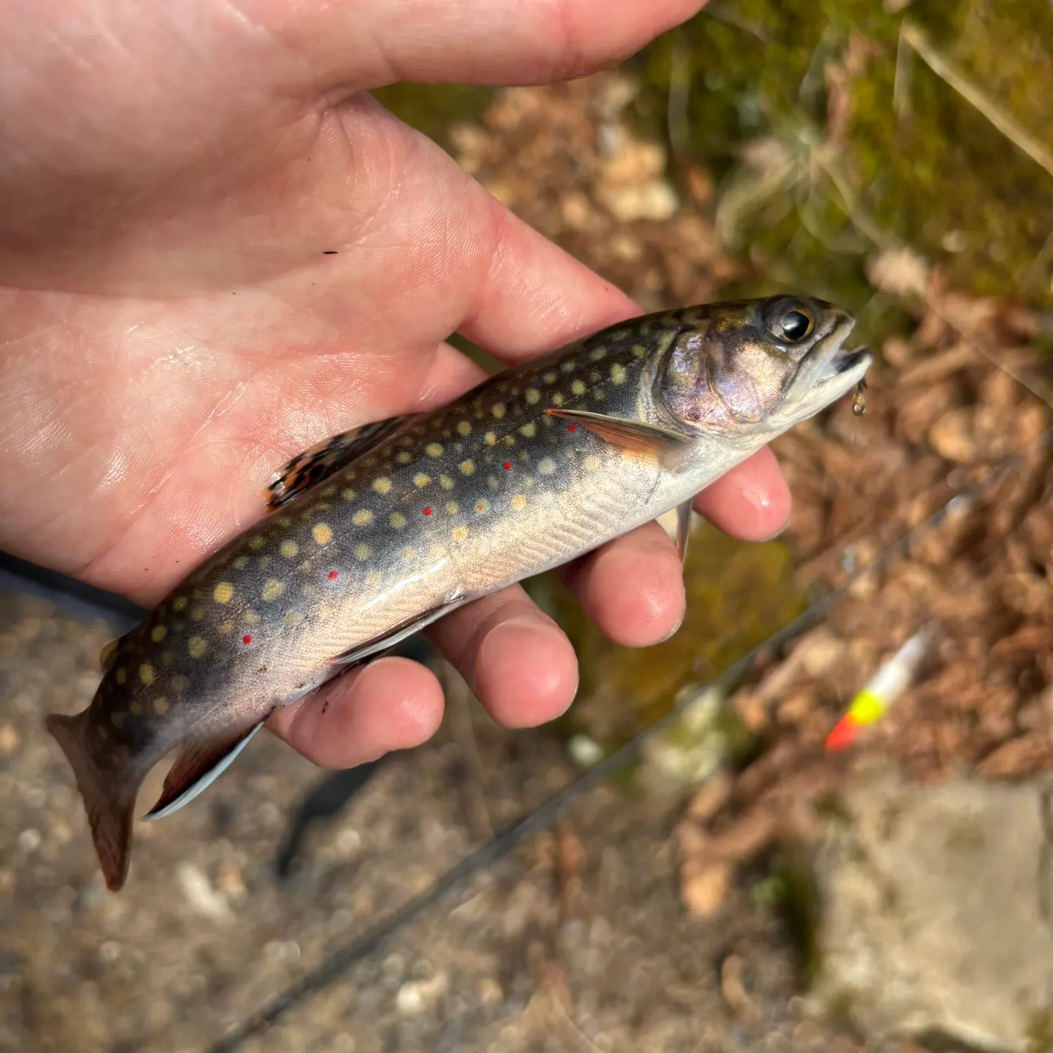
Laurel Run fishing reports
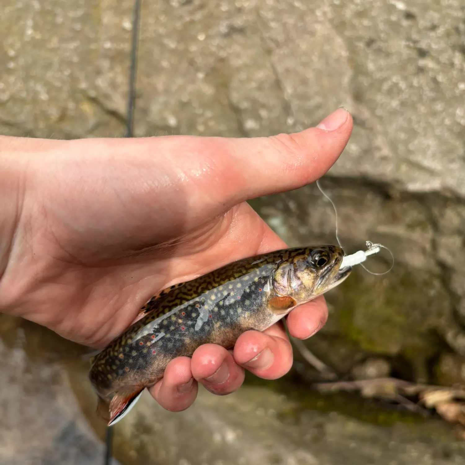
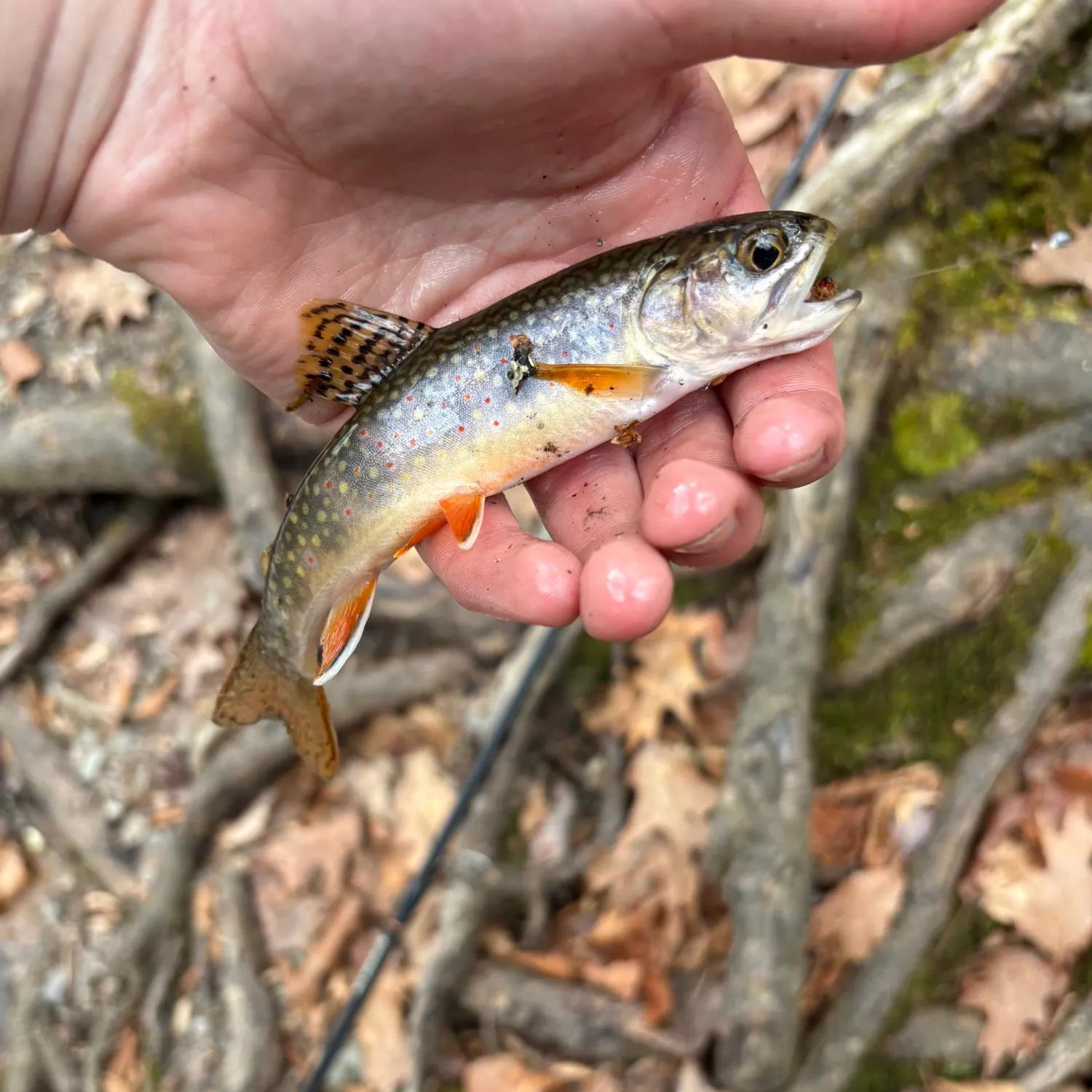
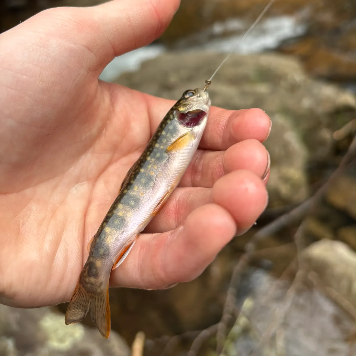

Continue browsing catches and catch locations in the Fishbrain app
Fishing regulations at Laurel Run, PA
Disclaimer: Always check local fishing regulations, water access rights and land ownership before fishing, regardless of any catches logged in that area by the Fishbrain community. Fishbrain has mapped millions of acres of government-owned land across the USA to help you identify potential fishing access, but you are responsible for ensuring compliance with all legal requirements.
Fishing regulations in Pennsylvania can change throughout the year. Make sure to check this page before fishing for the most up to date rules and regulations for the current season. Local regulations govern when you can fish, the max size of the fish you can keep, how many fish you can keep, and more.
Regulations for top species
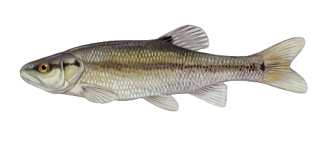
Creek chub
Bag limit50
The maximum number of individual fish legally harvested per harvester per day. Bag limits are only for properly licensed anglers actively harvesting the species. People who are not actively harvesting or are not properly licensed (if a license is required) may NOT be counted for the purpose of bag limits.
Special gear
PA Gear (freshwater)
RODS, LINES AND HOOKS. An angler may use a maximum of three lines fished either by rod or hand when fishing for gamefish, baitfish or both. An exception to this rule exists for those fishing through ice in winter (see Ice Fishing Equipment below). On open water (not covered by ice), it is unlawful for a person to fish with more than three fishing rods at a time. There is no restriction on the number of hooks used on each fishing line. All rods, lines and hooks shall be under the immediate control of the person using them. ICE FISHING EQUIPMENT. It is unlawful while ice fishing to use more than five fishing devices, which may consist of rods, hand lines, tip-ups or any combination. Each device shall contain a single fishing line with no restriction on the number of hooks used for fishing, except when fishing in the Pymatuning Reservoir, where no more than three hooks shall be attached to each line. Self-hooking devices such as jaw jackers and automated fisherman are allowed. Holes cut in ice may not exceed 10 inches between the farthest points as measured in any direction. All lines, rods or tip-ups shall be under the immediate control of the person using them. On PFBC lakes, shelters or shanties must be removed when through fishing for the day. SNAGGING HOOKS may not be used or possessed while in the act of fishing. A snagging hook is a device designed or modified to facilitate the snagging of fish and may be a hook with a single barb, weighted on a shank below the eye and above the barbs, or a hook otherwise designed or modified to make the snagging of fish more likely than it would be with a normal hook.SPEARS OR GIGS. Spears or gigs may be used to take ONLY snakeheads, carp, suckers and catfish. Spears or gigs may not be mechanically propelled, may not have more than five barbed points and may not be used in stocked trout waters.BOW AND ARROW (including compound bows and crossbows) may be used for taking ONLY snakeheads, carp, suckers and catfish on all Commonwealth waters, day or night, with the following exceptions: (1) bowfishing is strictly prohibited in stocked trout waters during the closed season, (2) bowfishing is strictly prohibited in special regulations trout waters, (3) it is unlawful to cast direct rays of a spotlight, mounted headlight or any other kind of artificial light from any watercraft upon any occupied building or another watercraft and (4) it is unlawful to use generators on board a watercraft while bowfishing with a noise level that exceeds 90 db. Handfishing is not permitted.
Restrictions & requirements
PA Snagged Fish
It is unlawful to take or attempt to take fish or keep fish accidentally caught by snatch-fishing, foul hooking, or snag fishing. Handfishing is not permitted.
PA Nets
It is unlawful to use or have in possession while on or along Commonwealth waters nets larger than 4 feet square or in diameter except with a special permit issued by the PFBC.
PA Keep Whole
It is unlawful to possess a fish in any form or condition other than in the whole or having the entrails removed while on shore, along the waters of the Commonwealth, onboard a boat or on a dock, pier, launch area, or parking lot adjacent thereto. Fish may be processed fully if they are being prepared for immediate consumption on site. This does not apply to fish processed at a fish cleaning station officially recognized by the Commission or by a permitted charter boat/fishing guide operation.
Additional information
Synonyms

Channel catfish
Bag limit50
The maximum number of individual fish legally harvested per harvester per day. Bag limits are only for properly licensed anglers actively harvesting the species. People who are not actively harvesting or are not properly licensed (if a license is required) may NOT be counted for the purpose of bag limits.
Aggregate limit50
The maximum number of individual fish across an aggregate group of species legally harvested per harvester per day.
Special gear
PA Gear (freshwater)
RODS, LINES AND HOOKS. An angler may use a maximum of three lines fished either by rod or hand when fishing for gamefish, baitfish or both. An exception to this rule exists for those fishing through ice in winter (see Ice Fishing Equipment below). On open water (not covered by ice), it is unlawful for a person to fish with more than three fishing rods at a time. There is no restriction on the number of hooks used on each fishing line. All rods, lines and hooks shall be under the immediate control of the person using them. ICE FISHING EQUIPMENT. It is unlawful while ice fishing to use more than five fishing devices, which may consist of rods, hand lines, tip-ups or any combination. Each device shall contain a single fishing line with no restriction on the number of hooks used for fishing, except when fishing in the Pymatuning Reservoir, where no more than three hooks shall be attached to each line. Self-hooking devices such as jaw jackers and automated fisherman are allowed. Holes cut in ice may not exceed 10 inches between the farthest points as measured in any direction. All lines, rods or tip-ups shall be under the immediate control of the person using them. On PFBC lakes, shelters or shanties must be removed when through fishing for the day. SNAGGING HOOKS may not be used or possessed while in the act of fishing. A snagging hook is a device designed or modified to facilitate the snagging of fish and may be a hook with a single barb, weighted on a shank below the eye and above the barbs, or a hook otherwise designed or modified to make the snagging of fish more likely than it would be with a normal hook.SPEARS OR GIGS. Spears or gigs may be used to take ONLY snakeheads, carp, suckers and catfish. Spears or gigs may not be mechanically propelled, may not have more than five barbed points and may not be used in stocked trout waters.BOW AND ARROW (including compound bows and crossbows) may be used for taking ONLY snakeheads, carp, suckers and catfish on all Commonwealth waters, day or night, with the following exceptions: (1) bowfishing is strictly prohibited in stocked trout waters during the closed season, (2) bowfishing is strictly prohibited in special regulations trout waters, (3) it is unlawful to cast direct rays of a spotlight, mounted headlight or any other kind of artificial light from any watercraft upon any occupied building or another watercraft and (4) it is unlawful to use generators on board a watercraft while bowfishing with a noise level that exceeds 90 db. Handfishing is not permitted.
Restrictions & requirements
PA Snagged Fish
It is unlawful to take or attempt to take fish or keep fish accidentally caught by snatch-fishing, foul hooking, or snag fishing. Handfishing is not permitted.
PA Nets
It is unlawful to use or have in possession while on or along Commonwealth waters nets larger than 4 feet square or in diameter except with a special permit issued by the PFBC.
PA Keep Whole
It is unlawful to possess a fish in any form or condition other than in the whole or having the entrails removed while on shore, along the waters of the Commonwealth, onboard a boat or on a dock, pier, launch area, or parking lot adjacent thereto. Fish may be processed fully if they are being prepared for immediate consumption on site. This does not apply to fish processed at a fish cleaning station officially recognized by the Commission or by a permitted charter boat/fishing guide operation.
Edibility
Synonyms


Free trial available