
Top fish species at Little Wapsipinicon River

Check which species have trophy potential in Little Wapsipinicon River
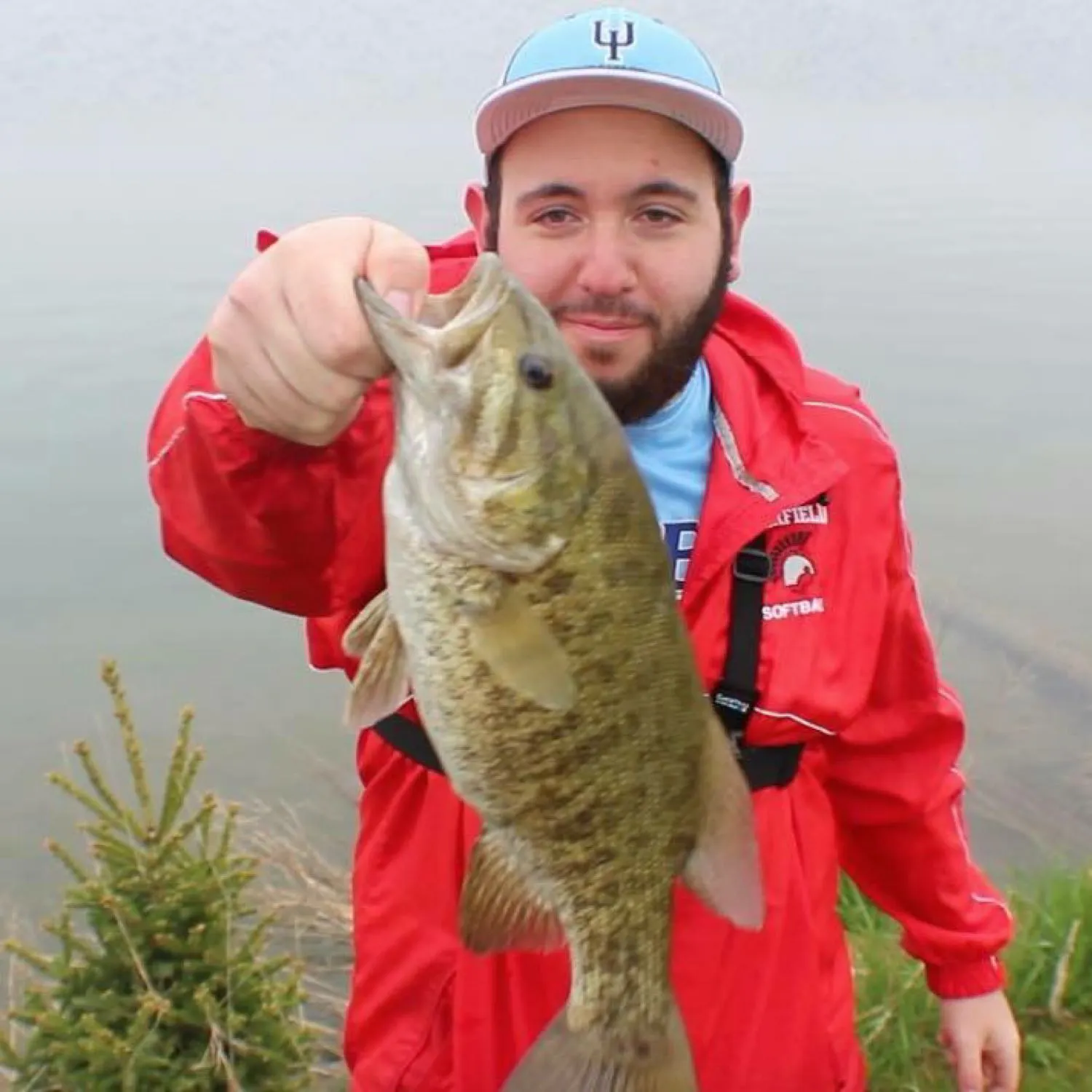
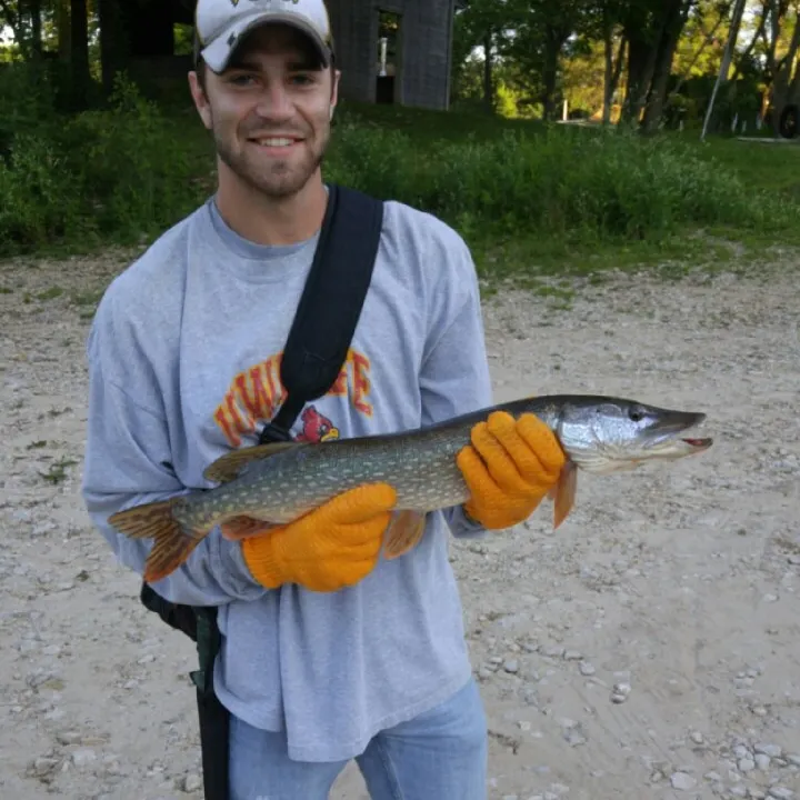
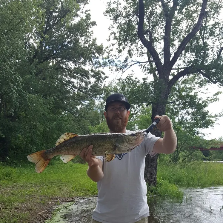
Little Wapsipinicon River fishing reports
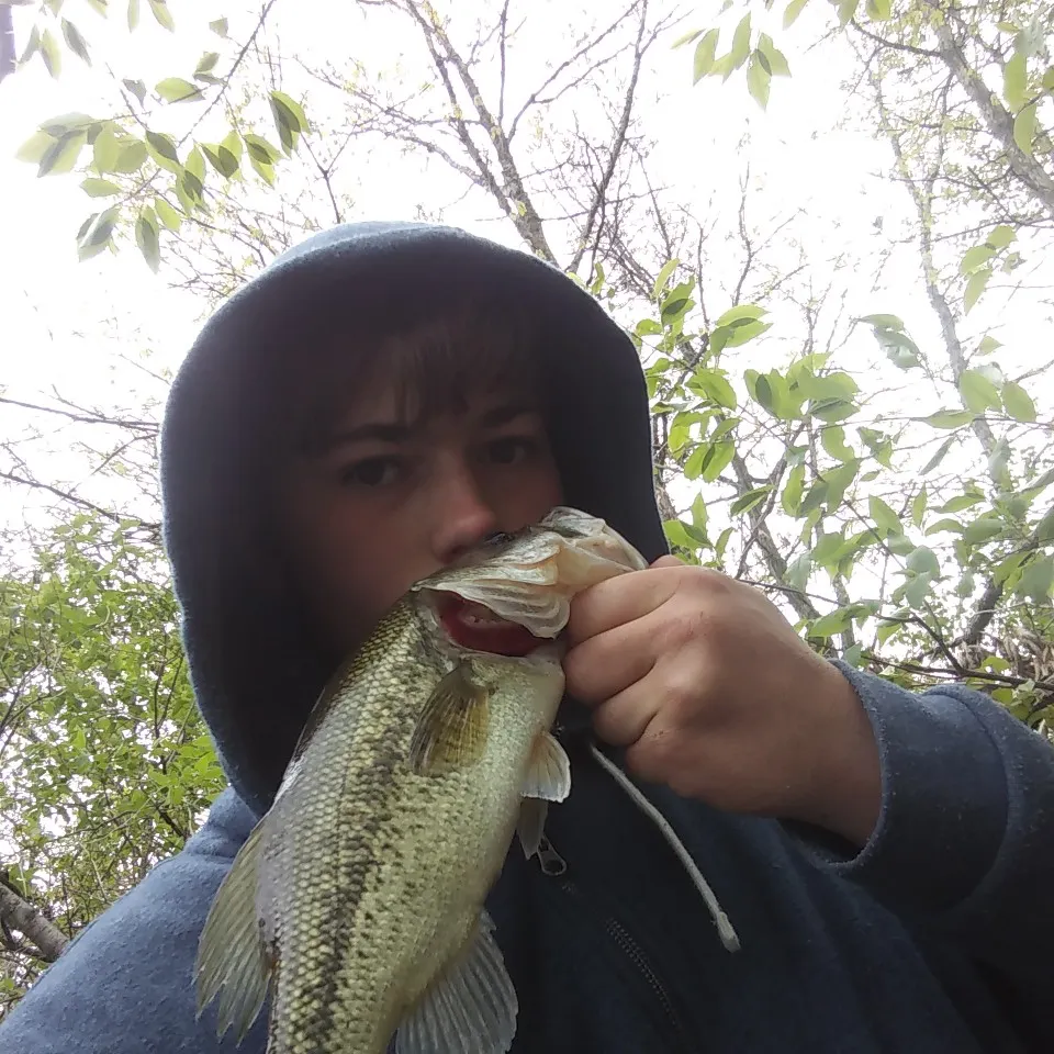
length · weight
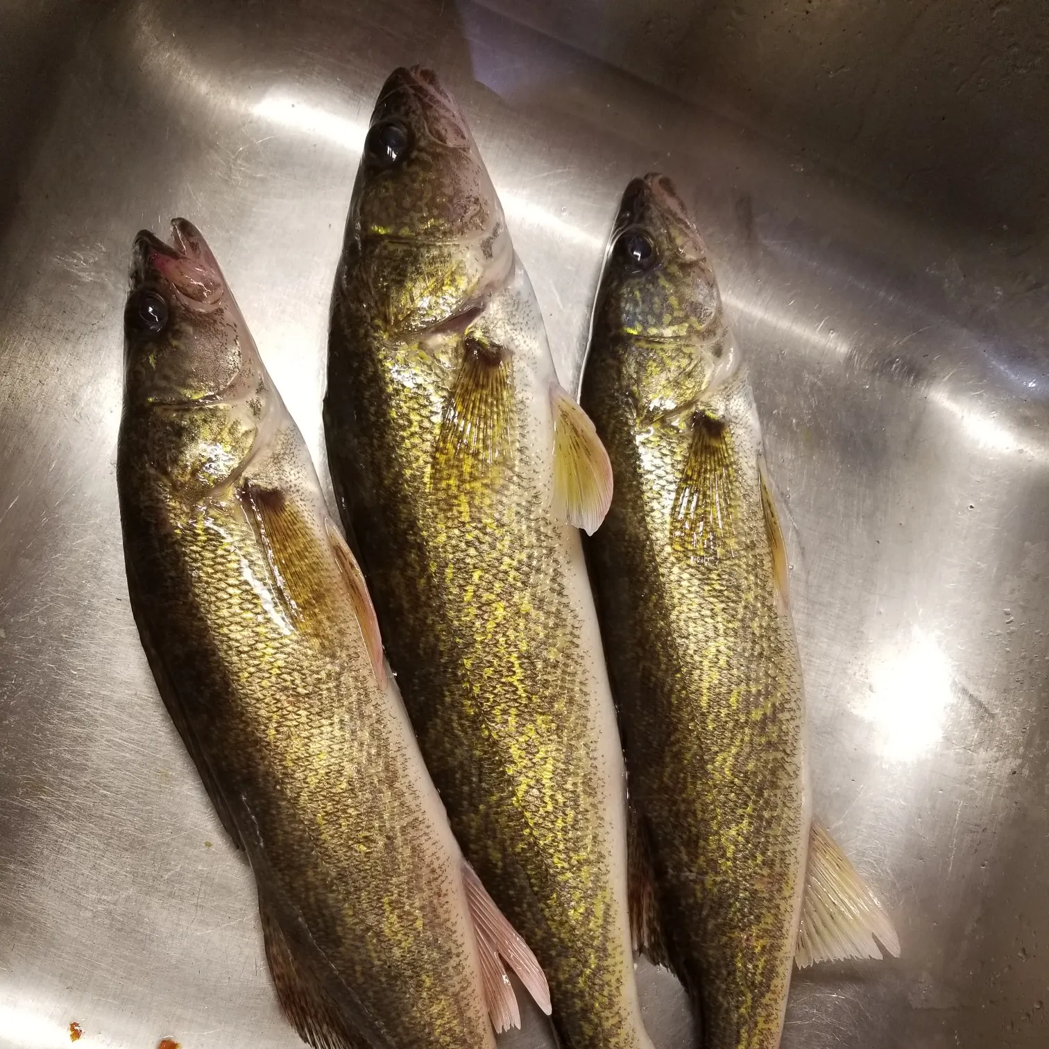
length · weight

Continue browsing catches and catch locations in the Fishbrain app
When are Northern Pike biting on Little Wapsipinicon River?
Learn what time of year and day to go fishing at Little Wapsipinicon River. Download Fishbrain today to look for new fishing spots, scout new fishing access, or prep for your next trip.

Fishing regulations at Little Wapsipinicon River, IA
Disclaimer: Always check local fishing regulations, water access rights and land ownership before fishing, regardless of any catches logged in that area by the Fishbrain community. Fishbrain has mapped millions of acres of government-owned land across the USA to help you identify potential fishing access, but you are responsible for ensuring compliance with all legal requirements.
Fishing regulations in Iowa can change throughout the year. Make sure to check this page before fishing for the most up to date rules and regulations for the current season. Local regulations govern when you can fish, the max size of the fish you can keep, how many fish you can keep, and more.
Regulations for top species
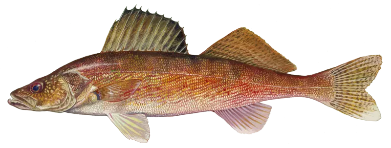
Walleye
Bag limit5
The maximum number of individual fish legally harvested per harvester per day. Bag limits are only for properly licensed anglers actively harvesting the species. People who are not actively harvesting or are not properly licensed (if a license is required) may NOT be counted for the purpose of bag limits.
Aggregate limit10
The maximum number of individual fish across an aggregate group of species legally harvested per harvester per day.
Special gear
IA Gear
You may use gaff hooks or landing nets to help you land fish. Hooks: When fishing by hook-and-line, you cannot use more than two lines or more than two hooks on each line when still fishing or trolling. When fly fishing, you cannot use more than two flies on one line. When you are trolling and bait casting, you cannot use more than two trolling spoons or artificial baits on one line. You can use a third line if you have a valid third line fishing permit. You cannot leave fishing line or lines with hooks in the water unattended by being out of visual sight of the lines. One hook is a single, double or treble-pointed hook, and all hooks attached as a part of an artificial bait or lure are counted as one hook. An Alabama (umbrella) rig is not an artificial bait or lure. Ice Fishing Shelters: Ice fishing shelters left unattended on land or water under the jurisdiction of the state, must have the owner's name, street address and city in 4-inch or larger block letters (in a color contrasting to their background) on all sides, but do not need to be registered. Attach reflectors to all sides of any shelter left on the ice after sundown. Keep shelters unlocked while in use. Remove shelters from all state-owned lands and waters by Feb. 20 or ice melt, whichever comes first, unless the deadline is extended. Tip-Up Fishing Device: A "tip-up" is an ice fishing device with an attached flag or signal to show fishing action, used to hold fishing line and a hook. You may fish a combination of one tip-up and one additional line, or two tip-ups and no additional lines. You can use an additional line or tip-up if you have a third line fishing permit. When fishing the Mississippi, Missouri and Big Sioux Rivers and their connected backwaters, the following regulations apply: you can use up to three tip-up fishing devices. You can use two or three hooks on the same line, but the total number of hooks each person uses cannot exceed three. Each tip-up fishing device must have a tag attached, plainly labeled with the owner's name and address. You cannot use a tip-up fishing device within 300 feet of a dam or spillway or in a part of the river which is closed or posted against use of the device. Three tip-up fishing devices may be used in addition to two lines with no more than two hooks per line. Trotlines: "Trotlines" as used in this section refers to lines commonly called "tagged lines," "throw lines," "banklines," You can use trotlines in all Iowa rivers and streams, except those in Mitchell, Howard, Winneshiek, Allamakee, Fayette, Clayton, Delaware, Dubuque and Jackson counties. Trotlines may be used in the above nine counties only in the following stream sections: Mississippi River; Maquoketa River, mouth to Backbone State Park dam; North Fork Maquoketa River, mouth to Jones-Dubuque county line; Turkey River, mouth to Elkader dam; and Upper Iowa River, mouth to the first dam upstream in Winneshiek County. You cannot use more than five trotlines with a valid sport fishing license. These trotlines cannot have more than 15 hooks total. Each separate line must have a tag attached, plainly labeled with the owner's name and address. You must check the line at least once every 24 hours. Remove all trotlines and parts from the shore if they are not being actively fished. A trotline is considered actively fished if at least once daily the trotline is left with at least one baited hook in the water. You cannot use trotlines in a stocked lake or within 300 feet of a dam or spillway, or in a stream or portion of stream which is closed or posted against its use. One end of the line must be set from the shore and visible above the shore waterline. You cannot set the line entirely across a stream or body of water. Any conservation officer can remove untagged or unlawful lines. Bow Fishing and Spearing: You can take nongame fish and frogs by bow and arrow and spear with a valid sport fishing license. Bow fishing and spearing are allowed on public lakes, reservoirs and rivers, private ponds with permission, and border waters. Some state parks, federal refuges and lakes controlled by city and county governments may have additional regulations specific to bow fishing and spearing.
Restrictions & requirements
No Culling
Release of fish caught and placed on a stringer, in a livewell, or otherwise held in possession is prohibited.
IA Unlawful Means
You must not use any grab hook, snag hook, any kind of net, seine, trap, firearm, dynamite or other explosives, or poisonous or stupefying substances, lime, ashes, electricity or hand fishing to take or try to take any fish. You must return to the water immediately all game fish not hooked in the mouth, except Paddlefish, with as little injury as possible.
Bow Fishing, Spearing, Snagging
A valid sport fishing license lets you take Common Carp, Bighead Carp, Silver Carp, Grass Carp, Black Carp, Bigmouth Buffalo, Smallmouth Buffalo, Black Buffalo, Quillback, Highfin Carpsucker, River Carpsucker, Spotted Sucker, White Sucker, Shorthead Redhorse, Golden Redhorse, Silver Redhorse, Freshwater Drum, Shortnose Gar, Longnose Gar, Bowfin, Gizzard Shad and Goldfish by snagging, bow fishing and spearing and Paddlefish by snagging. You cannot use a hook larger than a 5/0 treble hook or measuring more than 1.25-inches long when two of the hook points are placed on a ruler. Snagging is not permitted in the following areas: Des Moines River from directly below Saylorville Dam to Southeast 14th St. bridge in Des Moines; Cedar River in Cedar Rapids from directly below the 5 in 1 Dam under I-380 to the 1st Ave. bridge; Cedar River in Cedar Rapids from directly below the "C" St. Roller Dam to 300 yards downstream; Iowa River from directly below the Coralville Dam to 300 yards downstream; Chariton River from directly below Lake Rathbun Dam to 300 yards downstream; Spillway area from directly below the Spirit Lake outlet to the confluence at East Okoboji Lake; Northeast bank of the Des Moines River from directly below the Ottumwa Dam, including the catwalk, to the Jefferson St. bridge. Snagging from the South Market St. bridge is also prohibited; Missouri River, any Missouri River tributary beginning at its confluence and extending below its Interstate 29 bridge and the Big Sioux River from the Interstate 29 bridge to the confluence with the Missouri River with the exception of snagging Paddlefish and rough fish during the open season; Des Moines River from directly below the hydroelectric dam (Big Dam) to the Hawkeye Avenue bridge in Fort Dodge; Des Moines River from directly below the Little Dam to the Union Pacific Railroad bridge in Fort Dodge; Skunk River, from directly below the Oakland Mills Dam to the downstream end of the 253rd Street boat ramp. Snagging, bow and arrow fishing and spearing is not permitted in the following areas: From the Ventura Grade roadway, jetties and bridges of Clear Lake and Ventura Marsh; Within 300 feet of the concrete culvert and metal fish barrier of Lost Island Lake Inlet; Within 300 feet of the outlet and metal fish barrier of Lost Island Lake Outlet; Within 300 feet of the outlet and metal fish barrier of Barringer Slough; Beginning at 230th Avenue and extending downstream to the signed Iowa Great Lakes Sanitary District property line of Lower Gar Lake outlet.
Additional information
Edibility
Synonyms
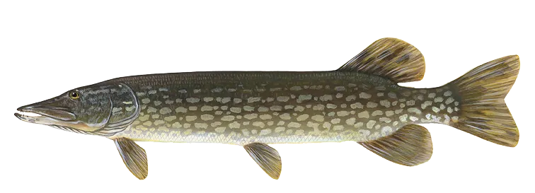
Northern pike
Bag limit3
The maximum number of individual fish legally harvested per harvester per day. Bag limits are only for properly licensed anglers actively harvesting the species. People who are not actively harvesting or are not properly licensed (if a license is required) may NOT be counted for the purpose of bag limits.
Special gear
IA Gear
You may use gaff hooks or landing nets to help you land fish. Hooks: When fishing by hook-and-line, you cannot use more than two lines or more than two hooks on each line when still fishing or trolling. When fly fishing, you cannot use more than two flies on one line. When you are trolling and bait casting, you cannot use more than two trolling spoons or artificial baits on one line. You can use a third line if you have a valid third line fishing permit. You cannot leave fishing line or lines with hooks in the water unattended by being out of visual sight of the lines. One hook is a single, double or treble-pointed hook, and all hooks attached as a part of an artificial bait or lure are counted as one hook. An Alabama (umbrella) rig is not an artificial bait or lure. Ice Fishing Shelters: Ice fishing shelters left unattended on land or water under the jurisdiction of the state, must have the owner's name, street address and city in 4-inch or larger block letters (in a color contrasting to their background) on all sides, but do not need to be registered. Attach reflectors to all sides of any shelter left on the ice after sundown. Keep shelters unlocked while in use. Remove shelters from all state-owned lands and waters by Feb. 20 or ice melt, whichever comes first, unless the deadline is extended. Tip-Up Fishing Device: A "tip-up" is an ice fishing device with an attached flag or signal to show fishing action, used to hold fishing line and a hook. You may fish a combination of one tip-up and one additional line, or two tip-ups and no additional lines. You can use an additional line or tip-up if you have a third line fishing permit. When fishing the Mississippi, Missouri and Big Sioux Rivers and their connected backwaters, the following regulations apply: you can use up to three tip-up fishing devices. You can use two or three hooks on the same line, but the total number of hooks each person uses cannot exceed three. Each tip-up fishing device must have a tag attached, plainly labeled with the owner's name and address. You cannot use a tip-up fishing device within 300 feet of a dam or spillway or in a part of the river which is closed or posted against use of the device. Three tip-up fishing devices may be used in addition to two lines with no more than two hooks per line. Trotlines: "Trotlines" as used in this section refers to lines commonly called "tagged lines," "throw lines," "banklines," You can use trotlines in all Iowa rivers and streams, except those in Mitchell, Howard, Winneshiek, Allamakee, Fayette, Clayton, Delaware, Dubuque and Jackson counties. Trotlines may be used in the above nine counties only in the following stream sections: Mississippi River; Maquoketa River, mouth to Backbone State Park dam; North Fork Maquoketa River, mouth to Jones-Dubuque county line; Turkey River, mouth to Elkader dam; and Upper Iowa River, mouth to the first dam upstream in Winneshiek County. You cannot use more than five trotlines with a valid sport fishing license. These trotlines cannot have more than 15 hooks total. Each separate line must have a tag attached, plainly labeled with the owner's name and address. You must check the line at least once every 24 hours. Remove all trotlines and parts from the shore if they are not being actively fished. A trotline is considered actively fished if at least once daily the trotline is left with at least one baited hook in the water. You cannot use trotlines in a stocked lake or within 300 feet of a dam or spillway, or in a stream or portion of stream which is closed or posted against its use. One end of the line must be set from the shore and visible above the shore waterline. You cannot set the line entirely across a stream or body of water. Any conservation officer can remove untagged or unlawful lines. Bow Fishing and Spearing: You can take nongame fish and frogs by bow and arrow and spear with a valid sport fishing license. Bow fishing and spearing are allowed on public lakes, reservoirs and rivers, private ponds with permission, and border waters. Some state parks, federal refuges and lakes controlled by city and county governments may have additional regulations specific to bow fishing and spearing.
Restrictions & requirements
No Culling
Release of fish caught and placed on a stringer, in a livewell, or otherwise held in possession is prohibited.
IA Unlawful Means
You must not use any grab hook, snag hook, any kind of net, seine, trap, firearm, dynamite or other explosives, or poisonous or stupefying substances, lime, ashes, electricity or hand fishing to take or try to take any fish. You must return to the water immediately all game fish not hooked in the mouth, except Paddlefish, with as little injury as possible.
Bow Fishing, Spearing, Snagging
A valid sport fishing license lets you take Common Carp, Bighead Carp, Silver Carp, Grass Carp, Black Carp, Bigmouth Buffalo, Smallmouth Buffalo, Black Buffalo, Quillback, Highfin Carpsucker, River Carpsucker, Spotted Sucker, White Sucker, Shorthead Redhorse, Golden Redhorse, Silver Redhorse, Freshwater Drum, Shortnose Gar, Longnose Gar, Bowfin, Gizzard Shad and Goldfish by snagging, bow fishing and spearing and Paddlefish by snagging. You cannot use a hook larger than a 5/0 treble hook or measuring more than 1.25-inches long when two of the hook points are placed on a ruler. Snagging is not permitted in the following areas: Des Moines River from directly below Saylorville Dam to Southeast 14th St. bridge in Des Moines; Cedar River in Cedar Rapids from directly below the 5 in 1 Dam under I-380 to the 1st Ave. bridge; Cedar River in Cedar Rapids from directly below the "C" St. Roller Dam to 300 yards downstream; Iowa River from directly below the Coralville Dam to 300 yards downstream; Chariton River from directly below Lake Rathbun Dam to 300 yards downstream; Spillway area from directly below the Spirit Lake outlet to the confluence at East Okoboji Lake; Northeast bank of the Des Moines River from directly below the Ottumwa Dam, including the catwalk, to the Jefferson St. bridge. Snagging from the South Market St. bridge is also prohibited; Missouri River, any Missouri River tributary beginning at its confluence and extending below its Interstate 29 bridge and the Big Sioux River from the Interstate 29 bridge to the confluence with the Missouri River with the exception of snagging Paddlefish and rough fish during the open season; Des Moines River from directly below the hydroelectric dam (Big Dam) to the Hawkeye Avenue bridge in Fort Dodge; Des Moines River from directly below the Little Dam to the Union Pacific Railroad bridge in Fort Dodge; Skunk River, from directly below the Oakland Mills Dam to the downstream end of the 253rd Street boat ramp. Snagging, bow and arrow fishing and spearing is not permitted in the following areas: From the Ventura Grade roadway, jetties and bridges of Clear Lake and Ventura Marsh; Within 300 feet of the concrete culvert and metal fish barrier of Lost Island Lake Inlet; Within 300 feet of the outlet and metal fish barrier of Lost Island Lake Outlet; Within 300 feet of the outlet and metal fish barrier of Barringer Slough; Beginning at 230th Avenue and extending downstream to the signed Iowa Great Lakes Sanitary District property line of Lower Gar Lake outlet.
Additional information
Synonyms
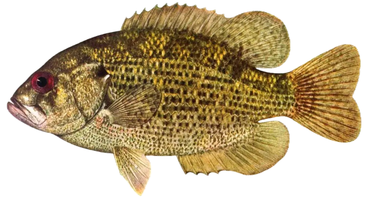
Rock bass
Special gear
IA Gear
You may use gaff hooks or landing nets to help you land fish. Hooks: When fishing by hook-and-line, you cannot use more than two lines or more than two hooks on each line when still fishing or trolling. When fly fishing, you cannot use more than two flies on one line. When you are trolling and bait casting, you cannot use more than two trolling spoons or artificial baits on one line. You can use a third line if you have a valid third line fishing permit. You cannot leave fishing line or lines with hooks in the water unattended by being out of visual sight of the lines. One hook is a single, double or treble-pointed hook, and all hooks attached as a part of an artificial bait or lure are counted as one hook. An Alabama (umbrella) rig is not an artificial bait or lure. Ice Fishing Shelters: Ice fishing shelters left unattended on land or water under the jurisdiction of the state, must have the owner's name, street address and city in 4-inch or larger block letters (in a color contrasting to their background) on all sides, but do not need to be registered. Attach reflectors to all sides of any shelter left on the ice after sundown. Keep shelters unlocked while in use. Remove shelters from all state-owned lands and waters by Feb. 20 or ice melt, whichever comes first, unless the deadline is extended. Tip-Up Fishing Device: A "tip-up" is an ice fishing device with an attached flag or signal to show fishing action, used to hold fishing line and a hook. You may fish a combination of one tip-up and one additional line, or two tip-ups and no additional lines. You can use an additional line or tip-up if you have a third line fishing permit. When fishing the Mississippi, Missouri and Big Sioux Rivers and their connected backwaters, the following regulations apply: you can use up to three tip-up fishing devices. You can use two or three hooks on the same line, but the total number of hooks each person uses cannot exceed three. Each tip-up fishing device must have a tag attached, plainly labeled with the owner's name and address. You cannot use a tip-up fishing device within 300 feet of a dam or spillway or in a part of the river which is closed or posted against use of the device. Three tip-up fishing devices may be used in addition to two lines with no more than two hooks per line. Trotlines: "Trotlines" as used in this section refers to lines commonly called "tagged lines," "throw lines," "banklines," You can use trotlines in all Iowa rivers and streams, except those in Mitchell, Howard, Winneshiek, Allamakee, Fayette, Clayton, Delaware, Dubuque and Jackson counties. Trotlines may be used in the above nine counties only in the following stream sections: Mississippi River; Maquoketa River, mouth to Backbone State Park dam; North Fork Maquoketa River, mouth to Jones-Dubuque county line; Turkey River, mouth to Elkader dam; and Upper Iowa River, mouth to the first dam upstream in Winneshiek County. You cannot use more than five trotlines with a valid sport fishing license. These trotlines cannot have more than 15 hooks total. Each separate line must have a tag attached, plainly labeled with the owner's name and address. You must check the line at least once every 24 hours. Remove all trotlines and parts from the shore if they are not being actively fished. A trotline is considered actively fished if at least once daily the trotline is left with at least one baited hook in the water. You cannot use trotlines in a stocked lake or within 300 feet of a dam or spillway, or in a stream or portion of stream which is closed or posted against its use. One end of the line must be set from the shore and visible above the shore waterline. You cannot set the line entirely across a stream or body of water. Any conservation officer can remove untagged or unlawful lines. Bow Fishing and Spearing: You can take nongame fish and frogs by bow and arrow and spear with a valid sport fishing license. Bow fishing and spearing are allowed on public lakes, reservoirs and rivers, private ponds with permission, and border waters. Some state parks, federal refuges and lakes controlled by city and county governments may have additional regulations specific to bow fishing and spearing.
Restrictions & requirements
No Culling
Release of fish caught and placed on a stringer, in a livewell, or otherwise held in possession is prohibited.
IA Unlawful Means
You must not use any grab hook, snag hook, any kind of net, seine, trap, firearm, dynamite or other explosives, or poisonous or stupefying substances, lime, ashes, electricity or hand fishing to take or try to take any fish. You must return to the water immediately all game fish not hooked in the mouth, except Paddlefish, with as little injury as possible.
Bow Fishing, Spearing, Snagging
A valid sport fishing license lets you take Common Carp, Bighead Carp, Silver Carp, Grass Carp, Black Carp, Bigmouth Buffalo, Smallmouth Buffalo, Black Buffalo, Quillback, Highfin Carpsucker, River Carpsucker, Spotted Sucker, White Sucker, Shorthead Redhorse, Golden Redhorse, Silver Redhorse, Freshwater Drum, Shortnose Gar, Longnose Gar, Bowfin, Gizzard Shad and Goldfish by snagging, bow fishing and spearing and Paddlefish by snagging. You cannot use a hook larger than a 5/0 treble hook or measuring more than 1.25-inches long when two of the hook points are placed on a ruler. Snagging is not permitted in the following areas: Des Moines River from directly below Saylorville Dam to Southeast 14th St. bridge in Des Moines; Cedar River in Cedar Rapids from directly below the 5 in 1 Dam under I-380 to the 1st Ave. bridge; Cedar River in Cedar Rapids from directly below the "C" St. Roller Dam to 300 yards downstream; Iowa River from directly below the Coralville Dam to 300 yards downstream; Chariton River from directly below Lake Rathbun Dam to 300 yards downstream; Spillway area from directly below the Spirit Lake outlet to the confluence at East Okoboji Lake; Northeast bank of the Des Moines River from directly below the Ottumwa Dam, including the catwalk, to the Jefferson St. bridge. Snagging from the South Market St. bridge is also prohibited; Missouri River, any Missouri River tributary beginning at its confluence and extending below its Interstate 29 bridge and the Big Sioux River from the Interstate 29 bridge to the confluence with the Missouri River with the exception of snagging Paddlefish and rough fish during the open season; Des Moines River from directly below the hydroelectric dam (Big Dam) to the Hawkeye Avenue bridge in Fort Dodge; Des Moines River from directly below the Little Dam to the Union Pacific Railroad bridge in Fort Dodge; Skunk River, from directly below the Oakland Mills Dam to the downstream end of the 253rd Street boat ramp. Snagging, bow and arrow fishing and spearing is not permitted in the following areas: From the Ventura Grade roadway, jetties and bridges of Clear Lake and Ventura Marsh; Within 300 feet of the concrete culvert and metal fish barrier of Lost Island Lake Inlet; Within 300 feet of the outlet and metal fish barrier of Lost Island Lake Outlet; Within 300 feet of the outlet and metal fish barrier of Barringer Slough; Beginning at 230th Avenue and extending downstream to the signed Iowa Great Lakes Sanitary District property line of Lower Gar Lake outlet.
Additional information
Edibility
Synonyms


Free trial available