

Check which species have trophy potential in Cascade Creek
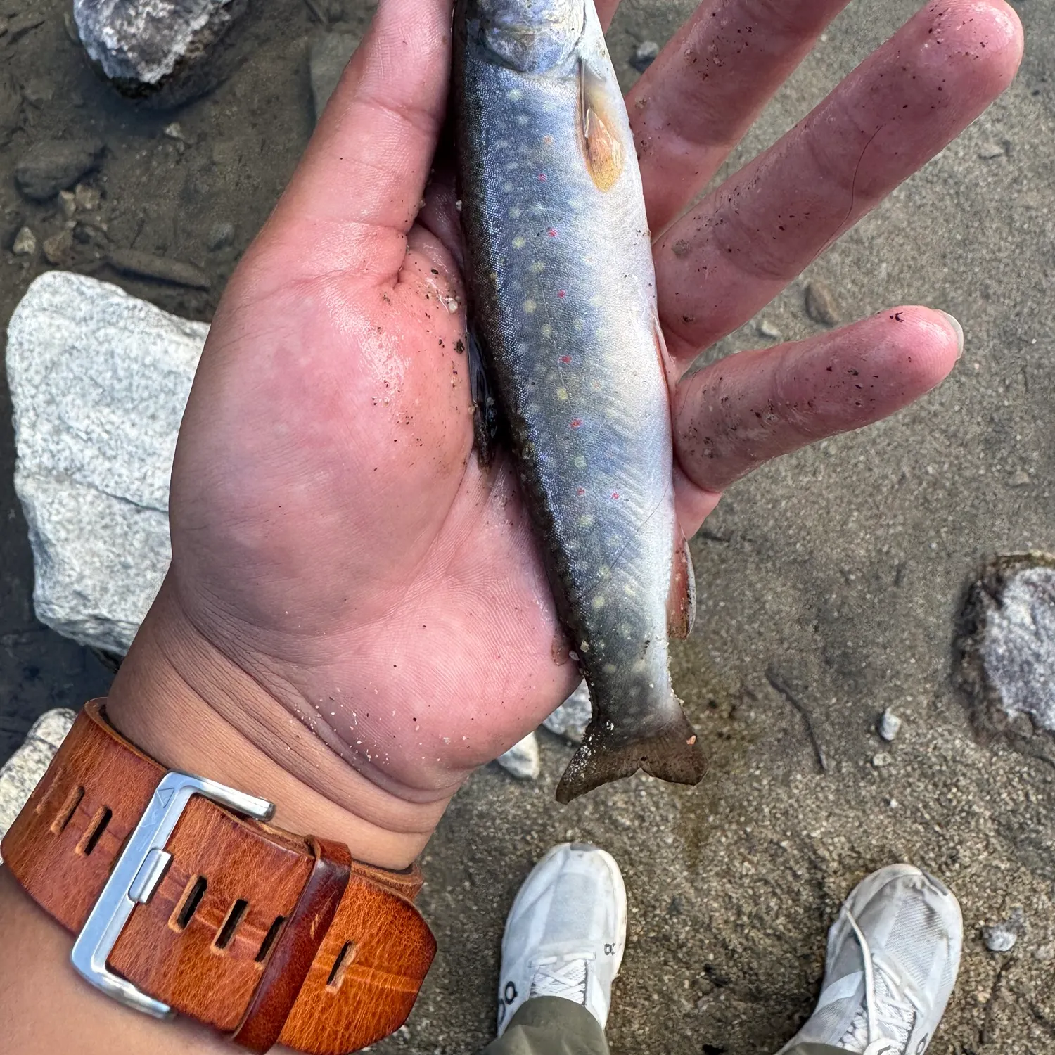
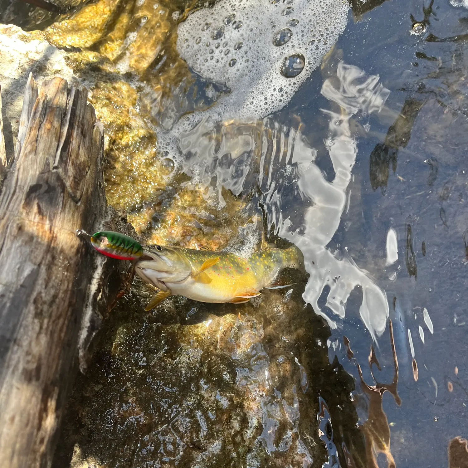
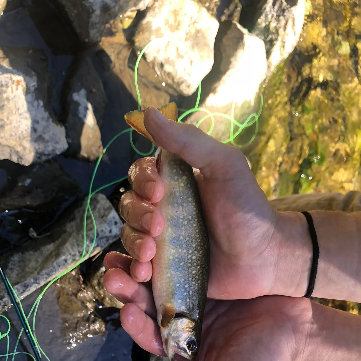
Cascade Creek fishing reports
length · weight


Continue browsing catches and catch locations in the Fishbrain app
Fishing regulations at Cascade Creek, WY
Disclaimer: Always check local fishing regulations, water access rights and land ownership before fishing, regardless of any catches logged in that area by the Fishbrain community. Fishbrain has mapped millions of acres of government-owned land across the USA to help you identify potential fishing access, but you are responsible for ensuring compliance with all legal requirements.
Fishing regulations in Wyoming can change throughout the year. Make sure to check this page before fishing for the most up to date rules and regulations for the current season. Local regulations govern when you can fish, the max size of the fish you can keep, how many fish you can keep, and more.
Regulations for top species
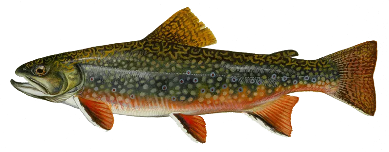
Brook trout
Bag limit16
The maximum number of individual fish legally harvested per harvester per day. Bag limits are only for properly licensed anglers actively harvesting the species. People who are not actively harvesting or are not properly licensed (if a license is required) may NOT be counted for the purpose of bag limits.
Restrictions & requirements
WY Snagging
It is unlawful to snag fish.
WY Illegal Methods
It is unlawful to take, wound or destroy fish with a firearm of any nature or by using poison, deleterious drug, electrical device, chemical, explosive or any similar substance or device.
WY Release of Caught Fish
It is unlawful to release fish alive that have been placed on a stringer, in a container, in a live well, or not released immediately to the water without written approval from the Department.
WY Release of fish or fish eggs
It is unlawful to plant or release live fish or fish eggs without the consent and supervision of the Department or its authorized personnel. This does not include fish captured by legal means and released immediately upon capture.
WY Sale or Purchase of Fish
It is unlawful to sell, barter, dispose of, or abandon, or obtain by sale or barter, any edible portion of any game fish in this state.
WY Taking Game Fish for another Person
It is unlawful to take game fish for another person.
WY Aquatic Invasive Species
It is unlawful to possess of transport an aquatic invasive species in the State of Wyoming
WY Allowed Methods
Except as otherwise provided, fish shall only be taken or fished for with a maximum of two (2) rods or poles, with lines and hooks attached and the angler in attendance. No line may have more than three (3) single hooked devices attached. It is legal to use hand lines, set lines, poles, or tip ups when fishing through the ice and the angler is in attendance.
WY Use of Bait
Internal organs, eggs, eyes, fins, and skin of game fish are the only portions that may be used legally as bait. Any part of nongame fish may be used as bait. The use of bait may be restricted on specific waters. Use or possession of bait is prohibited in areas or on waters where fishing is permitted by the use of artificial flies and lures only. Corn may be possessed and used as bait in all waters where fishing with bait is permitted.
WY Use of a Trout Bead
A trout bead fixed on a line or leader two (2) inches or less from the eye of a bare hook is considered an artificial lure. Fishing with a trout bead more than two (2) inches from the eye of a bare hook or artificial fly is considered snagging and is prohibited.
WY Archery Equipment and Game Fish vs Nongame Fish
It is legal to take nongame fish with archery equipment without a license or permit, but it is always unlawful to take game fish with archery equipment.
WY Use of Artificial Light
Artificial light may be used while fishing with legal fishing methods.
WY Use of Spear Gun
No person shall use an underwater spear gun to take game fish under water without obtaining a fishing license.Fish may be taken by underwater spear gun fishing in lakes only.Underwater spear gun fishing is not permitted within one hundred (100) yards of any designated swimming or water ski areas, boat dock, ramp or spillway.A diver flag shall be displayed on the water when diving or under- water spear gun fishing. It shall be a rectangular flag that is either blue and white in color or red in color with a white diagonal stripe, not less than twelve (12) inches by twelve (12) inches and displayed no less than three (3) feet above the surface of the water.The use of artificial light to take game fish with a spear gun is prohibited.No game fish may be taken unless the underwater spear gun fisherman is completely submerged.All spears used on spear guns shall be attached to the spear gun with a lanyard with a maximum length of twenty (20) feet.
WY Ice Fishing
The use of more than two lines is permitted only during the ice covered period, and only when the angler is fishing through the ice, on waters listed below as being included under the Special Winter Ice Fishing Provision. No person shall use more than six lines at any time to fish. When using more than two lines, the angler's name shall be attached to each line, pole or tip-up; the angler shall be no more than three hundred yards from all lines; and, anglers shall check their own lines. Special Winter Ice Fishing Provision Waters:Alcova ReservoirBighorn Lake in Big Horn CountyBig Sandy ReservoirBoulder Lake in Sublette CountyBoysen ReservoirDeaver Reservoir in Park CountyFlaming Gorge ReservoirFontenelle Reservoir in Lincoln CountyGlendo ReservoirGoldeneye ReservoirGray Reef ReservoirGrayrocks ReservoirGuernsey ReservoirHarrington Reservoir in Big Horn CountyHawk Springs ReservoirKeyhole ReservoirKortes ReservoirLake DeSmetLake HattieOcean Lake in Fremont CountyPathfinder ReservoirPilot Butte ReservoirSeminoe ReservoirSulphur Creek Reservoir in Uinta CountyWardell ReservoirWheatland Reservoir #1 in Platte CountyWheatland Reservoir #3 in Albany CountyWoodruff Reservoir
WY Seining and Trapping of Fish
No person shall seine, net, trap or spear baitfish without first obtaining a valid seining license. A valid seining license is required when using a seine, net, trap or spear to take baitfish, even those that will be used as dead bait. Legal gear for taking baitfish includes seines, traps, cast nets, umbrella nets and dip nets. There are no restrictions on the size of mesh or net size for cast nets, umbrella nets or dip nets. Collection gear shall be hand operated. Seines used for the purpose of taking baitfish shall not be more than five (5) feet deep. Traps used for the purpose of taking baitfish shall not be more than thirty-six (36) inches long, twelve (12) inches deep, twelve (12) inches wide or twelve (12) inches in diameter and the throat shall not exceed one (1) inch width. A seining license holder shall not use more than five (5) traps at a time. A holder of both a seining license and live baitfish dealer's license shall have no restriction on the number of traps that can be used. The owner's name and seining license number shall be attached to each trap while in use. Any game fish taken by trap, net or seine shall be released to the water immediately.
WY Other Animals as Bait
Amphibians and reptiles shall not be used as fishing bait. The possession of live or dead amphibians and reptiles while fishing is prohibited. Crayfish shall only be used as live fishing bait in the water body from which they were captured.
WY Use of Live Baitfish
The use or possession of live baitfish is prohibited throughout Areas 1 and 4 and on all waters in Areas 2, 3, and 5 except as otherwise provided in Wyoming fishing regulations which describe where live baitfish may be obtained, possessed and used. Wild caught live baitfish shall not be transported out of the designated wild caught live baitfish possession area from which they were collected. This area shall be listed on the seining license, live baitfish dealer license or live baitfish receipt. No person shall possess live baitfish while fishing on any water where the use of live baitfish is prohibited. Commercially produced live baitfish may be transported and possessed throughout Areas 2, 3 and 5 (east of the continental divide) except where the use of live baitfish is prohibited. Use or possession of commercially produced live baitfish is prohibited on all waters except as otherwise provided in Wyoming fishing regulations
Synonyms
Location specific information
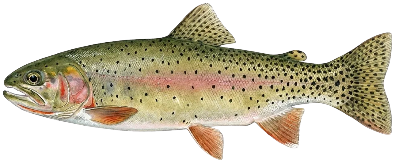
Cutthroat trout
Bag limit3
The maximum number of individual fish legally harvested per harvester per day. Bag limits are only for properly licensed anglers actively harvesting the species. People who are not actively harvesting or are not properly licensed (if a license is required) may NOT be counted for the purpose of bag limits.
Aggregate limit3
The maximum number of individual fish across an aggregate group of species legally harvested per harvester per day.
Memorable / trophy limits1 > 12
The maximum number of trophy individuals legally harvested per harvester per day. A trophy is any individual of a length greater than the max size limit. Trophy individuals are included in the daily bag limit unless stated otherwise.
Restrictions & requirements
WY Snagging
It is unlawful to snag fish.
WY Illegal Methods
It is unlawful to take, wound or destroy fish with a firearm of any nature or by using poison, deleterious drug, electrical device, chemical, explosive or any similar substance or device.
WY Release of Caught Fish
It is unlawful to release fish alive that have been placed on a stringer, in a container, in a live well, or not released immediately to the water without written approval from the Department.
WY Release of fish or fish eggs
It is unlawful to plant or release live fish or fish eggs without the consent and supervision of the Department or its authorized personnel. This does not include fish captured by legal means and released immediately upon capture.
WY Sale or Purchase of Fish
It is unlawful to sell, barter, dispose of, or abandon, or obtain by sale or barter, any edible portion of any game fish in this state.
WY Taking Game Fish for another Person
It is unlawful to take game fish for another person.
WY Aquatic Invasive Species
It is unlawful to possess of transport an aquatic invasive species in the State of Wyoming
WY Allowed Methods
Except as otherwise provided, fish shall only be taken or fished for with a maximum of two (2) rods or poles, with lines and hooks attached and the angler in attendance. No line may have more than three (3) single hooked devices attached. It is legal to use hand lines, set lines, poles, or tip ups when fishing through the ice and the angler is in attendance.
WY Use of Bait
Internal organs, eggs, eyes, fins, and skin of game fish are the only portions that may be used legally as bait. Any part of nongame fish may be used as bait. The use of bait may be restricted on specific waters. Use or possession of bait is prohibited in areas or on waters where fishing is permitted by the use of artificial flies and lures only. Corn may be possessed and used as bait in all waters where fishing with bait is permitted.
WY Use of a Trout Bead
A trout bead fixed on a line or leader two (2) inches or less from the eye of a bare hook is considered an artificial lure. Fishing with a trout bead more than two (2) inches from the eye of a bare hook or artificial fly is considered snagging and is prohibited.
WY Archery Equipment and Game Fish vs Nongame Fish
It is legal to take nongame fish with archery equipment without a license or permit, but it is always unlawful to take game fish with archery equipment.
WY Use of Artificial Light
Artificial light may be used while fishing with legal fishing methods.
WY Use of Spear Gun
No person shall use an underwater spear gun to take game fish under water without obtaining a fishing license.Fish may be taken by underwater spear gun fishing in lakes only.Underwater spear gun fishing is not permitted within one hundred (100) yards of any designated swimming or water ski areas, boat dock, ramp or spillway.A diver flag shall be displayed on the water when diving or under- water spear gun fishing. It shall be a rectangular flag that is either blue and white in color or red in color with a white diagonal stripe, not less than twelve (12) inches by twelve (12) inches and displayed no less than three (3) feet above the surface of the water.The use of artificial light to take game fish with a spear gun is prohibited.No game fish may be taken unless the underwater spear gun fisherman is completely submerged.All spears used on spear guns shall be attached to the spear gun with a lanyard with a maximum length of twenty (20) feet.
WY Ice Fishing
The use of more than two lines is permitted only during the ice covered period, and only when the angler is fishing through the ice, on waters listed below as being included under the Special Winter Ice Fishing Provision. No person shall use more than six lines at any time to fish. When using more than two lines, the angler's name shall be attached to each line, pole or tip-up; the angler shall be no more than three hundred yards from all lines; and, anglers shall check their own lines. Special Winter Ice Fishing Provision Waters:Alcova ReservoirBighorn Lake in Big Horn CountyBig Sandy ReservoirBoulder Lake in Sublette CountyBoysen ReservoirDeaver Reservoir in Park CountyFlaming Gorge ReservoirFontenelle Reservoir in Lincoln CountyGlendo ReservoirGoldeneye ReservoirGray Reef ReservoirGrayrocks ReservoirGuernsey ReservoirHarrington Reservoir in Big Horn CountyHawk Springs ReservoirKeyhole ReservoirKortes ReservoirLake DeSmetLake HattieOcean Lake in Fremont CountyPathfinder ReservoirPilot Butte ReservoirSeminoe ReservoirSulphur Creek Reservoir in Uinta CountyWardell ReservoirWheatland Reservoir #1 in Platte CountyWheatland Reservoir #3 in Albany CountyWoodruff Reservoir
WY Seining and Trapping of Fish
No person shall seine, net, trap or spear baitfish without first obtaining a valid seining license. A valid seining license is required when using a seine, net, trap or spear to take baitfish, even those that will be used as dead bait. Legal gear for taking baitfish includes seines, traps, cast nets, umbrella nets and dip nets. There are no restrictions on the size of mesh or net size for cast nets, umbrella nets or dip nets. Collection gear shall be hand operated. Seines used for the purpose of taking baitfish shall not be more than five (5) feet deep. Traps used for the purpose of taking baitfish shall not be more than thirty-six (36) inches long, twelve (12) inches deep, twelve (12) inches wide or twelve (12) inches in diameter and the throat shall not exceed one (1) inch width. A seining license holder shall not use more than five (5) traps at a time. A holder of both a seining license and live baitfish dealer's license shall have no restriction on the number of traps that can be used. The owner's name and seining license number shall be attached to each trap while in use. Any game fish taken by trap, net or seine shall be released to the water immediately.
WY Other Animals as Bait
Amphibians and reptiles shall not be used as fishing bait. The possession of live or dead amphibians and reptiles while fishing is prohibited. Crayfish shall only be used as live fishing bait in the water body from which they were captured.
WY Use of Live Baitfish
The use or possession of live baitfish is prohibited throughout Areas 1 and 4 and on all waters in Areas 2, 3, and 5 except as otherwise provided in Wyoming fishing regulations which describe where live baitfish may be obtained, possessed and used. Wild caught live baitfish shall not be transported out of the designated wild caught live baitfish possession area from which they were collected. This area shall be listed on the seining license, live baitfish dealer license or live baitfish receipt. No person shall possess live baitfish while fishing on any water where the use of live baitfish is prohibited. Commercially produced live baitfish may be transported and possessed throughout Areas 2, 3 and 5 (east of the continental divide) except where the use of live baitfish is prohibited. Use or possession of commercially produced live baitfish is prohibited on all waters except as otherwise provided in Wyoming fishing regulations
Additional information
Synonyms
Location regulation notes
Location specific information


Free trial available