Map

Dry Fork

Fishing spots, fishing reports, and regulations in

Arkansas, United States

5.0·1 catch

Top fish species at Dry Fork

Rainbow trout
Rainbow trout
App Section

Check which species have trophy potential in Dry Fork

Dry Fork fishing reports

Loading...

Rainbow trout

length · weight

Fishbrain
Have you been fishing here?

Log your catch and check out other catches from the community in the Fishbrain app.

Loading...
Loading...
Loading...

General info

Dry Fork is a stream located in Boone County, Arkansas, United States. It is most popular for fishing Rainbow trout.

Location

36°16′55.9″N 93°13′0.8″W
Directions

Amenities

Fishing regulations at Dry Fork, AR

Disclaimer: Always check local fishing regulations, water access rights and land ownership before fishing, regardless of any catches logged in that area by the Fishbrain community. Fishbrain has mapped millions of acres of government-owned land across the USA to help you identify potential fishing access, but you are responsible for ensuring compliance with all legal requirements.

Fishing regulations in Arkansas can change throughout the year. Make sure to check this page before fishing for the most up to date rules and regulations for the current season. Local regulations govern when you can fish, the max size of the fish you can keep, how many fish you can keep, and more.

Regulations for top species
Season open: year-round
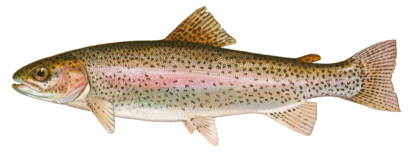
Rainbow trout

Rainbow trout

Regulation boundaryArkansas State Waters
Bag limit5

The maximum number of individual fish legally harvested per harvester per day. Bag limits are only for properly licensed anglers actively harvesting the species. People who are not actively harvesting or are not properly licensed (if a license is required) may NOT be counted for the purpose of bag limits.

Aggregate limit5

The maximum number of individual fish across an aggregate group of species legally harvested per harvester per day.

Required licenses
A trout permit is required to fish for trout in certain waters (tailwaters below Beaver Lake, Bull Shoals Lake, Norfork Lake, Greers Ferry Lake, Lake Greeson or east of Highway 59 on Spavinaw Creek) or to keep trout from any Arkansas waters.
Additional information
As of October 16: The proclamation calls for catch-and-release of all trout in the 45 miles of tailwater below Bull Shoals Dam to the White River's confluence with the North Fork River (specifically to the boat ramp at Norfork Access), as well as catch-and-release only on the entirety of the Norfork Dam tailwater. The trout waters below the White River-North Fork River confluence, from the Norfork Access boat ramp to the Highway 58 bridge at Guion, will have a two-trout-only limit with normal length and daily limits (only one trout over 14 inches). Tackle restrictions for the regular Bull Shoals and Rim Shoals catch-and-release areas on the White and the usual Norfork catch-and-release area still apply (artificial tackle only, and barbless hooks). Under the order, anglers in those two tailwaters may keep two trout up to 14 inches in length and must release all other caught trout. More updates on this, please see here. For area-specific regulations, see Arkansas special area-specific regulations.
Edibility
Excellent
Synonyms
Oncorhynchus mykiss
License Icon
Local laws and licenses

Arkansas fishing license

Get license

Reviews of Dry Fork

5.0
Loading...

1 ratings

5
4
3
2
1
Top reviews

Cities nearby

Alpena

4.9 miles away

Harrison

6.0 miles away

Bergman

11.6 miles away

Omaha

12.3 miles away

Green Forest

12.5 miles away

Zinc

16.8 miles away

Blue Eye

17.9 miles away

Blue Eye

18.5 miles away

Western Grove

19.2 miles away

Everton

19.3 miles away

Lead Hill

19.5 miles away

Berryville

20.6 miles away

Diamond City

20.8 miles away

Pyatt

20.9 miles away

Coney Island

23.7 miles away

Pindall

24.9 miles away

Branson

25.6 miles away

Wayton

25.8 miles away

Golden

30.0 miles away

Branson West

30.4 miles away

Shell Knob

30.9 miles away

Huntsville

31.6 miles away

Holiday Island

31.7 miles away

Beaver

33.7 miles away

Anything missing or inaccurate?

Suggest changes to improve what we show.

Suggest changes

FAQ about Dry Fork fishing

📍 Where is the Dry Fork located?
the Dry Fork is a stream located in Boone County, Arkansas, United States. Its coordinates are:
36°16′55.9″N 93°13′0.8″W
.
🎣 Where on the Dry Fork is it best to fish?
Find the best fishing spots on the Dry Fork by looking at where other anglers have caught fish. This can easily be done in the where it is also possible to see big fish potential and how good fishing is right now along with Garmin® depth maps.
🐟 What species are in the Dry Fork?
The most common species in the Dry Fork are:
📢 What are the latest Dry Fork fishing reports?
The latest Dry Fork fishing reports are:
🪪 Do I need a fishing license to fish at the Dry Fork?

Fishing in Arkansas requires a valid state fishing license for anglers. Licenses include resident, non-resident, short-term, and combination options, available online and at authorized vendors.

In Arkansas, no fishing license is required for anglers under 16 or residents 65 and older. A few other exceptions worth knowing:

  • Free fishing days — most states designate 1–2 weekends a year where anyone can fish without a license

  • Tribal waters — tribal members fishing on tribal land operate under separate tribal regulations

  • Private ponds — landowners fishing their own water typically don't need a license

Non-residents usually pay more for a license than residents. Some species also require an extra stamp or endorsement on top of your base license.

Get license
App Section
Download Fishbrain and fish smarter
Unlimited access to the best fishing spot finder in the game. Get all the fishing intel you need to start catching more, and bigger, fish.

Free trial available

Loading...
Loading...
Loading...
Loading...