
Top fish species at Runnins River

Check which species have trophy potential in Runnins River
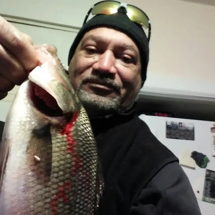
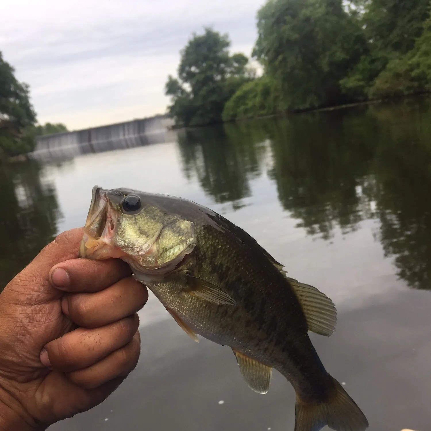
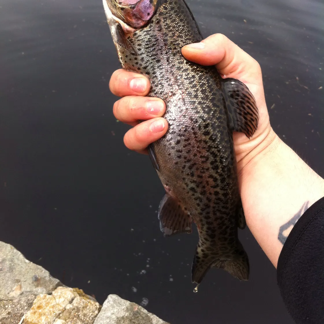
Runnins River fishing reports

Continue browsing catches and catch locations in the Fishbrain app
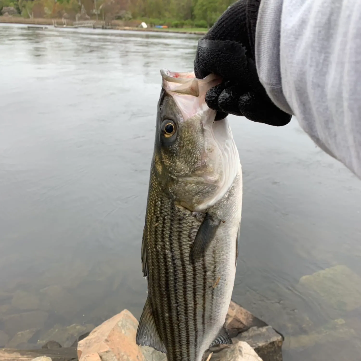
When are Striped Bass biting on Runnins River?
Learn what time of year and day to go fishing at Runnins River. Download Fishbrain today to look for new fishing spots, scout new fishing access, or prep for your next trip.

Fishing regulations at Runnins River, MA
Disclaimer: Always check local fishing regulations, water access rights and land ownership before fishing, regardless of any catches logged in that area by the Fishbrain community. Fishbrain has mapped millions of acres of government-owned land across the USA to help you identify potential fishing access, but you are responsible for ensuring compliance with all legal requirements.
Fishing regulations in Massachusetts can change throughout the year. Make sure to check this page before fishing for the most up to date rules and regulations for the current season. Local regulations govern when you can fish, the max size of the fish you can keep, how many fish you can keep, and more.
Regulations for top species
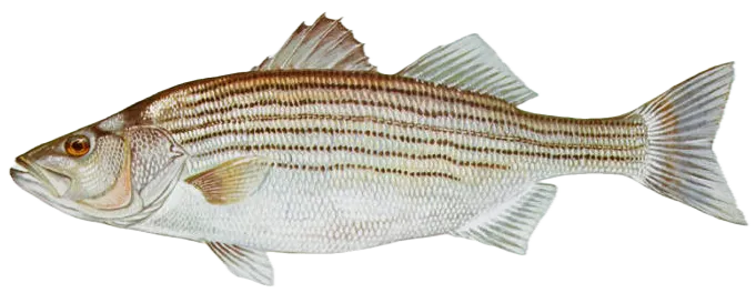
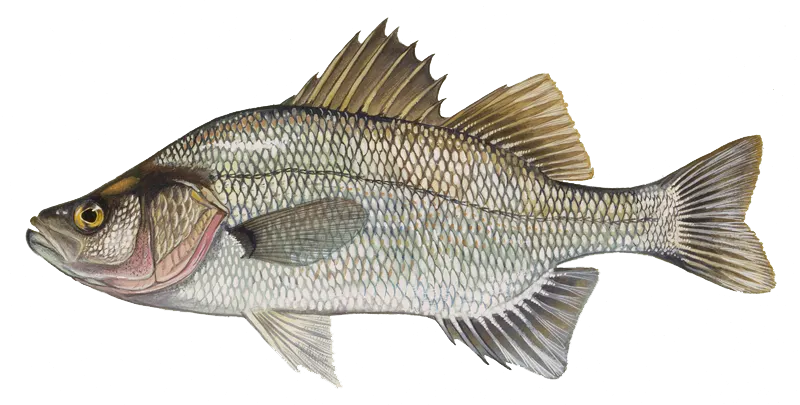
Striped bass
Bag limit1
The maximum number of individual fish legally harvested per harvester per day. Bag limits are only for properly licensed anglers actively harvesting the species. People who are not actively harvesting or are not properly licensed (if a license is required) may NOT be counted for the purpose of bag limits.
Min size28" (Total Length)
No person shall harvest any individual fish less than the minimum size limit.
Total length means the straight line distance from the most forward point of the head with the mouth closed, to the farthest tip of the tail with the tail compressed or squeezed, while the fish is lying on its side.
Max size31" (Total Length)
No person shall harvest any individual fish greater than the maximum size except as permitted.
Total length means the straight line distance from the most forward point of the head with the mouth closed, to the farthest tip of the tail with the tail compressed or squeezed, while the fish is lying on its side.
RequirementKeep intact
In waters where minimum-length or slot-size limits apply, game fish may not be filleted, nor their head or tail fin removed until the angler has completed fishing for the day.
Restrictions & requirements
Spears
Harvest of this species by "spearing" is prohibited. Spearing includes the catching or taking of a fish by bow hunting, gigging, spearfishing, or by any device used to capture a fish by piercing the body.
Keep Intact
In waters where minimum-length or slot-size limits apply, game fish may not be filleted, nor their head or tail fin removed until the angler has completed fishing for the day.
Additional information
No closed season.
Striped bass are measured from the tip of the snout or jaw (mouth closed) to the farthest extremity of the tail. The discard of dead legal sized striped bass is unlawful. The practice of high-grading, whereby legal sized striped bass are released in favor of larger fish caught subsequently is unlawful. Accordingly, it is also unlawful to keep a striped bass alive in water by attaching a line or chain to the fish (stringer), or placing it in a live well or holding car.
Striped bass must be kept whole, meaning the head, tail, and body remain intact. Only evisceration is allowed. Permitted for-hire vessels may fillet striped bass for their customers.
The use non-lethal devices to remove striped bass from the water is required; gaffing striped bass is prohibited. Revised Circle Hook Requirement: All recreational anglers—including those fishing onboard for-hire vessels—who are fishing for striped bass with bait are required to use inline (non-offset) circle hooks. This shall not apply to any artificial lure with bait attached. Bait is defined as any marine or aquatic organism, live or dead, whole or parts thereof. Striped bass caught on an unapproved method of take (while targeting other finfish species)—such as a baited J hook or treble hook—must be returned to the water immediately without unnecessary injury.
Please note that this requirement applies to all recreational anglers, whether fishing from shore, a private vessel, or a for-hire charter or party boat.
The hook of an artificial lure does not need to be an inline circle hook to have bait attached. This allowance provides for the continued use of tackle such as a tube-and-worm rig, a bucktail jig tipped with a pork rind, and an eel skin plug. Conversely, a rigged eel (a whole dead eel with hooks threaded through its body) cannot be used unless the hooks are inline circle hooks, and a menhaden snagged on a treble hook cannot be used as bait until transferred onto an inline circle hook.
An inline circle hook is defined as a fishing hook designed and manufactured so that the point of the hook is not offset from the plane of the shank and bend and is turned perpendicularly back towards the shank to form a circular or oval shape.
While it's understandable that striped bass may be inadvertently caught on an unapproved rig when other species are being targeted, such fish must be returned to the water as quickly and gently as possible.
Synonyms
White perch
Restrictions & requirements
MA Freshwater Prohibitions
Prohibitions while fishingMore than two hooks for fishing open water or more than five hooks when ice fishing. A hook is defined as an angling device attached to a fishing line that is designed to take one fish at a time but is not limited to devices commonly called spinners, spoons, bait harnesses, jigs, or plugs.Lead sinkers, lead weights, and lead jigs weighing less than an ounce. Any sinker or weight made from lead that weighs less than 1 ounce, and any lead jig (meaning any lead-weighted hook) that weighs less than 1 ounce, is prohibited for use in all inland waters of the Commonwealth. The term lead sinker shall not include any other sinkers, weights, fishing lures or fishing tackle including, but not limited to, artificial lures, hooks, weighted flies, and lead-core or other weighted fishing lines.Jug, toggle, or trot line fishing.SnaggingPoisons, explosivesLittering in inland waters.The taking of any fish from the inland waters of the Commonwealth for the purposes of sale.Releasing live fish or spawn into inland waters, except by permit.Transporting live fish (except bait for personal use) without a permit.
MA Freshwater Bait
It is unlawful to take fish from the inland waters of the state to sell as bait. Anglers who trap fish for personal use as bait may use only one trap.Licensed anglers may take bait for personal use at any time by any legal method. These methods include a rectangular net not to exceed 36 square feet in net area, a circular or ring net not to exceed six feet in diameter, or a fish trap with openings not to exceed one inch. Nets designed to catch fish through its gills may no be used. For personal use as bait, dead or alive, licensed anglers may only take these species:Banded killifishFallfishFathead minnowGolden shinerMummichogPumpkinseedRainbow smelt*Yellow perchWhite sucker * Smelt may be taken only by hook and line. Possession or use of smelt as bait in inland waters other than during the smelt season is prohibited.
MA Ice Fishing
Ice fishing: All anglers are allowed up to five hooks in the ice at one time. A hook is defined as an angling device attached to the line of a tip-up or jig stick that is designed to take one fish. This includes plain hooks, treble hooks, spinners, spoons, bait harnesses, jigs, or plugs. The device is not restricted to a single hook – lures with multiple treble hooks count as one hook in the water. Hooks can be on any combination of tip-ups or jig sticks, but no more than five hooks are allowed in total.Anglers must be able to tend their own hooks (tip-ups or jig sticks). Adults may assist kids with cutting holes or removing hooks, but kids must be able to tend tip-ups or jig sticks on their own.
MA Interstate Ponds
Fishing regulations on interstate ponds: Wallum Lake in Douglas: Fishing is permitted by anglers licensed in MA or RI. RI regulations apply.Lake Monomonac and Robbins Pond in Winchendon; Long Pond in Tyngsboro and Dracut; Bent Pond in Warwick; Tuxbury Pond in Amesbury: Fishing is permitted by anglers licensed in MA or NH. NH regulations apply.Colebrook Reservoir in Tolland; Perry Pond in Dudley; Muddy Pond in Southbridge; Breakneck Pond in Sturbridge; Congamond Lake in Southwick; Hamilton Reservoir in Holland: Fishing is permitted by anglers licensed in MA or CT. CT regulations apply to Colebrook Reservoir, Breakneck Pond, Perry Pond and Muddy Pond. MA regulations apply to Congamond Lake and Hamilton Reservoir.Sherman Reservoir in Rowe: MA regulations apply, and MA license is required in MA. VT regulations apply, and VT license required in VT.
Required licenses
Additional information
Edibility
Synonyms


Free trial available