Top fish species at Svensen Slough

White sturgeon
White sturgeon
App Section

Check which species have trophy potential in Svensen Slough

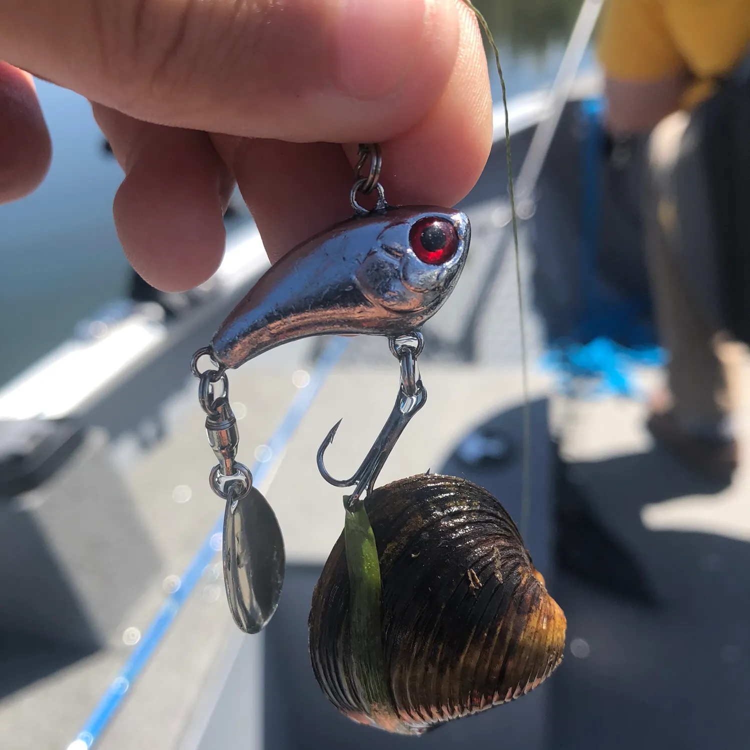
Svensen Slough fishing reports
Loading...

length Ā· weight

Loading...

White sturgeon

length Ā· weight

Fishbrain
Have you been fishing here?

Log your catch and check out other catches from the community in the Fishbrain app.

Loading...
Loading...
Loading...

General info

Svensen Slough is a stream located in Clatsop County, Oregon, United States. It is most popular for fishing White sturgeon.

Location

46°10′37.9″N 123°40′2.4″W
Directions

Fishing regulations at Svensen Slough, OR

Disclaimer: Always check local fishing regulations, water access rights and land ownership before fishing, regardless of any catches logged in that area by the Fishbrain community. Fishbrain has mapped millions of acres of government-owned land across the USA to help you identify potential fishing access, but you are responsible for ensuring compliance with all legal requirements.

Fishing regulations in Oregon can change throughout the year. Make sure to check this page before fishing for the most up to date rules and regulations for the current season. Local regulations govern when you can fish, the max size of the fish you can keep, how many fish you can keep, and more.

Regulations for top species
Season open: year-round
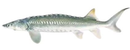
White sturgeon

White sturgeon

Regulation boundaryOR Oregon Columbia River Zone
Bag limit0

The maximum number of individual fish legally harvested per harvester per day. Bag limits are only for properly licensed anglers actively harvesting the species. People who are not actively harvesting or are not properly licensed (if a license is required) may NOT be counted for the purpose of bag limits.

Restrictions & requirements

OR Using devices to land fish

It is unlawful to use gurdies, winches or reels affixed to a boat to land a fish.

OR Use of drones and radios

It is unlawful to use drones/ radio controlled boats/ or other unmanned vehicles when angling or to aid in angling.

OR Snagging

It is unlawful to snag or attempt to snag gamefish.Additional anti-snagging gear restrictions:Fishing gear restricted to artificial fly, lure, or bait with one single-point hook.Unless otherwise specified, hook must measure 3/4 inch or less at the gap.Hook must be attached to or below any lure or bait.Weight cannot be less than 18 inches above the lure or bait.Consult exceptions to zone regulations for which leader length applies:Leader length: 18-36 inches or less than or equal to 6 feet

OR Unlawful Taking & Retention

It is unlawful to fish for or take and retain any legal species while possessing on board any species not allowed to be taken in that area at that time.

OR Use of More than One Rod or Line

It is unlawful to use more than one rod or line when angling except:with a Two-Rod Validation as a youth anglers (under 12 years of age) when angling outside of three miles from shore for offshore pelagic species, any number of rods or lines are allowed only if no species other than offshore pelagic species have been retained.

OR Ice hole size

Angling through a human-made ice hole larger than 12 inches in diameter or length is unlawful.

OR Use of chum

Taking or attempting to take any fish by chumming, or knowingly angle with the aid of chum is unlawful except when angling for offshore pelagic species outside of three miles from shore if no species other than offshore pelagic species have been retained.

OR Buying or selling fish and fish parts

Buying or selling fish or shellfish, or parts thereof, that were caught or taken for personal use. Except the skeletal remains of ocean food fish may be sold; and eggs from ocean-caught salmon may be sold to a licensed fish or bait dealer.

OR Fish with radio tags

It is unlawful to take a fish with a radio tag (identified by an antenna trailing from its mouth or body) except in the mainstem Columbia River and its tributaries, when consistent with all other applicable laws and regulations.

OR Fishways weirs and fish traps

It is unlawful to trespass on a fishway, weir or fish trap, or angle within 200 feet above and 200 feet below a weir or the entrance/exit of a private or public fishway or fish trap.

OR Transport of live fish and egs

Bringing live fish or live eggs into the state, transporting them overland, or from one waterbody to another without a permit from ODFW is unlawful.

OR Salmon and Steelhead Bobber Rules

When fishing for salmon and steelhead fishing gear restricted to artificial fly, lure, or bait with one single-point hook. Salmon/steelhead bobber angling gear mustinclude a bobber and leader no longer than36 inches. Any weight is to be no more than 36 inchesfrom the hook when suspended vertically. The bobber must suspend the weight, leader, and terminal gear, not allowing it to rest on the river bottom.

OR Bait Restriction

The following may NOT be used as bait:• Live fish. Except live nongame fish maybe used in the ocean, bays and tidewaters when taken from the same waters in which they will be used as bait.• Goldfish. Nor can they be in an angler's possession while angling.• Lamprey.• Live crayfish.• Live leeches. Nor can they be in an angler'spossession while angling.

OR 3 Hook Maximum

No more than three hooks may be used when angling, except herring jigs may be used for marine food fish species.• A double or treble point hook is classified asone hook.• When angling with two rods (whereallowed and with a Two-Rod Validation), the general hook rule applies to each rod.

OR Salmon, Steelhead, Halibut, Sturgeon Hooks

Salmon, Steelhead, Halibut and SturgeonPacific halibut: no more than two hooks may be used.Sturgeon:no more than one single point barbless hook may be used.Ocean salmon: no more than two single point barbless hooks when angling for salmon in the ocean, or when angling for other ocean species with salmon or steelhead onboard.Salmon/Steelhead (except ocean): Single-point hooks larger than 1inch gap and multiple point hooks larger than 9/16 inch gap are prohibited. All weight, if not part of conventional lure, must be attached on the fishing line between the lure and the end of the rod. With hooks larger than 5/8 inch gap or multiple point hook, weight must be attached 18 inches or more above the uppermost hook.

OR Daylight Hours

It is unlawful to angle for or take salmon, shad, steelhead, sturgeon, trout or whitefish except during daylight hours (one hour before sunrise until one hour after sunset). Unless there is an exception for specific waterbodies.

OR Game Fish Unlawful Methods

It is unlawful to take game fish other than those hooked inside the mouth. It is unlawful to: snag, spear, gaff, net, trap, club, shoot or ensnare any freshwater game fish. A hand-held landing net may be used to land a legally hooked fish. A gaff may not be used to land salmon, steelhead or other freshwater game fish in inland or ocean fisheries.

OR Removal of eggs

It is unlawful to remove eggs from any salmon, steelhead or sturgeon without retaining the carcass while in the field.

OR Field dressing of mutilating

It is unlawful to possess game fish in the field that have been dressed or mutilated so that size, species or fin clip cannot be determined. Fish may be dressed when the angler has reached their automobile (or principle means of land transportation) and has finished angling for the day.

OR Dip Net, Cast Net, Angling, Herring Jigs ONLY

May only be taken by dip net, cast net, angling and herring jigs.Ā 

OR Angling with Single Line or Spear

May be taken by angling with a single line, no more than 2 hooks; and by spear.

OR Ocean Salmon Regulations

Ocean salmon regulations are finalized in late-April for the "salmon year" that starts on May 16 and concludes the following April.Ā The season regulations that go into effectĀ March 15 of each year are those that wereĀ set in April of the previous year. In April, the Pacific Fishery Management Council and Oregon Fish andĀ WildlifeĀ Commission adopt additional salmon seasons for the new "salmon year" beginning May 16. To check the recreational Salmon quota status, visit the Ocean Salmon Management ProgramĀ catch indexĀ page.ā€Œ Refer to the currentĀ Oregon Sport Fishing RegulationsĀ for descriptions of special marine management areas including closed areas and additional restrictions. Anglers are advised to consult the following prior to fishing2024 Ocean Salmon Sport Seasons Guide2024Ā Oregon Sport Fishing Regulations for General (statewide)Marine Zone Regulations

OR Angling Tag in Possession

All anglers need a valid Combined Angling Tag (authorizing harvest of 20 salmon or steelhead per year) in possession to angle for salmon, steelhead, sturgeon and halibut.Harvested adult wild salmon or steelhead must be immediately recorded on the Combined Angling Tag.

Additional information
Catch-and-release only, except as noted underĀ location exceptions.(See Bonneville Dam upstream to Oregon/ Washington border.)Catch-and-release:Ā Open all year, except as noted under locationĀ exceptions.Note:Ā Sturgeon fisheries are managed on a quota basis. Check the status of regulations prior to fishing. Columbia River Zone Closed to retention of green sturgeon. All oversize, undersize and unwanted legal size sturgeon must be released immediately unharmed into the water.Sturgeon over 54 inches in fork length cannot be removed totally or in part from the water.Only one single-point, barbless hook may be used for sturgeon.Closed to retention of white sturgeon below Bonneville Dam.Additional opportunity is determined on an annual basis, visit myodfw.com for more information. See Oregon Sport Fishing Regulations for more information.
Synonyms
Acipenser transmontanus
Location regulation notes
Exceptions to Columbia River Zone RegulationsColumbia RiverBuoy 10 line up to a line projected from Rocky Point on the Washington bank through Red Buoy 44 to the navigation light at Tongue Point on the Oregon bankOpen for hatchery steelhead Jan 1 - Mar 31 and Aug 1 - Dec 31.Open for hatchery Chinook salmon Jan1 - Mar 31.Open for adult Chinook salmon Aug 1 - Aug 31.Open for adult hatchery coho salmon Aug1 - Dec 31. Minimum length for adult coho is 16 inches.Retention of jack salmon allowed Oct 1 - Dec 31.The Columbia River South Jetty is open to salmon angling seven days a week when the fall Buoy 10 or adjacent ocean salmon fishery is open.Closed to angling within the Youngs Bay Control Zone Aug 1 - Sep 15. See map on pg 78.In the waters of the Pacific Ocean and the Columbia River up to a line projected from Rocky Point on the Washington bank through Red Buoy 44 to the navigation light at Tongue Point on the Oregon bank, each angler aboard a vessel may continue to use angling gear until the daily limit of fish for all legally licensed and juvenile anglers aboard has been achieved. However, no individual angler may exceed any personal daily bag limit.A line projected from Rocky Point on the Washington bank through Red Buoy 44 to the navigation light at Tongue Point on the Oregon bank up to I-5 bridgeOpen for hatchery cutthroat trout Jan 1 - Mar 31 and May 22 - Dec 31.Open for hatchery Chinook salmon and hatchery steelhead Jan 1 - Mar 31.Open for hatchery jack Chinook and hatchery steelhead May 16 - Jul 31.Open for hatchery adult Chinook Jun 16-30.Open for hatchery coho and hatchery steelhead Aug 1 - Dec 31.Open for Chinook Aug 1-31.Angling from the Big Creek RR trestle is prohibited Aug. 16-Oct. 15.I-5 bridge to Bonneville DamOpen for hatchery steelhead Jan 1 - Mar 31 and Jun 16 - Dec 31.Open for hatchery jack Chinook Jun 16 - Jul31.Open for adult hatchery Chinook Jun 16- Jun 30.Open for hatchery coho Aug 1 - Dec. 31.Open for Chinook Aug 1 - Aug 31.Closed:Ā»Between markers 150 ft above and 450 ft below the mouth of Tanner Cr out to center of the Columbia River Aug 16 - Oct 15; Ā»Inside the south navigation lock at Bonneville Dam from a marker on the western-most point of Robins Island to a marker on the Oregon mainland shore;Ā»Angling is prohibited for all species during Jan 1 - Apr 30 from a line between the upstream end of Sand Island (near Rooster Rock) and a marker on the Oregon shoreline, downstream to a line between the lower end of Sand Island and a marker on the Oregon shoreline.Bank angling prohibited:Ā»From Bradford Island below Bonneville Dam from south shore between the dam and a line perpendicular to the shoreline marker at west end of riprap and from north shore between fishway entrance and a line perpendicular to the shoreline marker 850 ft downstream;Ā»From Robins Island below Bonneville Dam downstream to a line perpendicular to the shoreline marker on mooring cell.Angling from a floating device or using a floating device to set lines is prohibited in the area between Bonneville Dam and a line crossing the river below the dam marked by the boat-restricted zone sign on the Oregon shore at the westernmost tip of Robins Island to the boat-restricted zone sign approx. 50 ft above the Hamilton Island boat ramp on the Washington shore (USACE Boat Restricted Zone).Sturgeon angling is prohibited May 1 - Aug 31 from Bonneville Dam downstream approx. 9 mi to a line crossing the Columbia River from Navigation Marker 82 on the Oregon shore westerly to a boundary markeron the Washington shore above Fir Point.Salmon angling from a floating device is prohibited from Beacon Rock to BonnevilleDam Nov 1 - Dec 31.Bonneville Dam to Oregon/Washington border above McNary DamOpen for hatchery steelhead Jan 1 - Mar 31 and Jun 16 - Dec 31.Open for hatchery Chinook salmon Jun16 - Jul 31.Open for Chinook and coho salmon Aug 1 -Dec 31. Only hatchery coho salmon may be retained between Bonneville Dam and the Hood River Bridge at RM 169.When angling for salmon and steelhead, a single-point hook with a gap size no larger than 3/4-inch is required for all non-buoyant lures Aug 1 - Dec 31 except when trolling from a vessel or floating device.Only single-point hooks allowed when angling at Cascade Locks in the area between the boat ramp at the lower end of the locks upstream to the east (upstream) end of the lock wall.Sturgeon RegulationsĀ»Open for white sturgeon from Jan 1 - until quota is reached. Ā»Bag limit is 1 per day, 2 per year.Ā»Bonneville Dam to The Dalles Dam sturgeon must be between 38 inch minimum and 54 inch maximum forklength. Ā»The Dalles Dam to McNary Dam sturgeon must be between 43 inch minimum, 54 inch maximum forklength.Ā»Only catch-and-release allowed for sturgeon from McNary Dam to the Oregon/Washington border.Ā»Catch-and-release for sturgeon is allowed after taking the daily or annual limit or the after quota is reached. Check myodfw.com for regulation updates.Ā»Angling for sturgeon is prohibited from May 1 through August 31 in the following areas:–A line projected from the east (upstream) dock at the Port of The Dalles boat ramp straight across to a marker on the Washington bank upstream to The Dalles Dam.–A line projected from the west end of the grain silo at Rufus straight across to a marker on the Washington bank upstream to John Day Dam.–A line projected from the east end grain elevators at Patterson Ferry Road straight across to a marker on the Washington bank upstream to McNary Dam.Closed:Ā»Bonneville Dam upstream to a line across the river 1,000 ft from the dam as indicated by USACE signs;Ā»Interstate Hwy 197 bridge at The Dalles upstream to the upper line of The Dalles Dam, except bank angling is permitted above the Hwy bridge for 1,100 ft to the cyclone fence;Ā»John Day Dam downstream approx. 3,000 ft except that bank angling is permitted up to 600 ft below the fishway entrance;Ā»From a floating device in USACE designated hazard zones above and below McNary Dam.Benson Lake (Multnomah Co.)Open all year.5 hatchery trout per day, 8 inch minimum length.Blind Slough/Knappa Slough Select AreaIncluding Gnat Cr from RR bridge up to Aldrich Pt Rd Bridge (Clatsop Co.) (see map on pg 79)Open all year for hatchery Chinook, hatchery coho and hatchery steelhead.Use of barbed hooks allowed.Eagle CreekMouth to mainline railroad bridgeOpen for Chinook, hatchery coho salmon, and hatchery steelhead consistent with regulations for the Columbia River from Bonneville Dam to Oregon/Washington border.See Central Zone for area above mainline RR bridge.Hartman PondOpen all year.5 trout per day, 8 inch minimum length.1 bass per day.10 crappie per day.2 channel catfish per day.No minimum length on warmwater fish.Herman CreekEast of peninsula from the markers at the mouth to the mainline railroad bridge (see map on pg 77).Open for salmon and steelhead consistent with regulations for the Columbia River from Bonneville Dam to the OR/ WA border, except closed Aug 16 - Nov 30.See Central Zone for area above the mainline RR bridge.Herman Cr Youth and Disabled Angler Angling Area - West of peninsula from the markers at the mouth to lower Herman Cr Pond structure (see map on pg 77).Open for salmon and steelhead consistent with regulations for the Columbia River from Bonneville Dam to the OR/WA border. Open to youth angling (ages 17 and under) and Oregon Disabilities Hunting and Fishing Permit holders only.Herman Cr Lagoon- East of the line from Northwest tip of the jetty, south to marker on shore (See map on pg 77).Open for salmon and steelhead consistent with regulations for the Columbia River from Bonneville Dam to the OR/ WA border. An Oregon angling license and combined angling tag are required.Multnomah CreekMouth to the mainline railroad bridgeOpen for Chinook salmon, hatchery coho salmon, and hatchery steelhead consistent with regulations for the Columbia River from I-5 bridge up to Bonneville Dam except closed Aug 16 - Nov 30.Open all year for trout from Benson Lake downstream to the culvert under Hwy 84.5 hatchery trout per day, 8 inch minimum length.See Willamette Zone for areas above mainline RR bridge.Plympton CreekMouth to mainline railroad bridgeOpen for Chinook salmon, hatchery coho salmon and hatchery steelhead consistent with regulations for the Columbia River from the Rocky Point-Tongue Point line up to I-5 bridge.See Northwest Zone for area above mainline RR bridge.Tanner, Bridal Veil, Wahkeena, Horsetail and Oneonta CreeksMouth to the mainline railroad bridgeOpen for Chinook salmon, hatchery coho salmon, and hatchery steelhead consistent with regulations for the Columbia River from I-5 bridge up to Bonneville Dam except closed Aug 16 - Nov 30.See Willamette Zone for areas above mainline RR bridge.Wahkeena PondSee Hartman Pond above.Youngs Bay Select Area (Clatsop Co.)Hwy 101 bridge to marker at confluence of Youngs Bay and Klaskanine R., including Walluski R. tidewater (see map on pg 78)Open all year for hatchery Chinook salmon hatchery coho salmon and hatchery steelhead.Use of barbed hooks allowed.
Location specific information
Exceptions to Columbia River Zone RegulationsColumbia RiverBuoy 10 line up to a line projected from Rocky Point on the Washington bank through Red Buoy 44 to the navigation light at Tongue Point on the Oregon bankOpen for hatchery steelhead Jan 1 - Mar 31 and Aug 1 - Dec 31.Open for hatchery Chinook salmon Jan1 - Mar 31.Open for adult Chinook salmon Aug 1 - Aug 31.Open for adult hatchery coho salmon Aug1 - Dec 31. Minimum length for adult coho is 16 inches.Retention of jack salmon allowed Oct 1 - Dec 31.The Columbia River South Jetty is open to salmon angling seven days a week when the fall Buoy 10 or adjacent ocean salmon fishery is open.Closed to angling within the Youngs Bay Control Zone Aug 1 - Sep 15. See map on pg 78.In the waters of the Pacific Ocean and the Columbia River up to a line projected from Rocky Point on the Washington bank through Red Buoy 44 to the navigation light at Tongue Point on the Oregon bank, each angler aboard a vessel may continue to use angling gear until the daily limit of fish for all legally licensed and juvenile anglers aboard has been achieved. However, no individual angler may exceed any personal daily bag limit.A line projected from Rocky Point on the Washington bank through Red Buoy 44 to the navigation light at Tongue Point on the Oregon bank up to I-5 bridgeOpen for hatchery cutthroat trout Jan 1 - Mar 31 and May 22 - Dec 31.Open for hatchery Chinook salmon and hatchery steelhead Jan 1 - Mar 31.Open for hatchery jack Chinook and hatchery steelhead May 16 - Jul 31.Open for hatchery adult Chinook Jun 16-30.Open for hatchery coho and hatchery steelhead Aug 1 - Dec 31.Open for Chinook Aug 1-31.Angling from the Big Creek RR trestle is prohibited Aug. 16-Oct. 15.I-5 bridge to Bonneville DamOpen for hatchery steelhead Jan 1 - Mar 31 and Jun 16 - Dec 31.Open for hatchery jack Chinook Jun 16 - Jul31.Open for adult hatchery Chinook Jun 16- Jun 30.Open for hatchery coho Aug 1 - Dec. 31.Open for Chinook Aug 1 - Aug 31.Closed:Ā»Between markers 150 ft above and 450 ft below the mouth of Tanner Cr out to center of the Columbia River Aug 16 - Oct 15; Ā»Inside the south navigation lock at Bonneville Dam from a marker on the western-most point of Robins Island to a marker on the Oregon mainland shore;Ā»Angling is prohibited for all species during Jan 1 - Apr 30 from a line between the upstream end of Sand Island (near Rooster Rock) and a marker on the Oregon shoreline, downstream to a line between the lower end of Sand Island and a marker on the Oregon shoreline.Bank angling prohibited:Ā»From Bradford Island below Bonneville Dam from south shore between the dam and a line perpendicular to the shoreline marker at west end of riprap and from north shore between fishway entrance and a line perpendicular to the shoreline marker 850 ft downstream;Ā»From Robins Island below Bonneville Dam downstream to a line perpendicular to the shoreline marker on mooring cell.Angling from a floating device or using a floating device to set lines is prohibited in the area between Bonneville Dam and a line crossing the river below the dam marked by the boat-restricted zone sign on the Oregon shore at the westernmost tip of Robins Island to the boat-restricted zone sign approx. 50 ft above the Hamilton Island boat ramp on the Washington shore (USACE Boat Restricted Zone).Sturgeon angling is prohibited May 1 - Aug 31 from Bonneville Dam downstream approx. 9 mi to a line crossing the Columbia River from Navigation Marker 82 on the Oregon shore westerly to a boundary markeron the Washington shore above Fir Point.Salmon angling from a floating device is prohibited from Beacon Rock to BonnevilleDam Nov 1 - Dec 31.Bonneville Dam to Oregon/Washington border above McNary DamOpen for hatchery steelhead Jan 1 - Mar 31 and Jun 16 - Dec 31.Open for hatchery Chinook salmon Jun16 - Jul 31.Open for Chinook and coho salmon Aug 1 -Dec 31. Only hatchery coho salmon may be retained between Bonneville Dam and the Hood River Bridge at RM 169.When angling for salmon and steelhead, a single-point hook with a gap size no larger than 3/4-inch is required for all non-buoyant lures Aug 1 - Dec 31 except when trolling from a vessel or floating device.Only single-point hooks allowed when angling at Cascade Locks in the area between the boat ramp at the lower end of the locks upstream to the east (upstream) end of the lock wall.Sturgeon RegulationsĀ»Open for white sturgeon from Jan 1 - until quota is reached. Ā»Bag limit is 1 per day, 2 per year.Ā»Bonneville Dam to The Dalles Dam sturgeon must be between 38 inch minimum and 54 inch maximum forklength. Ā»The Dalles Dam to McNary Dam sturgeon must be between 43 inch minimum, 54 inch maximum forklength.Ā»Only catch-and-release allowed for sturgeon from McNary Dam to the Oregon/Washington border.Ā»Catch-and-release for sturgeon is allowed after taking the daily or annual limit or the after quota is reached. Check myodfw.com for regulation updates.Ā»Angling for sturgeon is prohibited from May 1 through August 31 in the following areas:–A line projected from the east (upstream) dock at the Port of The Dalles boat ramp straight across to a marker on the Washington bank upstream to The Dalles Dam.–A line projected from the west end of the grain silo at Rufus straight across to a marker on the Washington bank upstream to John Day Dam.–A line projected from the east end grain elevators at Patterson Ferry Road straight across to a marker on the Washington bank upstream to McNary Dam.Closed:Ā»Bonneville Dam upstream to a line across the river 1,000 ft from the dam as indicated by USACE signs;Ā»Interstate Hwy 197 bridge at The Dalles upstream to the upper line of The Dalles Dam, except bank angling is permitted above the Hwy bridge for 1,100 ft to the cyclone fence;Ā»John Day Dam downstream approx. 3,000 ft except that bank angling is permitted up to 600 ft below the fishway entrance;Ā»From a floating device in USACE designated hazard zones above and below McNary Dam.Benson Lake (Multnomah Co.)Open all year.5 hatchery trout per day, 8 inch minimum length.Blind Slough/Knappa Slough Select AreaIncluding Gnat Cr from RR bridge up to Aldrich Pt Rd Bridge (Clatsop Co.) (see map on pg 79)Open all year for hatchery Chinook, hatchery coho and hatchery steelhead.Use of barbed hooks allowed.Eagle CreekMouth to mainline railroad bridgeOpen for Chinook, hatchery coho salmon, and hatchery steelhead consistent with regulations for the Columbia River from Bonneville Dam to Oregon/Washington border.See Central Zone for area above mainline RR bridge.Hartman PondOpen all year.5 trout per day, 8 inch minimum length.1 bass per day.10 crappie per day.2 channel catfish per day.No minimum length on warmwater fish.Herman CreekEast of peninsula from the markers at the mouth to the mainline railroad bridge (see map on pg 77).Open for salmon and steelhead consistent with regulations for the Columbia River from Bonneville Dam to the OR/ WA border, except closed Aug 16 - Nov 30.See Central Zone for area above the mainline RR bridge.Herman Cr Youth and Disabled Angler Angling Area - West of peninsula from the markers at the mouth to lower Herman Cr Pond structure (see map on pg 77).Open for salmon and steelhead consistent with regulations for the Columbia River from Bonneville Dam to the OR/WA border. Open to youth angling (ages 17 and under) and Oregon Disabilities Hunting and Fishing Permit holders only.Herman Cr Lagoon- East of the line from Northwest tip of the jetty, south to marker on shore (See map on pg 77).Open for salmon and steelhead consistent with regulations for the Columbia River from Bonneville Dam to the OR/ WA border. An Oregon angling license and combined angling tag are required.Multnomah CreekMouth to the mainline railroad bridgeOpen for Chinook salmon, hatchery coho salmon, and hatchery steelhead consistent with regulations for the Columbia River from I-5 bridge up to Bonneville Dam except closed Aug 16 - Nov 30.Open all year for trout from Benson Lake downstream to the culvert under Hwy 84.5 hatchery trout per day, 8 inch minimum length.See Willamette Zone for areas above mainline RR bridge.Plympton CreekMouth to mainline railroad bridgeOpen for Chinook salmon, hatchery coho salmon and hatchery steelhead consistent with regulations for the Columbia River from the Rocky Point-Tongue Point line up to I-5 bridge.See Northwest Zone for area above mainline RR bridge.Tanner, Bridal Veil, Wahkeena, Horsetail and Oneonta CreeksMouth to the mainline railroad bridgeOpen for Chinook salmon, hatchery coho salmon, and hatchery steelhead consistent with regulations for the Columbia River from I-5 bridge up to Bonneville Dam except closed Aug 16 - Nov 30.See Willamette Zone for areas above mainline RR bridge.Wahkeena PondSee Hartman Pond above.Youngs Bay Select Area (Clatsop Co.)Hwy 101 bridge to marker at confluence of Youngs Bay and Klaskanine R., including Walluski R. tidewater (see map on pg 78)Open all year for hatchery Chinook salmon hatchery coho salmon and hatchery steelhead.Use of barbed hooks allowed.
License Icon
Local laws and licenses

Oregon fishing license

Get license

Cities nearby

Svensen

1.7 miles away

Knappa

4.1 miles away

Astoria

6.6 miles away

Altoona

6.9 miles away

Rosburg

9.1 miles away

Deep River

12.2 miles away

Puget Island

13.6 miles away

Skamokawa Valley

14.4 miles away

Naselle

14.5 miles away

Westport

14.5 miles away

Chinook

14.8 miles away

Gearhart

15.8 miles away

Upper Elochoman

17.0 miles away

Long Beach

22.3 miles away

Clatskanie

22.7 miles away

Cannon Beach

24.4 miles away

Lebam

27.3 miles away

Ocean Park

28.4 miles away

Vernonia

31.9 miles away

Pe Ell

32.4 miles away

Ryderwood

32.7 miles away

Neahkahnie

33.4 miles away

Bay Center

33.6 miles away

Longview

33.8 miles away

Anything missing or inaccurate?

Suggest changes to improve what we show.

Suggest changes

FAQ about Svensen Slough fishing

šŸ“ Where is the Svensen Slough located?
the Svensen Slough is a stream located in Clatsop County, Oregon, United States. Its coordinates are:
46°10′37.9″N 123°40′2.4″W
.
šŸŽ£ Where on the Svensen Slough is it best to fish?
Find the best fishing spots on the Svensen Slough by looking at where other anglers have caught fish. This can easily be done in the where it is also possible to see big fish potential and how good fishing is right now along with GarminĀ® depth maps.
🐟 What species are in the Svensen Slough?
The most common species in the Svensen Slough are:
šŸ“¢ What are the latest Svensen Slough fishing reports?
The latest Svensen Slough fishing reports are:
šŸ—“ļø What species are in season at the Svensen Slough right now?
According to fishing regulations at the Svensen Slough, some of the species in season this November include: Brown trout. For full details on other species — including bag limits, minimum and maximum size limits, and seasonal closures — download the .
🪪 Do I need a fishing license to fish at the Svensen Slough?

Fishing in Oregon requires a valid state fishing license for anglers. Licenses include resident and non-resident, annual, short-term, and combination permits, available online or at licensed vendors.

In Oregon, no fishing license is required for anglers under 12. Residents 70 and older qualify for a discounted license. A few other exceptions worth knowing:

  • Free fishing days — most states designate 1–2 weekends a year where anyone can fish without a license

  • Tribal waters — tribal members fishing on tribal land operate under separate tribal regulations

  • Private ponds — landowners fishing their own water typically don't need a license

Non-residents usually pay more for a license than residents. Some species also require an extra stamp or endorsement on top of your base license.

Get license
App Section
Download Fishbrain and fish smarter
Unlimited access to the best fishing spot finder in the game. Get all the fishing intel you need to start catching more, and bigger, fish.

Free trial available

Loading...
Loading...
Loading...
Loading...