
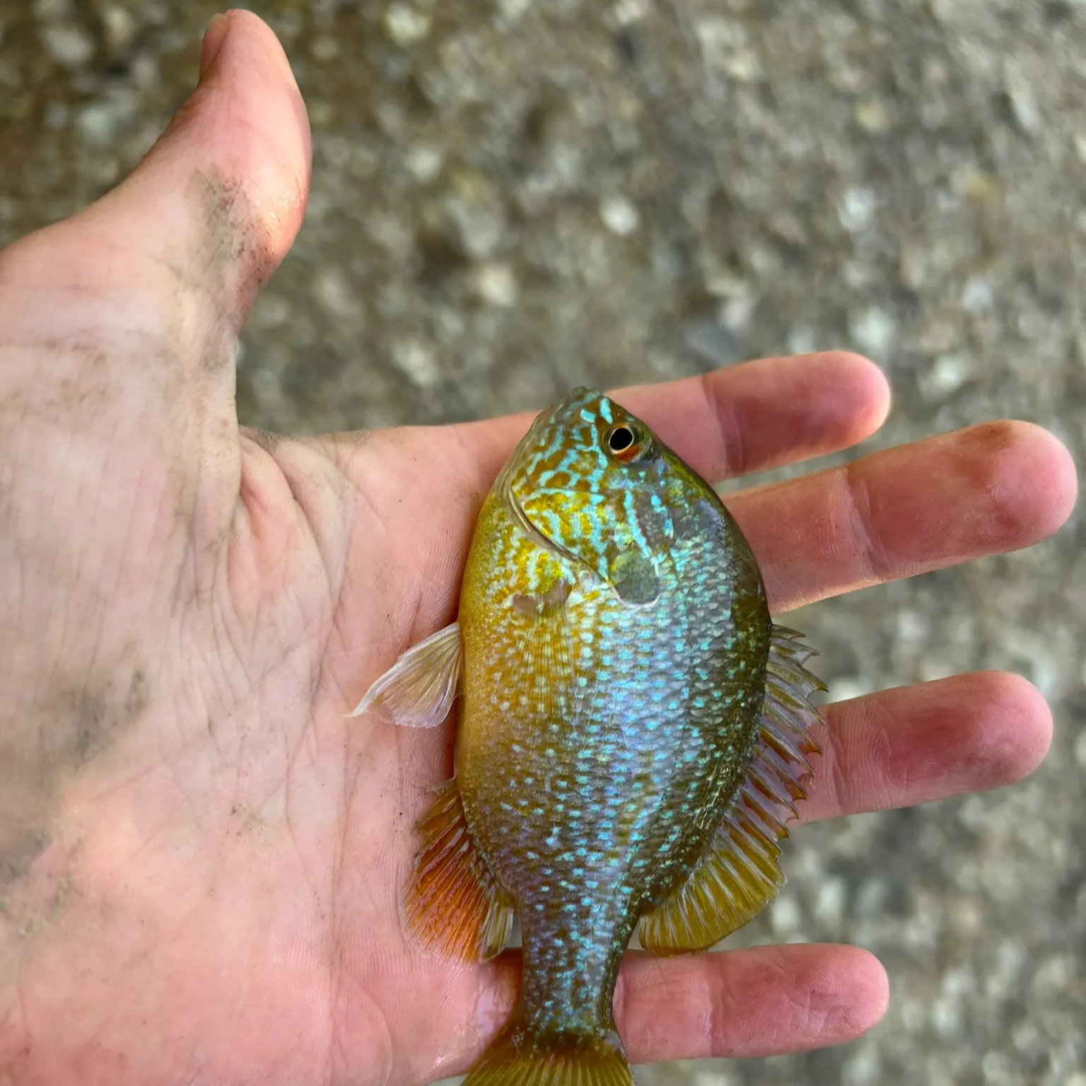
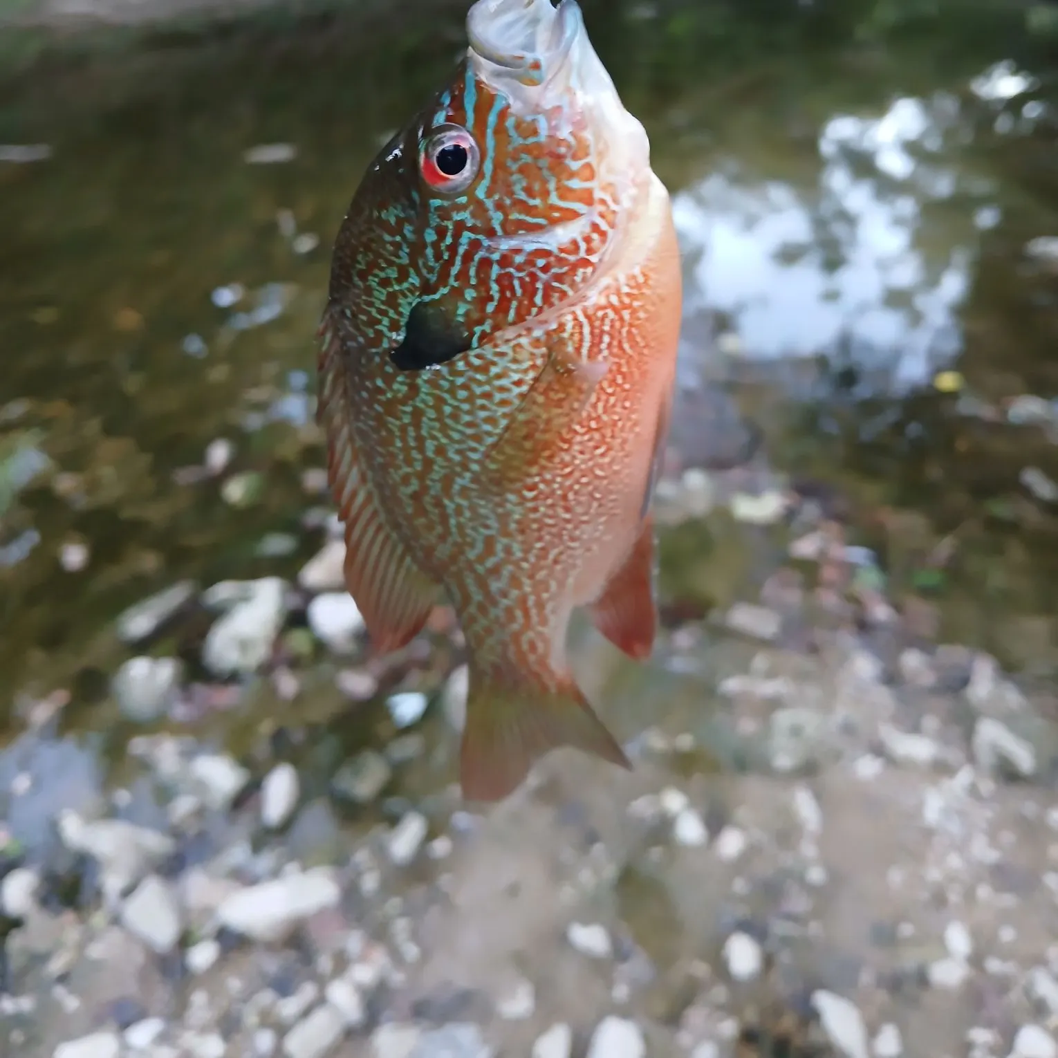
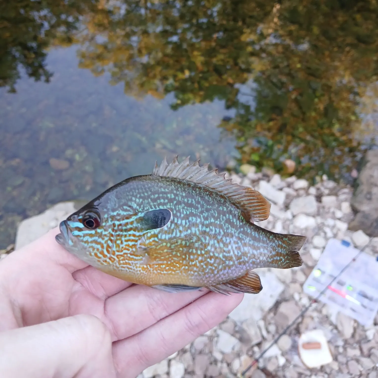
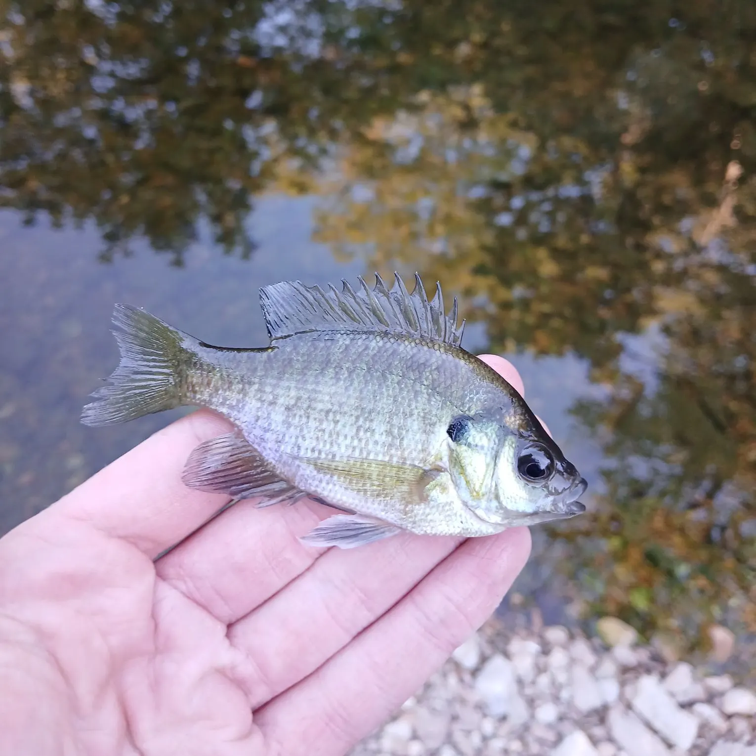
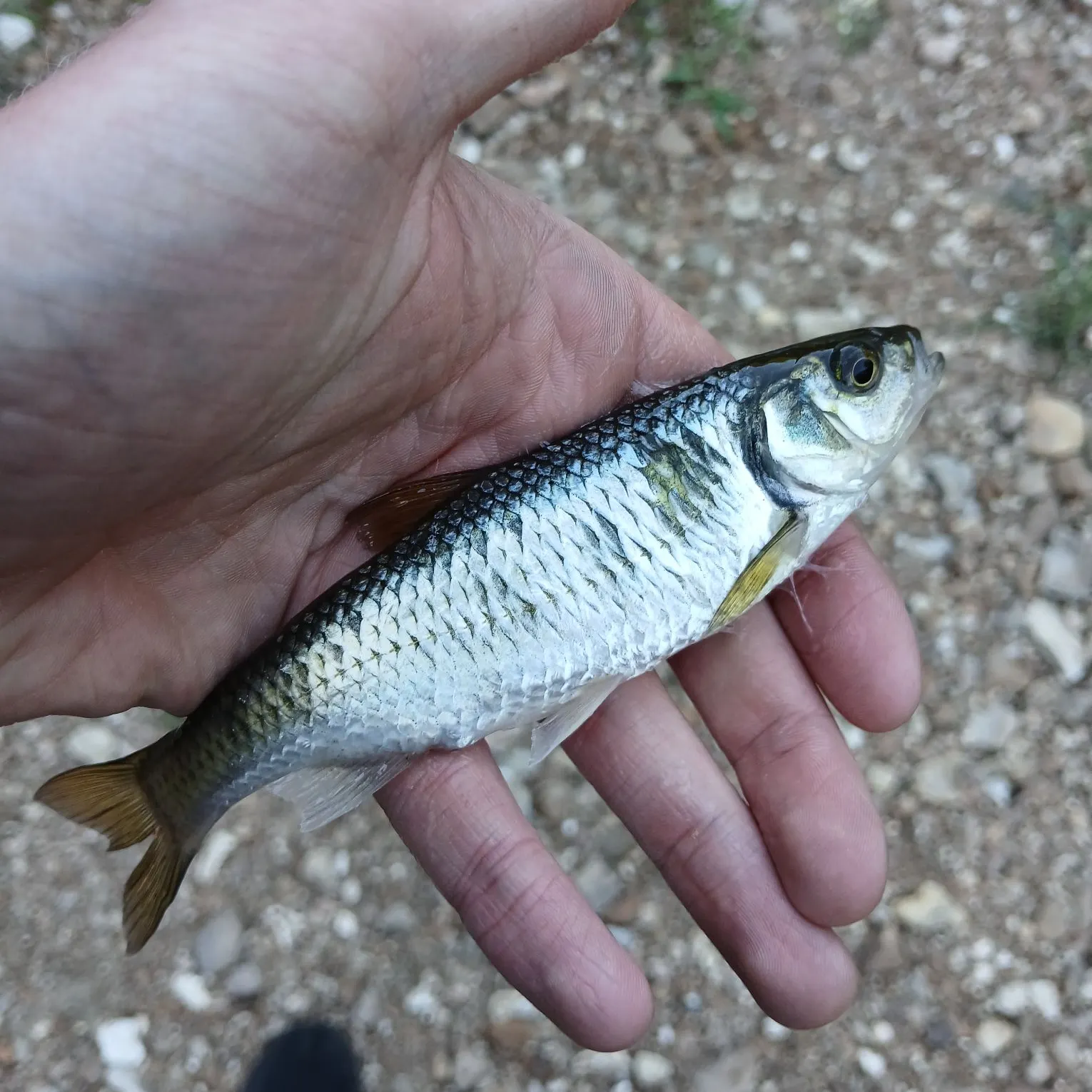
Logged catches
Top fish species at Little Dry Fork

Check which species have trophy potential in Little Dry Fork
Little Dry Fork fishing reports

Continue browsing catches and catch locations in the Fishbrain app
Fishing regulations at Little Dry Fork, MO
Disclaimer: Always check local fishing regulations, water access rights and land ownership before fishing, regardless of any catches logged in that area by the Fishbrain community. Fishbrain has mapped millions of acres of government-owned land across the USA to help you identify potential fishing access, but you are responsible for ensuring compliance with all legal requirements.
Fishing regulations in Missouri can change throughout the year. Make sure to check this page before fishing for the most up to date rules and regulations for the current season. Local regulations govern when you can fish, the max size of the fish you can keep, how many fish you can keep, and more.
Regulations for top species
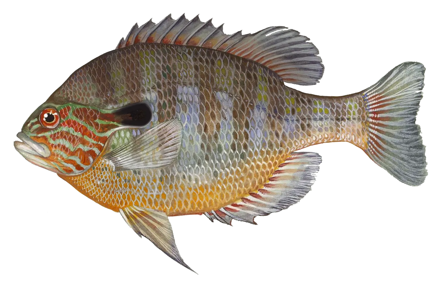
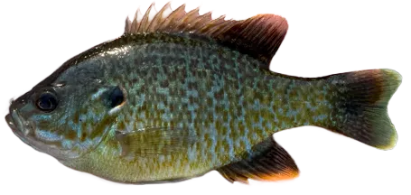
Longear sunfish
Bag limit50
The maximum number of individual fish legally harvested per harvester per day. Bag limits are only for properly licensed anglers actively harvesting the species. People who are not actively harvesting or are not properly licensed (if a license is required) may NOT be counted for the purpose of bag limits.
Aggregate limit50
The maximum number of individual fish across an aggregate group of species legally harvested per harvester per day.
Special gear
MO Gear
Seasonal Harvest Method Restrictions and Limits:Nongame Fish: Gig/Atlatl: Impounded WatersFebruary 16, 2023 - September 14, 2023Hours: Sunrise to sunsetDaily limit: 20, Possession limit: 40, except on the Mississippi River which has a daily and possession limit of 100.For more information please see Nongame fish: additional gear and area specific seasonsNongame Fish: Bowfishing: Impounded WatersApril 1, 2023 - January 31, 2024February 1, 2024 - March 31, 2024 Hours: Sunrise to midnight from February 1 to March 31.Applies to bowfishing in impounded waters.Daily limit: 20, Possession limit: 40, except on the Mississippi River which has a daily and possession limit of 100.Applies to bowfishing in impounded waters.For more information please see Nongame fish: additional gear and area specific seasonsNongame Fish: Snagging/Grabbing: Streams and Impounded WatersMarch 15, 2024 - May 15, 2024September 15, 2023 - February 15, 2024Hours: 24 HoursDaily limit: 20, Possession limit: 40, except on the Mississippi River which has a daily and possession limit of 100.In the Osage River downstream from U.S. Highway 54 to the Missouri River and in the Lake of the Ozarks and Harry S. Truman Reservoir, nongame fish may be taken by snagging, snaring, and grabbing from March 15 through April 30.On the Mississippi River, nongame fish may be taken by snagging, snaring, and grabbing from March 15 through May 15 and Sept. 15through Dec. 15.For more information please see Nongame fish: additional gear and area specific seasonsNongame Fish:Snaring:Streams and Impounded WatersMarch 15, 2024 - May 15, 2024September 15, 2023 - February 15, 2024Hours: 24 HoursDaily limit: 20Possession limit: 40, except on the Mississippi River which has a daily and possession limit of 100.In the Osage River downstream from U.S. Highway 54 to the Missouri River and in the Lake of the Ozarks and Harry S. Truman Reservoir,nongame fish may be taken by snagging, snaring, and grabbing from March 15 through April 30.On the Mississippi River, nongame fish may be taken by snagging, snaring, and grabbing from March 15 through May 15 and Sept. 15 through Dec. 15.For more information please see Nongame fish: additional gear and area specific seasonsNongame Fish: Gig/Atlatl:Streams and Impounded WatersSeptember 15, 2023 - February 15, 2024Hours: Sunrise to midnightDaily limit: 20, Possession limit: 40, except on the Mississippi River which has a daily and possession limit of 100.For more information please see Nongame fish: additional gear and area specific seasonsNongame Fish: Crossbow: Impounded Waters and Temporary OverflowJanuary 1, 2024 - December 31, 2024Hours: Sunrise to sunsetDaily limit: 20, Possession limit: 40, except on the Mississippi River which has a daily and possession limit of 100.Applies to crossbow fishing in impounded waters and bodies of water produced by the temporary overflow of a river or ditch.For more information please see Nongame fish: additional gear and area specific seasonsNongame Fish: Bowfishing: Mississippi, Missouri, St. Francis RiversJanuary 1, 2024 - December 31, 2024Hours: 24 HoursDaily limit: 20, Possession limit: 40, except on the Mississippi River which has a daily and possession limit of 100.Applies to bowfishing in portions of the Missouri, Mississippi, and St Francis rivers.For more information please see Nongame fish: additional gear and area specific seasonsNongame Fish: Snagging/Grabbing:Temporary OverflowJanuary 1, 2024 - December 31, 2024Hours: Sunrise to sunsetDaily limit: 20, Possession limit: 40, except on the Mississippi River which has a daily and possession limit of 100.Applies to snagging/grabbing in bodies of water produced by the temporary overflow of a river or ditch.For more information please see Nongame fish: additional gear and area specific seasonsNongame Fish: Gig/Atlatl: Temporary OverflowJanuary 1, 2024 - December 31, 2024Hours: Sunrise to sunsetDaily limit: 20, Possession limit: 40, except on the Mississippi River which has a daily and possession limit of 100.Applies to gigging in bodies of water produced by the temporary overflow of a river or ditch.For more information please see Nongame fish: additional gear and area specific seasonsNongame Fish: Line MethodsJanuary 1, 2024 - December 31, 2024Hours: 24 hoursDaily limit: 50, except on the Mississippi River which has a daily and possession limit of 100Possession limit: 100Applies to fishing in streams and impounded watersFor more information please see Nongame fish: additional gear and area specific seasons
Restrictions & requirements
MO Explosives Chemicals Poison Electricity
No one may use any explosive, poison, chemical or electrical equipment to kill or stupefy fish. Such material or equipment may not be possessed on waters of the state or adjacent banks.
MO Hand Fishing
It also is illegal to attempt to take fish by hand, with or without a hook, and to intentionally leave or abandon any commonly edible portion of any fish.
MO Spearguns
Spearguns may not be possessed on unimpounded waters or adjacent banks, and spears may not be propelled by explosives.
Additional information
Edibility
Synonyms

Smallmouth bass
Bag limit6
The maximum number of individual fish legally harvested per harvester per day. Bag limits are only for properly licensed anglers actively harvesting the species. People who are not actively harvesting or are not properly licensed (if a license is required) may NOT be counted for the purpose of bag limits.
Min size12" (Total Length)
No person shall harvest any individual fish less than the minimum size limit.
Total length means the straight line distance from the most forward point of the head with the mouth closed, to the farthest tip of the tail with the tail compressed or squeezed, while the fish is lying on its side.
Aggregate limit6
The maximum number of individual fish across an aggregate group of species legally harvested per harvester per day.
Restrictions & requirements
Gigging
Harvest by gigging prohibited.
Snagging
Harvest of this species by snagging (snatch hooking) is prohibited.
Spears
Harvest of this species by "spearing" is prohibited. Spearing includes the catching or taking of a fish by bow hunting, gigging, spearfishing, or by any device used to capture a fish by piercing the body.
MO Explosives Chemicals Poison Electricity
No one may use any explosive, poison, chemical or electrical equipment to kill or stupefy fish. Such material or equipment may not be possessed on waters of the state or adjacent banks.
MO Hand Fishing
It also is illegal to attempt to take fish by hand, with or without a hook, and to intentionally leave or abandon any commonly edible portion of any fish.
MO Spearguns
Spearguns may not be possessed on unimpounded waters or adjacent banks, and spears may not be propelled by explosives.
Additional information
Synonyms


Free trial available