
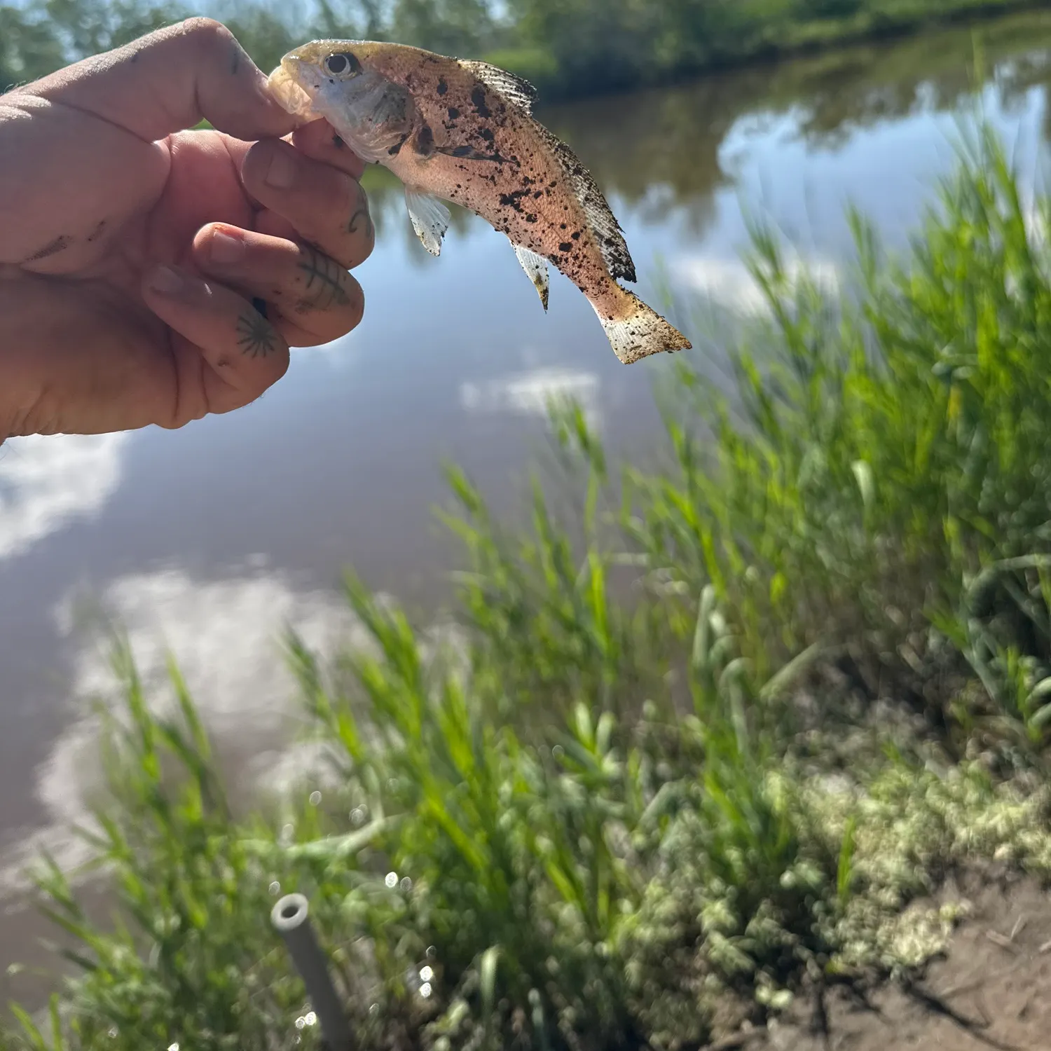
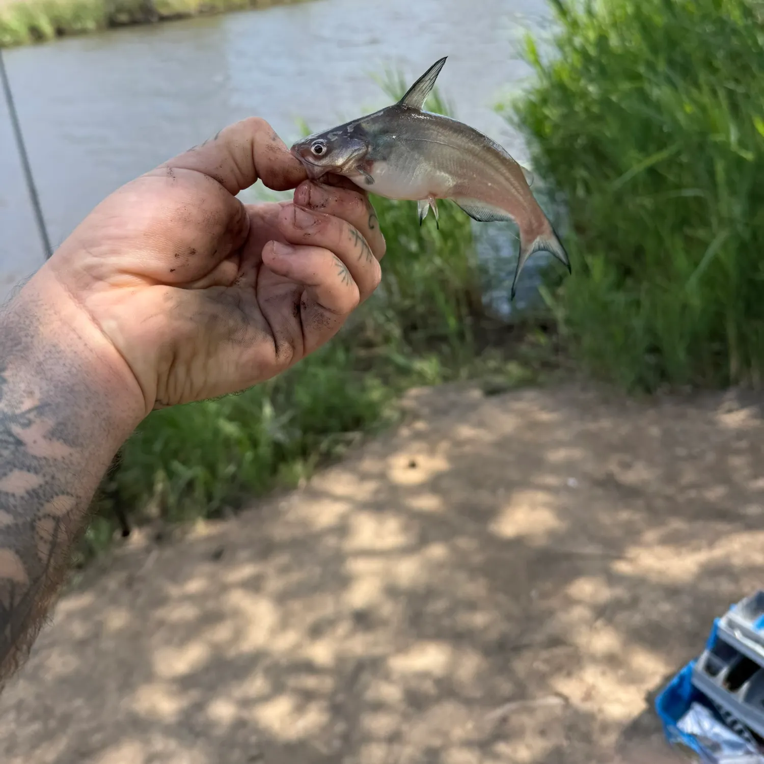
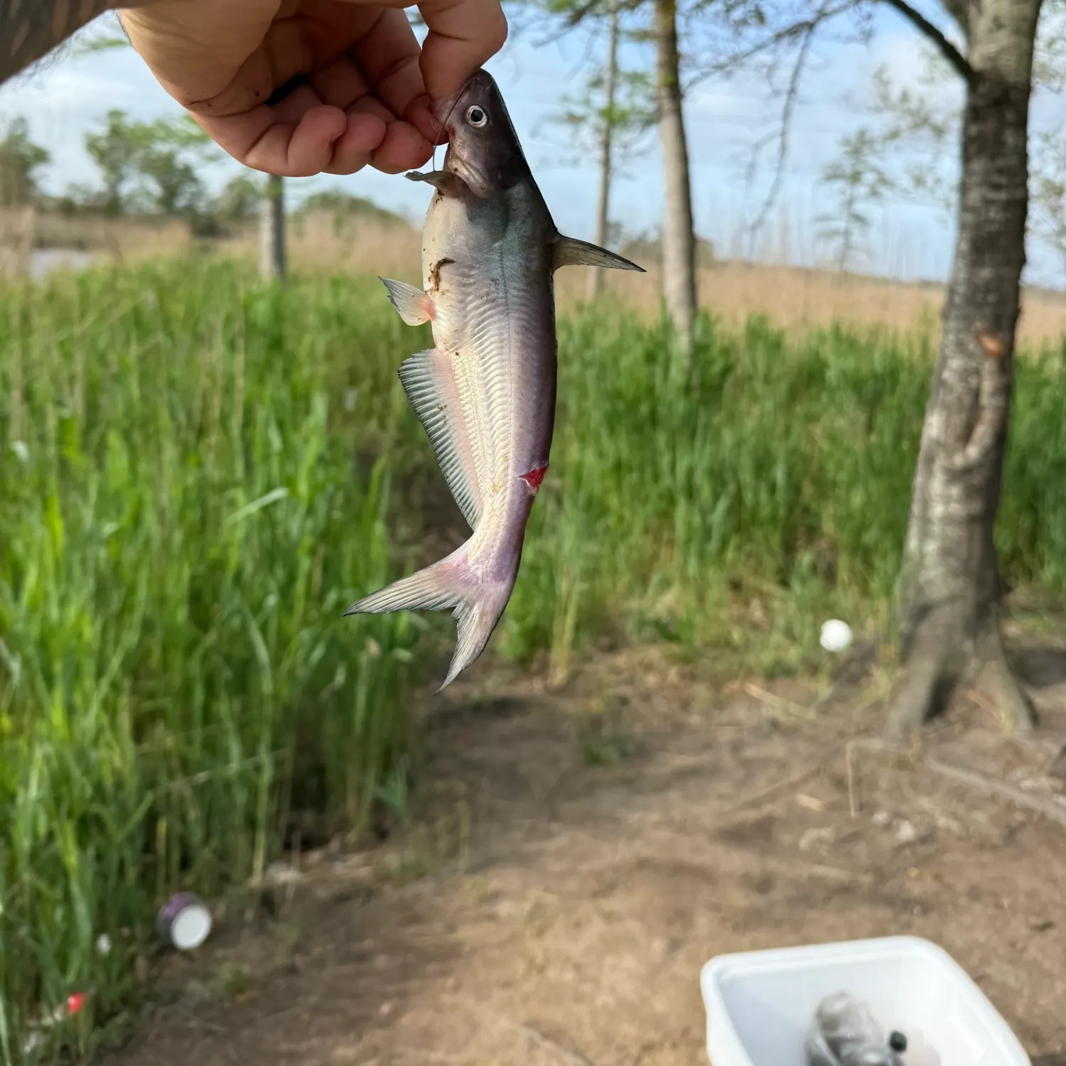
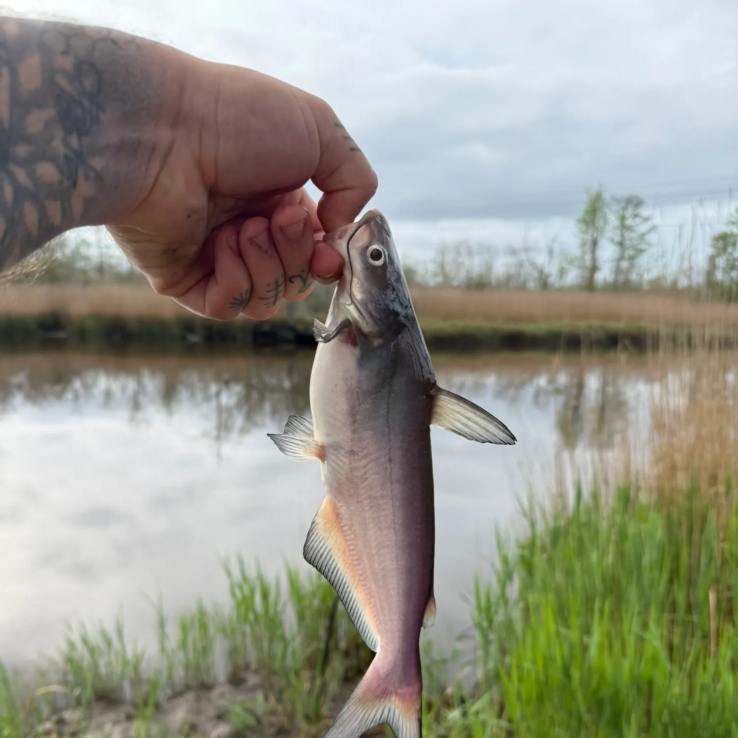
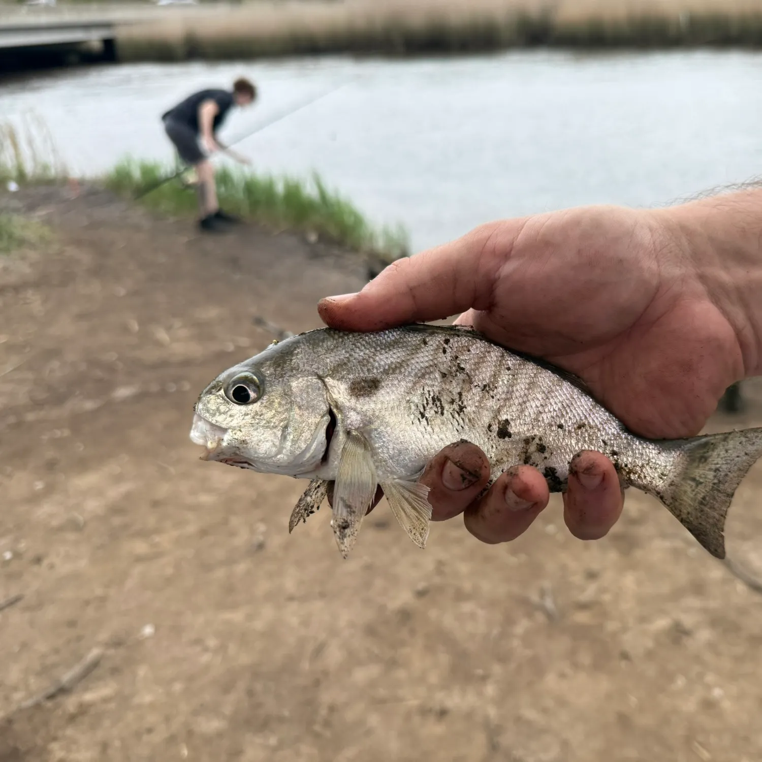
Top fish species at Alligator Creek

Check which species have trophy potential in Alligator Creek
Alligator Creek fishing reports

Continue browsing catches and catch locations in the Fishbrain app
Fishing regulations at Alligator Creek, NC
Disclaimer: Always check local fishing regulations, water access rights and land ownership before fishing, regardless of any catches logged in that area by the Fishbrain community. Fishbrain has mapped millions of acres of government-owned land across the USA to help you identify potential fishing access, but you are responsible for ensuring compliance with all legal requirements.
Fishing regulations in North Carolina can change throughout the year. Make sure to check this page before fishing for the most up to date rules and regulations for the current season. Local regulations govern when you can fish, the max size of the fish you can keep, how many fish you can keep, and more.
Regulations for top species

Channel catfish
Restrictions & requirements
NC Snagging
It is unlawful to snag fish by pulling or jerking a device equipped with one or more hooks through the water for the purpose of impaling fish. Applies to game and nongame fish.
NC Unlawful Possession
It is unlawful to possess:more than the daily creel limit while fishing, boating or afield; at any place more than three days' creel limit; fish whose size, creel or season restrictions are not in compliance with the regulations on the waters being fished.
NC Altering Fish
It is unlawful, while fishing, to change the appearance of fish subject to size limits or daily creel limits or remove the head and/ or tail from fish that are regulated by a size limit so that they may not be measured and/ or identified.
NC Trotlines Set-hooks and Jug-hooks
Trotlines, set-hooks and jug-hooks may be fished under any license that authorizes fishing privileges. It is unlawful to use live bait with trotlines, set-hooks or jug-hooks. Trotlines must be set parallel to the nearest shore in all public waters, where their use is authorized. Each trotline, set-hook and jug-hook shall have attached the user's name and address or the user's NCWRC customer number legibly inscribed. Each trotline shall be conspicuously marked at each end, and each set-hook shall be conspicuously marked at one end with a prominent flag or floating object. Metal cans and glass containers cannot be used as markers. The number of jug-hooks that may be fished is limited to 70 per boat. Trotlines, set-hooks and jug-hooks must be fished daily, and all fish must be removed daily. Exceptions:· No trotlines, set-hooks or jug-hooks may be used in the impounded waters of Sandhills Game Land. · No trotlines, set-hooks or jug-hooks may be used in Public Mountain Trout Waters, except impounded waters of power reservoirs and municipal water supply reservoirs open to the public for fishing. · In Lake Waccamaw, it is unlawful to use trotlines, set-hooks or jug-hooks from May 1–Sept. 30. · No trotlines, jug hooks, and set hooks in the inland fishing waters of the Roanoke River from April 1 to June 30.
NC Sale of Nongame Fish
Nongame fish caught on hook and line (including trotlines, set-hooks, and jug-hooks), grabbling and by special fishing devices with a Special Fishing Device License may be sold, subject to the following restrictions:Bowfin may not be sold. Blueback herring and alewife taken by any method in inland waters may not be sold, except for those fish less than six inches in length that are taken from Kerr Reservoir (Granville, Vance, and Warren counties).Blue crabs, Atlantic Croaker, Black Drum, Bluefish, Cobia, King Mackerel, Sheeps- head, Spanish Mackerel, Spot, and Weak- fish (Gray Trout) taken from inland fishing waters may not be sold.
NC Nongame Fish Harvest Method Restrictions
Nongame fishes, crustaceans (crayfish and blue crabs), and mollusks may be taken for personal use (bait or personal consumption) only with the equipment listed below, and with a valid license that provides basic inland fishing privileges. A dip net not greater than 6 feet across. » A seine not greater than 12 feet in length with a bar mesh measure of not more than 1/4 inch, except in Lake Waccamaw any length seine may be used to collectbait fishes.A cast net.A bow net in those counties and waterswith open seasons .Dip nets used in conjunction with a licensed hand-crank electrofisher where authorized by local law.Minnow traps not exceeding 12 inchesin diameter and 24 inches in length, with funnel openings not exceeding one inch in diameter. All fish and animals must be removed daily, and the traps must be labeled with the user's name and address or WRC customer number.A gig except in Public Mountain Trout Waters.Traps (no more than three) in those counties and waters with open seasons Eel pots (no more than two).A spear gun in those counties and waters with open seasons Hand-held lines with single baits attached to each.A single, multiple bait line for taking crabs not to exceed 100 feet in length that is under the immediate control and attendance of the user and is limited to one line per person and no more than one line per vessel. The line is required to be marked on each end with a solid float no less than five inches in diameter and bearing legible and indelible identification of the user's name and address.A collapsible crab trap with the largest opening not greater than 18 inches and which, by design, collapses at all times when in the water, except when being retrieved or lowered to the bottom.Nongame fish may be taken year-round with archery equipment in water- fowl impoundments located entirely on game lands and in all inland fishing waters other than the impounded waters on the Sandhills Game Land, Public Mountain Trout Waters, and reservoirs with restrictions on taking grass carp. In the PeeDee River downstream of Blewett Falls Dam to the South Carolina state line and all tributaries, archery equipment may only be used to take catfish, subject to size and creel limits .
NC Single Barbless Hook
In the inland waters of the Roanoke River upstream of the U.S. 258 bridge, only a single barbless circle hook when fishing with live or natural bait or other tackle with a single barbless hook may be used from April 1 to June 30. "Barbless" means that the hook either does not have a barb or that the barb is bent down. Tandem rigs are prohibited.
NC Special Fishing Devices
Special fishing devices for the taking of non- game fishes with a Special Fishing Device License, include the following: seines, cast nets, gill nets, dip nets, bow nets, reels, gigs, spear guns, baskets, fish pots, eel pots, traps (excluding crab traps and automobile tires), and hand-crank electrofishers where authorized by local law. Special fishing devices may only be used in inland fishing waters during designated seasons. Each user of a special device must have their own license in possession, except that a bow net or dip net may be used by another person who has the owner's license in their possession. Only the principal owner or operator must be licensed when drag seines are used at inland beaches to take mullet. Dip nets may be used in conjunction with a licensed hand-crank electrofisher where authorized by local law to take nongame fish for bait or personal consumption in inland fishing waters with any valid license that provides basic inland fishing privileges. Stationary nets must not exceed 100 yards in length and must be spaced at least 50 yards apart. "Attendance" requires that a netter be within 100 yards of their net at all times. Stationary nets must run parallel to the nearest shoreline. Anchored, fixed or drift gill nets must be marked at each end with two separate yellow buoys, which shall be of solid foam or other solid buoy- ant material no less than five inches in their smallest dimension. Buoys on each of the nets shall be marked (by engraving buoys or attaching engraved metal or plastic tags) with one of the following: owner's N.C. vessel registration number, owner's U.S. vessel documentation name or owner's last name and initials. No wires or ropes associated with a special fishing device may extend across any navigable waterway. A fish trap may be no more than 60 inches in length and no more than 30 inches in depth or width. No lead nets, wing nets or other devices may be attached to the trap nor used within 25 feet of the trap. Such devices, when set and left unattended, shall be affixed with a card or tag furnished by the license-holder and upon which their name and address shall be legibly inscribed. It is unlawful to use eel pots with mesh sizes smaller than one-half inch by one-half inch. Each eel pot must be marked by attaching a floating buoy, which shall be of solid foam or other solid buoyant material and no less than five inches in diameter and no less than five inches in length. Buoys may be any color except yellow. The owner shall always be identified on the attached buoy by using engraved buoys or by engraved metal or plastic tags attached to the buoy. Such identification shall include one of the following: owner's N.C. vessel registration number, owner's U.S. vessel documentation name, or owner's last name and initials. Hand-crank electrofishers are any manually operated device capable of generating a low- voltage electrical current, not to exceed 300 volts, for the taking of catfish. No special fishing devices, including crab pots, may be used in designated waterfowl impoundments located on game lands. Seasons and waters, in which use of special devices with a Special Fishing Device License are indicated by the following counties:Alamance: July 1 – Aug. 31 with seines in Alamance Creek below N.C. 49 bridge and Haw River. July 1 – June 30 with gigs in all public waters. Alexander: July 1 – June 30 with traps and gigs in all public waters; and with spear guns in Lake Hickory and Lookout Shoals Reservoir. Alleghany: July 1 – June 30 with gigs in New River, except Public Mountain Trout Waters. Anson: July 1 – June 30 with traps and gigs in all public waters. March 1 – April 30 with bow nets in Pee Dee River below Blewett Falls Dam. July 1 – Aug. 31 with seines in all running public waters, except Pee Dee River from Blewett Falls Dam downstream to the Seaboard Coastline Railroad trestle. Ashe: July 1 – June 30 with gigs in New River (both forks), except Public Mountain Trout Waters. Beaufort: July 1 – June 30 with traps in the Pungo River and in the Tar-Pamlico River above Norfolk and Southern Rail- road bridge; and with gigs in all inland public waters. March 1 – April 30 with bow nets in all inland public waters. Bertie: July 1 – June 30 with traps in Broad Creek (tributary of Roanoke River). March 1 – April 30 with bow nets in all inland public waters, excluding public lakes, ponds and other impounded waters. Bladen: March 1 – April 30 with bow nets in Black River; July 1 – March 1 with hand-crank electrofishers in Cape Fear River between Locks and Dams 1 and 3 and Black River (local law), except that hand-crank electrofishing is prohibited within 800 feet downstream and 400 yards upstream of Lock and Dam 1; 400 yards downstream and upstream of Lock and Dam 2; and 400 yards downstream of Lock and Dam 3. Brunswick: March 1 – April 30 with bow nets in Alligator Creek, Hoods Creek, Indian Creek, Orton Creek below Orton Pond, Rices Creek, Sturgeon Creek and Town Creek. Buncombe: July 1 – June 30 with gigs in all public waters, except Public Mountain Trout Waters. Burke: July 1 – Aug. 31 with seines in all running public waters, except Johns River and Public Mountain Trout Waters. July 1 – June 30 with traps, gigs and spear guns in all public waters, except Public Mountain Trout Waters and Lake James. Fishing by use of an unattended float is prohibited on Lake James (local law). Cabarrus: July 1 – Aug. 31 with seines in all running public waters. July 1 – June 30 with traps and gigs in all public waters. Caldwell: July 1 – June 30 with traps, gigs and spear guns in all public waters, except Public Mountain Trout Waters. Camden: July 1 – June 30 with traps in all inland public waters. March 1 – April 30 with bow nets in all inland public waters, excluding public lakes, ponds and other impounded waters. Carteret: March 1 – April 30 with bow nets in all inland public waters, except South River and the tributaries of the White Oak River. Caswell: July 1 – June 30 with gigs in all public waters. July1 – Aug. 31 with seines in all running public waters, except Moons Creek. July 1 – June 30 with traps in Hyco Reservoir.Catawba: July 1 – Aug. 31 with seines in all running public waters, except Catawba River below Lookout Dam. July 1 – June 30 with traps, spear guns and gigs in all public waters. Chatham: Dec. 1 – April 15 with dip and gill nets in the Cape Fear River, Haw River, Deep River and Rocky River (local law). July 1 – Aug. 31 with seines in the Cape Fear River and Haw River. July 1 – June 30 with traps in Deep River; and with gigs in all public waters. Cherokee: July 1 – June 30 with gigs in all public waters, except Public Mountain Trout Waters. Chowan: March 1 – April 30 with bow nets in all inland public waters, excluding public lakes, ponds and other impounded waters. July 1 – June 30 with traps in all inland public waters, excluding public lakes, ponds and other impounded waters. Clay: July 1 – June 30 with gigs in all public waters, except Public Mountain Trout Waters. Cleveland: July 1 – Aug. 31 with seines in all running public waters. July 1 – June 30 with gigs, traps and spear guns in all public waters. Columbus: Dec. 1 – March 1 with gigs in all inland public waters, except Lake Waccamaw and its tributaries. March 1 – April 30 with bow nets in Livingston Creek. July 1 – March 1 with hand-crank electrofishers in Waccamaw and Lumber rivers (local law). Craven: July 1 – June 30 with traps in the main run of the Trent and Neuse rivers. March 1 – April 30 with bow nets in all inland public waters, except Pitch Kettle, Grindle, Slocum (downstream from the U.S. 70 bridge), Spring and Hancock creeks and their tributaries; and with seines in the Neuse River. Currituck: July 1 – June 30 with traps in Tulls Creek and Northwest River. March 1 – April 30 with bow nets in all inland public waters, excluding public lakes, ponds and other impounded waters. Dare: July 1 – June 30 with traps in Mashoes Creek, Milltail Creek, East Lake and South Lake. March 1 – April 30 with bow nets in all inland public waters, excluding public lakes, ponds and other impounded waters. Davidson: July 1 – Aug. 31 with seines in all running public waters. July 1 – June 30 with gigs in all public waters; and with traps in all public waters except Leonard's Creek, Abbott's Creek below Lake Thom- A-Lex Dam and the Abbott's Creek arm of High Rock Lake upstream from the N.C. 8 bridge. Davie: July 1 – June 30 with traps and gigs in all public waters. July 1 – Aug. 31 for taking only carp and suckers with seines in Dutchman's Creek from U.S. 601 to Yadkin River and in Hunting Creek from S.R. 1338 to South Yadkin River. Duplin: Dec. 1 – June 5 with seines in the main run of the Northeast Cape Fear River downstream from a point one mile above Serecta Bridge. March 1 – April 30 with bow nets in the main run of the Northeast Cape Fear River downstream from a point one mile above Serecta Bridge. Durham: July 1 – Aug. 31 with seines in Neuse River. July 1 – June 30 with gigs in all public waters. Edgecombe: March 1 – April 30 with bow nets in all public waters. Forsyth: July 1 – June 30 with traps and gigs in all public waters, except traps may not be used in Belews Creek Reservoir. Franklin: July 1 – Aug. 31 with seines in Tar River. July 1 – June 30 with gigs in all public waters, except Parrish, Laurel Mill, Jackson, Clifton, Moore's and Perry's ponds, and in the Franklinton city ponds. Gaston: July 1 – Aug. 31 with seines in all running public waters. July 1 – June 30 with gigs, traps and spear guns in all public waters. Gates: March 1 – April 30 with bow nets in all inland public waters, excluding public lakes, ponds and other impounded waters. Graham: July 1 – June 30 with gigs in all public waters, except Public Mountain Trout Waters. Special devices are not permitted on Santeetlah Lake, Fontana Lake, Cheoah Reservoir and Calderwood Reservoir (local law). Granville: July 1 – June 30 with gigs in all public waters, except Kerr Reservoir. July 1 – Aug. 31 with seines in the Tar River below U.S. 158 bridge. July 1 – June 30 with dip and cast nets in Kerr Reservoir. Greene: March 1 – April 30 with bow nets and reels in Contentnea Creek. Guilford: July 1 – Aug. 31 with seines in Haw River, Deep River below Jamestown Dam and Reedy Fork Creek below U.S. 29 bridge. July 1 – June 30 with gigs in all public waters. Halifax: March 1 – April 30 with bow nets in Beech Swamp, Clarks Canal, Conocon- nara Swamp, Fishing Creek below the Fishing Creek Mill Dam, Kehukee Swamp, Looking Glass Gut, Quankey Creek and White's Mill Pond Run. April 1 – June 15 in Fishing Creek on Thursdays, Fridays and Saturdays, shad and herring (not to exceed 6 inches in length) may be taken with skim or gill nets having a bar mesh of not less than 1.5 inch (local law).Harnett: Jan. 1 – May 31 with gigs in Cape Fear River and tributaries. March 1 – April 30 with bow nets in Cape Fear River. Haywood: July 1 – June 30 with gigs in all public waters, except Lake Junaluska and Public Mountain Trout Waters. Henderson: July 1 – June 30 with gigs in all public waters, except Public Mountain Trout Waters. Hertford: July 1 – June 30 with traps in Wiccacon Creek. March 1 – April 30 with bow nets in all inland public waters, excluding public lakes, ponds and other impounded waters. Hyde: July 1 – June 30 with traps in all inland waters. March 1 – April 30 with bow nets in all inland public waters, ex- cluding public lakes, ponds and other im- pounded waters. Iredell: July 1 – June 30 with traps and gigs in all public waters; and with spear guns in Lookout Shoals Reservoir and Lake Norman. Jackson: July 1 – June 30 with gigs in all public waters, except Public Mountain Trout Waters. Johnston: March 1 – April 30 with bow nets in Black Creek, Little River, Middle Creek, Mill Creek, Neuse River and Swift Creek. Jones: July 1 – June 30 with traps in the Trent River below U.S. 17 bridge and White Oak River below U.S. 17 bridge. March 1 – April 30 with bow nets in all inland public waters, except the tributaries to White Oak River. Lee: Dec. 1 – April 15 with dip and gill nets in Cape Fear River and Deep River (local law). July 1 – Aug. 31 with seines in Cape Fear River. July 1 – June 30 with traps in Deep River; and with gigs in all public waters. Lenoir: July 1 – June 30 with traps in Neu- se River below U.S. 70 bridge at Kinston. March 1 – April 30 with bow nets in Neuse River and Contentnea Creek upstream from N.C. 118 bridge at Grifton; and with seines in Neuse River. Lincoln: July 1 – Aug. 31 with seines in all running public waters. July 1 – June 30 with traps, gigs and spear guns in all public waters. McDowell: July 1 – Aug. 31 with seines in all running public waters, except Public Mountain Trout Waters. July 1 – June 30 with traps, gigs and spear guns in all public waters, except Public Mountain Trout Waters and Lake James. Fishing by use of an unattended float is prohibited on Lake James (local law). Macon: July 1 – June 30 with gigs in all public waters, except Public Mountain Trout Waters. Madison: July 1 – June 30 with gigs in all public waters, except Public Mountain Trout Waters. Martin: March 1 – April 30 with bow nets in all inland public waters, excluding public lakes, ponds and other impounded waters. Mecklenburg: July 1 – Aug. 31 with seines in all running public waters. July 1 – June 30 with traps, gigs and spear guns in all public waters, except Freedom Park Pond and Hornet's Nest pond. Montgomery: July 1 – Aug. 31 with seines in all running public waters, except in Pee Dee River between Tillery Dam and Rocky River. July 1 – June 30 with traps and gigs in all public waters. Moore: July 1 – Aug. 31 with seines in all running public waters, except Deep River. July 1 – June 30 with gigs in all public wa- ters, except lakes located on the Sandhills Game Land; and with traps in Deep River and its tributaries. Nash: July 1 – June 30 with gigs in all public waters, except Tar River. March 1 – April 30 with bow nets in the Tar River below Harris' Landing and Fishing Creek below the Fishing Creek Mill Dam.New Hanover: March 1 – April 30 with bow nets in all inland public waters, except Sutton (Catfish) Lake. Northampton: July 1 – June 30 with gigs in all public waters, except Gaston and Roanoke Rapids reservoirs and the Roanoke River above the U.S. 301 bridge. March 1 – April 30 with bow nets in Occoneechee Creek, Old River Landing Gut and Vaughns Creek below Watsons Mill. Onslow: July 1 – June 30 with traps in White Oak River below U.S. 17 bridge. Aug. 1 – March 31 with eel pots in the main run of New River between U.S. 17 bridge and the mouth of Hawkins Creek. March 1 – April 30 with bow nets in the main run of New River and White Oak River, and in Grant's Creek. Orange: July 1 – Aug. 31 with seines in Haw River. July 1 – June 30 with gigs in all public waters. Pamlico: March 1 – April 30 with bow nets in all inland public waters, except Dawson Creek. Pasquotank: July 1 – June 30 with traps in all inland waters, except Dawson Creek. March 1 – April 30 with bow nets in all inland public waters, excluding public lakes, ponds and other impounded waters. Pender: Dec. 1 – June 5 with seines in the main run of the Northeast Cape Fear River. March 1 – April 30 with bow nets in the Northeast Cape Fear River, Long Creek, Moore's Creek approximately one mile upstream to New Moon Fishing Camp and Black River. July 1 – March 1 with hand- crank electrofishers in Black River (local law). Perquimans: July 1 – June 30 with traps in all inland waters. March 1 – April 30 with bow nets in all inland public waters, excluding public lakes, ponds and other impounded waters. Person: July 1 – Aug. 31 with seines in Hyco Creek and Mayo Creek. July 1 – June 30 with gigs in all public waters. Pitt: July 1 – June 30 with traps in Neuse River and in Tar River below the mouth of Hardee Creek east of Greenville. March 1 – April 30 with bow nets in all inland public waters, except Grindle Creek, and Contentnea Creek between N.C. 118 bridge at Grifton and the Neuse River. Dec. 1 to June 5 with seines in Tar River. Polk: July 1 – June 30 with gigs in all public waters, except Public Mountain Trout Waters. Randolph: July 1 – Aug. 31 with seines in Deep River above the Coleridge Dam and in Uwharrie River. July 1 – June 30 with gigs in all public waters. Richmond: July 1 – Aug. 31 with seines in all running public waters, except Pee Dee River from Blewett Falls Dam downstream to the Seaboard Coastline Railroad trestle. July 1 – June 30 with traps and gigs in all public waters, except lakes located on the Sandhills Game Land. March 1 – April 30 with bow nets in Pee Dee River below Blewett Falls Robeson: Dec. 1 – March 1 with gigs in all inland public waters. Rockingham: July 1 – Aug. 31 with seines in Dan River and Haw River. July 1 – June 30 with traps in Dan River; and with gigs in all public waters. Rowan: July 1 – Aug. 31 with seines in all running public waters. July 1 – June 30 with traps and gigs in all public waters. Rutherford: July 1 – Aug. 31 with seines in all running public waters, except Public Mountain Trout Waters. July 1 – June 30 with traps, gigs and spear guns in all public waters, except Public Mountain Trout Waters. Sampson: March 1 – April 30 with bow nets in Big Coharrie Creek, Black River and Six Runs Creek. July 1 – March 1 with hand-crank electrofishers in Black River downstream of N.C. 1105 bridge (local law). Stanly: July 1 – Aug. 31 with seines in all running public waters, except Pee Dee River between Tillery Dam and Rocky River. July 1 – June 30 with traps and gigs in all public waters. Stokes: July 1 – June 30 with traps and gigs in all public waters, except Public Mountain Trout Waters; and traps may not be used in Belews Creek Reservoir. Surry: July 1 – June 30 with gigs in all public waters, except Public Mountain Trout Waters; and with traps in the main stem of Yadkin River. Swain: July 1 – June 30 with gigs in all public waters, except Public Mountain Trout Waters. Special devices are not permitted on Santeetlah Lake, Fontana Lake, Cheoah Reservoir and Calderwood Reservoir (local law). Transylvania: July 1 – June 30 with gigs in all public waters, except Public Mountain Trout Waters. Tyrrell: July 1 – June 30 with traps in Scuppernong River and Alligator Creek. March 1 – April 30 with bow nets in all in- land public waters, excluding Lake Phelps, the drainage canals that connect Lake Phelps and Scuppernong River, public lakes, ponds and other impounded waters. Union: July 1 – Aug. 31 with seines in all running public waters. July 1 – June 30 with traps and gigs in all public waters. Vance: July 1 – Aug. 31 with seines in the Tar River. July 1 – June 30 with gigs in all public waters, except Rolands, Faulkners, Southerlands and Weldon ponds, City Lake, and Kerr Reservoir. July 1 – June 30 with dip and cast nets in Kerr Reservoir. Wake: July 1 – June 30 with gigs in all public waters, except Sunset, Benson, Wheeler, Raleigh and Johnson lakes. March 1 – April 30 with bow nets in the Neuse River below Falls Lake Dam, and Swift Creek below Lake Benson Dam. Warren: July 1 – Aug. 31 with seines in Fishing Creek, Shocco Creek and Walker Creek, excluding Duck and Hammes Mill ponds. July 1 – June 30 with gigs in all public waters, except Duck and Hammes Mill ponds, Kerr Reservoir and Gaston Reservoir. July 1 – June 30 with dip and cast nets in Kerr Reservoir. Washington: March 1 – April 30 with bow nets in all inland public waters, excluding Lake Phelps, the drainage canals that connect Lake Phelps and Scuppernong River, public lakes, ponds and other impound- ed waters. Wayne: March 1 – April 30 with bow nets in Little River, Mill Creek and Neuse River. Wilkes: July 1 – June 30 with traps in Yadkin River below W. Kerr Scott Reservoir; and with gigs and spear guns in all public waters, except Public Mountain Trout Waters. Wilson: July 1 – June 30 with gigs in Contentnea Creek (except Buckhorn Reservoir), including unnamed tributaries between Flowers Mill and S.R. 1163 (Deans) bridge. March 1 – April 30 with bow nets in Contentnea Creek below U.S. 301 bridge and in Toisnot Swamp down-stream from the Lake Toisnot Dam. Yadkin: July 1 – June 30 with gigs in all public waters, and with traps in the main stem of Yadkin River.
Additional information
No size or daily creel limit in all inland fishing waters except those listed below:
Daily creel limit 7 Channel Catfish; No size limit: Alamance County (Cedarock Park Pond), Alexander County (Ellendale Community Center Pond), Buncombe County (Azalea Park Pond, Charles Owen Park Pond, Lake Julian, Lake Louise, Lake Tomahawk), Cabarrus County (Frank Liske Park Pond, TN Spencer Park Pond), Cumberland County (Lake Rim*), Edgecombe County (Etheridge Pond*, Indian Lake, Newbold Pond*), Forsyth County (CG Hill Memorial Park Pond, Kernersville Lake, Village Point Lake, Winston Park Pond*), Franklin County (Owens Park Pond), Gaston County (Dallas Park Pond, George Poston Park Pond), Granville County (Lake Devin), Guilford County (Bur-Mill Park Ponds, Country Park Pond, Guilford County Farm Park, Hagan Stone Park Ponds, Keeley Park Ponds, Oka T Hester Pond), Jackson County (Cashiers Recreation Pond), Lee County (San-Lee Park Ponds), Lenoir County (Neuseway Nature Center Pond), Mecklenburg County (Elon Holmes Park Pond, Freedom Park Pond, Hor- net's Nest Park Pond, McAlpine Lake*, Robbins Park Ponds, Squirrel Lake), Moore County (Lake Luke Marion, Pages Lake), Nash County (Rocky Mount City Lake), Orange County (Anderson Community Park Pond, Lake Michael), Pitt County (River Park North Ponds), Polk County (Laughter Pond), Richmond County (Ellerbe Community Lake, Hamlet City Lake, Hinson Lake), Rowan County (Dan Nicholas Park Pond, Salisbury Community Park Lake, Lake Corriher), Stanly County (Albe- marle City Lake), Surry County (Big Elkin Creek, Tumbling Rock Reservoir), Union County (Dogwood Park Pond), Vance County (Fox Pond), Wake County (Bass Lake, Bond Park Pond, Harris Lake County Park Pond, Pine Lake in Apex Community Park, Lake Raleigh*, Shelley Lake, Simpkins Pond in Lake Wheeler Park), Yadkin County (Yadkin County Park Pond).
Ponds located on game lands - No size limit; daily creel limit 5 in combination (blue catfish, flathead catfish, channel catfish):
Pee Dee River downstream of Blewett Falls Dam to the South Carolina state line and all tributaries.
For more information please see https://www.ncwildlife.org/licensing/regulations
Edibility
Synonyms
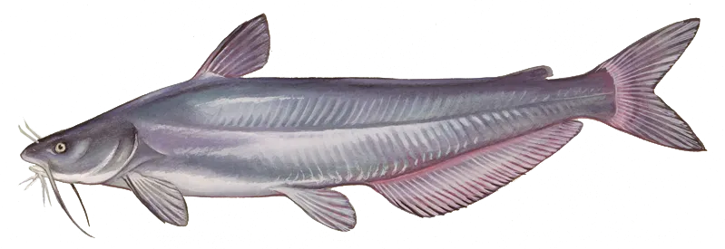
Blue catfish
Restrictions & requirements
NC Snagging
It is unlawful to snag fish by pulling or jerking a device equipped with one or more hooks through the water for the purpose of impaling fish. Applies to game and nongame fish.
NC Unlawful Possession
It is unlawful to possess:more than the daily creel limit while fishing, boating or afield; at any place more than three days' creel limit; fish whose size, creel or season restrictions are not in compliance with the regulations on the waters being fished.
NC Altering Fish
It is unlawful, while fishing, to change the appearance of fish subject to size limits or daily creel limits or remove the head and/ or tail from fish that are regulated by a size limit so that they may not be measured and/ or identified.
NC Trotlines Set-hooks and Jug-hooks
Trotlines, set-hooks and jug-hooks may be fished under any license that authorizes fishing privileges. It is unlawful to use live bait with trotlines, set-hooks or jug-hooks. Trotlines must be set parallel to the nearest shore in all public waters, where their use is authorized. Each trotline, set-hook and jug-hook shall have attached the user's name and address or the user's NCWRC customer number legibly inscribed. Each trotline shall be conspicuously marked at each end, and each set-hook shall be conspicuously marked at one end with a prominent flag or floating object. Metal cans and glass containers cannot be used as markers. The number of jug-hooks that may be fished is limited to 70 per boat. Trotlines, set-hooks and jug-hooks must be fished daily, and all fish must be removed daily. Exceptions:· No trotlines, set-hooks or jug-hooks may be used in the impounded waters of Sandhills Game Land. · No trotlines, set-hooks or jug-hooks may be used in Public Mountain Trout Waters, except impounded waters of power reservoirs and municipal water supply reservoirs open to the public for fishing. · In Lake Waccamaw, it is unlawful to use trotlines, set-hooks or jug-hooks from May 1–Sept. 30. · No trotlines, jug hooks, and set hooks in the inland fishing waters of the Roanoke River from April 1 to June 30.
NC Sale of Nongame Fish
Nongame fish caught on hook and line (including trotlines, set-hooks, and jug-hooks), grabbling and by special fishing devices with a Special Fishing Device License may be sold, subject to the following restrictions:Bowfin may not be sold. Blueback herring and alewife taken by any method in inland waters may not be sold, except for those fish less than six inches in length that are taken from Kerr Reservoir (Granville, Vance, and Warren counties).Blue crabs, Atlantic Croaker, Black Drum, Bluefish, Cobia, King Mackerel, Sheeps- head, Spanish Mackerel, Spot, and Weak- fish (Gray Trout) taken from inland fishing waters may not be sold.
NC Nongame Fish Harvest Method Restrictions
Nongame fishes, crustaceans (crayfish and blue crabs), and mollusks may be taken for personal use (bait or personal consumption) only with the equipment listed below, and with a valid license that provides basic inland fishing privileges. A dip net not greater than 6 feet across. » A seine not greater than 12 feet in length with a bar mesh measure of not more than 1/4 inch, except in Lake Waccamaw any length seine may be used to collectbait fishes.A cast net.A bow net in those counties and waterswith open seasons .Dip nets used in conjunction with a licensed hand-crank electrofisher where authorized by local law.Minnow traps not exceeding 12 inchesin diameter and 24 inches in length, with funnel openings not exceeding one inch in diameter. All fish and animals must be removed daily, and the traps must be labeled with the user's name and address or WRC customer number.A gig except in Public Mountain Trout Waters.Traps (no more than three) in those counties and waters with open seasons Eel pots (no more than two).A spear gun in those counties and waters with open seasons Hand-held lines with single baits attached to each.A single, multiple bait line for taking crabs not to exceed 100 feet in length that is under the immediate control and attendance of the user and is limited to one line per person and no more than one line per vessel. The line is required to be marked on each end with a solid float no less than five inches in diameter and bearing legible and indelible identification of the user's name and address.A collapsible crab trap with the largest opening not greater than 18 inches and which, by design, collapses at all times when in the water, except when being retrieved or lowered to the bottom.Nongame fish may be taken year-round with archery equipment in water- fowl impoundments located entirely on game lands and in all inland fishing waters other than the impounded waters on the Sandhills Game Land, Public Mountain Trout Waters, and reservoirs with restrictions on taking grass carp. In the PeeDee River downstream of Blewett Falls Dam to the South Carolina state line and all tributaries, archery equipment may only be used to take catfish, subject to size and creel limits .
NC Single Barbless Hook
In the inland waters of the Roanoke River upstream of the U.S. 258 bridge, only a single barbless circle hook when fishing with live or natural bait or other tackle with a single barbless hook may be used from April 1 to June 30. "Barbless" means that the hook either does not have a barb or that the barb is bent down. Tandem rigs are prohibited.
NC Special Fishing Devices
Special fishing devices for the taking of non- game fishes with a Special Fishing Device License, include the following: seines, cast nets, gill nets, dip nets, bow nets, reels, gigs, spear guns, baskets, fish pots, eel pots, traps (excluding crab traps and automobile tires), and hand-crank electrofishers where authorized by local law. Special fishing devices may only be used in inland fishing waters during designated seasons. Each user of a special device must have their own license in possession, except that a bow net or dip net may be used by another person who has the owner's license in their possession. Only the principal owner or operator must be licensed when drag seines are used at inland beaches to take mullet. Dip nets may be used in conjunction with a licensed hand-crank electrofisher where authorized by local law to take nongame fish for bait or personal consumption in inland fishing waters with any valid license that provides basic inland fishing privileges. Stationary nets must not exceed 100 yards in length and must be spaced at least 50 yards apart. "Attendance" requires that a netter be within 100 yards of their net at all times. Stationary nets must run parallel to the nearest shoreline. Anchored, fixed or drift gill nets must be marked at each end with two separate yellow buoys, which shall be of solid foam or other solid buoy- ant material no less than five inches in their smallest dimension. Buoys on each of the nets shall be marked (by engraving buoys or attaching engraved metal or plastic tags) with one of the following: owner's N.C. vessel registration number, owner's U.S. vessel documentation name or owner's last name and initials. No wires or ropes associated with a special fishing device may extend across any navigable waterway. A fish trap may be no more than 60 inches in length and no more than 30 inches in depth or width. No lead nets, wing nets or other devices may be attached to the trap nor used within 25 feet of the trap. Such devices, when set and left unattended, shall be affixed with a card or tag furnished by the license-holder and upon which their name and address shall be legibly inscribed. It is unlawful to use eel pots with mesh sizes smaller than one-half inch by one-half inch. Each eel pot must be marked by attaching a floating buoy, which shall be of solid foam or other solid buoyant material and no less than five inches in diameter and no less than five inches in length. Buoys may be any color except yellow. The owner shall always be identified on the attached buoy by using engraved buoys or by engraved metal or plastic tags attached to the buoy. Such identification shall include one of the following: owner's N.C. vessel registration number, owner's U.S. vessel documentation name, or owner's last name and initials. Hand-crank electrofishers are any manually operated device capable of generating a low- voltage electrical current, not to exceed 300 volts, for the taking of catfish. No special fishing devices, including crab pots, may be used in designated waterfowl impoundments located on game lands. Seasons and waters, in which use of special devices with a Special Fishing Device License are indicated by the following counties:Alamance: July 1 – Aug. 31 with seines in Alamance Creek below N.C. 49 bridge and Haw River. July 1 – June 30 with gigs in all public waters. Alexander: July 1 – June 30 with traps and gigs in all public waters; and with spear guns in Lake Hickory and Lookout Shoals Reservoir. Alleghany: July 1 – June 30 with gigs in New River, except Public Mountain Trout Waters. Anson: July 1 – June 30 with traps and gigs in all public waters. March 1 – April 30 with bow nets in Pee Dee River below Blewett Falls Dam. July 1 – Aug. 31 with seines in all running public waters, except Pee Dee River from Blewett Falls Dam downstream to the Seaboard Coastline Railroad trestle. Ashe: July 1 – June 30 with gigs in New River (both forks), except Public Mountain Trout Waters. Beaufort: July 1 – June 30 with traps in the Pungo River and in the Tar-Pamlico River above Norfolk and Southern Rail- road bridge; and with gigs in all inland public waters. March 1 – April 30 with bow nets in all inland public waters. Bertie: July 1 – June 30 with traps in Broad Creek (tributary of Roanoke River). March 1 – April 30 with bow nets in all inland public waters, excluding public lakes, ponds and other impounded waters. Bladen: March 1 – April 30 with bow nets in Black River; July 1 – March 1 with hand-crank electrofishers in Cape Fear River between Locks and Dams 1 and 3 and Black River (local law), except that hand-crank electrofishing is prohibited within 800 feet downstream and 400 yards upstream of Lock and Dam 1; 400 yards downstream and upstream of Lock and Dam 2; and 400 yards downstream of Lock and Dam 3. Brunswick: March 1 – April 30 with bow nets in Alligator Creek, Hoods Creek, Indian Creek, Orton Creek below Orton Pond, Rices Creek, Sturgeon Creek and Town Creek. Buncombe: July 1 – June 30 with gigs in all public waters, except Public Mountain Trout Waters. Burke: July 1 – Aug. 31 with seines in all running public waters, except Johns River and Public Mountain Trout Waters. July 1 – June 30 with traps, gigs and spear guns in all public waters, except Public Mountain Trout Waters and Lake James. Fishing by use of an unattended float is prohibited on Lake James (local law). Cabarrus: July 1 – Aug. 31 with seines in all running public waters. July 1 – June 30 with traps and gigs in all public waters. Caldwell: July 1 – June 30 with traps, gigs and spear guns in all public waters, except Public Mountain Trout Waters. Camden: July 1 – June 30 with traps in all inland public waters. March 1 – April 30 with bow nets in all inland public waters, excluding public lakes, ponds and other impounded waters. Carteret: March 1 – April 30 with bow nets in all inland public waters, except South River and the tributaries of the White Oak River. Caswell: July 1 – June 30 with gigs in all public waters. July1 – Aug. 31 with seines in all running public waters, except Moons Creek. July 1 – June 30 with traps in Hyco Reservoir.Catawba: July 1 – Aug. 31 with seines in all running public waters, except Catawba River below Lookout Dam. July 1 – June 30 with traps, spear guns and gigs in all public waters. Chatham: Dec. 1 – April 15 with dip and gill nets in the Cape Fear River, Haw River, Deep River and Rocky River (local law). July 1 – Aug. 31 with seines in the Cape Fear River and Haw River. July 1 – June 30 with traps in Deep River; and with gigs in all public waters. Cherokee: July 1 – June 30 with gigs in all public waters, except Public Mountain Trout Waters. Chowan: March 1 – April 30 with bow nets in all inland public waters, excluding public lakes, ponds and other impounded waters. July 1 – June 30 with traps in all inland public waters, excluding public lakes, ponds and other impounded waters. Clay: July 1 – June 30 with gigs in all public waters, except Public Mountain Trout Waters. Cleveland: July 1 – Aug. 31 with seines in all running public waters. July 1 – June 30 with gigs, traps and spear guns in all public waters. Columbus: Dec. 1 – March 1 with gigs in all inland public waters, except Lake Waccamaw and its tributaries. March 1 – April 30 with bow nets in Livingston Creek. July 1 – March 1 with hand-crank electrofishers in Waccamaw and Lumber rivers (local law). Craven: July 1 – June 30 with traps in the main run of the Trent and Neuse rivers. March 1 – April 30 with bow nets in all inland public waters, except Pitch Kettle, Grindle, Slocum (downstream from the U.S. 70 bridge), Spring and Hancock creeks and their tributaries; and with seines in the Neuse River. Currituck: July 1 – June 30 with traps in Tulls Creek and Northwest River. March 1 – April 30 with bow nets in all inland public waters, excluding public lakes, ponds and other impounded waters. Dare: July 1 – June 30 with traps in Mashoes Creek, Milltail Creek, East Lake and South Lake. March 1 – April 30 with bow nets in all inland public waters, excluding public lakes, ponds and other impounded waters. Davidson: July 1 – Aug. 31 with seines in all running public waters. July 1 – June 30 with gigs in all public waters; and with traps in all public waters except Leonard's Creek, Abbott's Creek below Lake Thom- A-Lex Dam and the Abbott's Creek arm of High Rock Lake upstream from the N.C. 8 bridge. Davie: July 1 – June 30 with traps and gigs in all public waters. July 1 – Aug. 31 for taking only carp and suckers with seines in Dutchman's Creek from U.S. 601 to Yadkin River and in Hunting Creek from S.R. 1338 to South Yadkin River. Duplin: Dec. 1 – June 5 with seines in the main run of the Northeast Cape Fear River downstream from a point one mile above Serecta Bridge. March 1 – April 30 with bow nets in the main run of the Northeast Cape Fear River downstream from a point one mile above Serecta Bridge. Durham: July 1 – Aug. 31 with seines in Neuse River. July 1 – June 30 with gigs in all public waters. Edgecombe: March 1 – April 30 with bow nets in all public waters. Forsyth: July 1 – June 30 with traps and gigs in all public waters, except traps may not be used in Belews Creek Reservoir. Franklin: July 1 – Aug. 31 with seines in Tar River. July 1 – June 30 with gigs in all public waters, except Parrish, Laurel Mill, Jackson, Clifton, Moore's and Perry's ponds, and in the Franklinton city ponds. Gaston: July 1 – Aug. 31 with seines in all running public waters. July 1 – June 30 with gigs, traps and spear guns in all public waters. Gates: March 1 – April 30 with bow nets in all inland public waters, excluding public lakes, ponds and other impounded waters. Graham: July 1 – June 30 with gigs in all public waters, except Public Mountain Trout Waters. Special devices are not permitted on Santeetlah Lake, Fontana Lake, Cheoah Reservoir and Calderwood Reservoir (local law). Granville: July 1 – June 30 with gigs in all public waters, except Kerr Reservoir. July 1 – Aug. 31 with seines in the Tar River below U.S. 158 bridge. July 1 – June 30 with dip and cast nets in Kerr Reservoir. Greene: March 1 – April 30 with bow nets and reels in Contentnea Creek. Guilford: July 1 – Aug. 31 with seines in Haw River, Deep River below Jamestown Dam and Reedy Fork Creek below U.S. 29 bridge. July 1 – June 30 with gigs in all public waters. Halifax: March 1 – April 30 with bow nets in Beech Swamp, Clarks Canal, Conocon- nara Swamp, Fishing Creek below the Fishing Creek Mill Dam, Kehukee Swamp, Looking Glass Gut, Quankey Creek and White's Mill Pond Run. April 1 – June 15 in Fishing Creek on Thursdays, Fridays and Saturdays, shad and herring (not to exceed 6 inches in length) may be taken with skim or gill nets having a bar mesh of not less than 1.5 inch (local law).Harnett: Jan. 1 – May 31 with gigs in Cape Fear River and tributaries. March 1 – April 30 with bow nets in Cape Fear River. Haywood: July 1 – June 30 with gigs in all public waters, except Lake Junaluska and Public Mountain Trout Waters. Henderson: July 1 – June 30 with gigs in all public waters, except Public Mountain Trout Waters. Hertford: July 1 – June 30 with traps in Wiccacon Creek. March 1 – April 30 with bow nets in all inland public waters, excluding public lakes, ponds and other impounded waters. Hyde: July 1 – June 30 with traps in all inland waters. March 1 – April 30 with bow nets in all inland public waters, ex- cluding public lakes, ponds and other im- pounded waters. Iredell: July 1 – June 30 with traps and gigs in all public waters; and with spear guns in Lookout Shoals Reservoir and Lake Norman. Jackson: July 1 – June 30 with gigs in all public waters, except Public Mountain Trout Waters. Johnston: March 1 – April 30 with bow nets in Black Creek, Little River, Middle Creek, Mill Creek, Neuse River and Swift Creek. Jones: July 1 – June 30 with traps in the Trent River below U.S. 17 bridge and White Oak River below U.S. 17 bridge. March 1 – April 30 with bow nets in all inland public waters, except the tributaries to White Oak River. Lee: Dec. 1 – April 15 with dip and gill nets in Cape Fear River and Deep River (local law). July 1 – Aug. 31 with seines in Cape Fear River. July 1 – June 30 with traps in Deep River; and with gigs in all public waters. Lenoir: July 1 – June 30 with traps in Neu- se River below U.S. 70 bridge at Kinston. March 1 – April 30 with bow nets in Neuse River and Contentnea Creek upstream from N.C. 118 bridge at Grifton; and with seines in Neuse River. Lincoln: July 1 – Aug. 31 with seines in all running public waters. July 1 – June 30 with traps, gigs and spear guns in all public waters. McDowell: July 1 – Aug. 31 with seines in all running public waters, except Public Mountain Trout Waters. July 1 – June 30 with traps, gigs and spear guns in all public waters, except Public Mountain Trout Waters and Lake James. Fishing by use of an unattended float is prohibited on Lake James (local law). Macon: July 1 – June 30 with gigs in all public waters, except Public Mountain Trout Waters. Madison: July 1 – June 30 with gigs in all public waters, except Public Mountain Trout Waters. Martin: March 1 – April 30 with bow nets in all inland public waters, excluding public lakes, ponds and other impounded waters. Mecklenburg: July 1 – Aug. 31 with seines in all running public waters. July 1 – June 30 with traps, gigs and spear guns in all public waters, except Freedom Park Pond and Hornet's Nest pond. Montgomery: July 1 – Aug. 31 with seines in all running public waters, except in Pee Dee River between Tillery Dam and Rocky River. July 1 – June 30 with traps and gigs in all public waters. Moore: July 1 – Aug. 31 with seines in all running public waters, except Deep River. July 1 – June 30 with gigs in all public wa- ters, except lakes located on the Sandhills Game Land; and with traps in Deep River and its tributaries. Nash: July 1 – June 30 with gigs in all public waters, except Tar River. March 1 – April 30 with bow nets in the Tar River below Harris' Landing and Fishing Creek below the Fishing Creek Mill Dam.New Hanover: March 1 – April 30 with bow nets in all inland public waters, except Sutton (Catfish) Lake. Northampton: July 1 – June 30 with gigs in all public waters, except Gaston and Roanoke Rapids reservoirs and the Roanoke River above the U.S. 301 bridge. March 1 – April 30 with bow nets in Occoneechee Creek, Old River Landing Gut and Vaughns Creek below Watsons Mill. Onslow: July 1 – June 30 with traps in White Oak River below U.S. 17 bridge. Aug. 1 – March 31 with eel pots in the main run of New River between U.S. 17 bridge and the mouth of Hawkins Creek. March 1 – April 30 with bow nets in the main run of New River and White Oak River, and in Grant's Creek. Orange: July 1 – Aug. 31 with seines in Haw River. July 1 – June 30 with gigs in all public waters. Pamlico: March 1 – April 30 with bow nets in all inland public waters, except Dawson Creek. Pasquotank: July 1 – June 30 with traps in all inland waters, except Dawson Creek. March 1 – April 30 with bow nets in all inland public waters, excluding public lakes, ponds and other impounded waters. Pender: Dec. 1 – June 5 with seines in the main run of the Northeast Cape Fear River. March 1 – April 30 with bow nets in the Northeast Cape Fear River, Long Creek, Moore's Creek approximately one mile upstream to New Moon Fishing Camp and Black River. July 1 – March 1 with hand- crank electrofishers in Black River (local law). Perquimans: July 1 – June 30 with traps in all inland waters. March 1 – April 30 with bow nets in all inland public waters, excluding public lakes, ponds and other impounded waters. Person: July 1 – Aug. 31 with seines in Hyco Creek and Mayo Creek. July 1 – June 30 with gigs in all public waters. Pitt: July 1 – June 30 with traps in Neuse River and in Tar River below the mouth of Hardee Creek east of Greenville. March 1 – April 30 with bow nets in all inland public waters, except Grindle Creek, and Contentnea Creek between N.C. 118 bridge at Grifton and the Neuse River. Dec. 1 to June 5 with seines in Tar River. Polk: July 1 – June 30 with gigs in all public waters, except Public Mountain Trout Waters. Randolph: July 1 – Aug. 31 with seines in Deep River above the Coleridge Dam and in Uwharrie River. July 1 – June 30 with gigs in all public waters. Richmond: July 1 – Aug. 31 with seines in all running public waters, except Pee Dee River from Blewett Falls Dam downstream to the Seaboard Coastline Railroad trestle. July 1 – June 30 with traps and gigs in all public waters, except lakes located on the Sandhills Game Land. March 1 – April 30 with bow nets in Pee Dee River below Blewett Falls Robeson: Dec. 1 – March 1 with gigs in all inland public waters. Rockingham: July 1 – Aug. 31 with seines in Dan River and Haw River. July 1 – June 30 with traps in Dan River; and with gigs in all public waters. Rowan: July 1 – Aug. 31 with seines in all running public waters. July 1 – June 30 with traps and gigs in all public waters. Rutherford: July 1 – Aug. 31 with seines in all running public waters, except Public Mountain Trout Waters. July 1 – June 30 with traps, gigs and spear guns in all public waters, except Public Mountain Trout Waters. Sampson: March 1 – April 30 with bow nets in Big Coharrie Creek, Black River and Six Runs Creek. July 1 – March 1 with hand-crank electrofishers in Black River downstream of N.C. 1105 bridge (local law). Stanly: July 1 – Aug. 31 with seines in all running public waters, except Pee Dee River between Tillery Dam and Rocky River. July 1 – June 30 with traps and gigs in all public waters. Stokes: July 1 – June 30 with traps and gigs in all public waters, except Public Mountain Trout Waters; and traps may not be used in Belews Creek Reservoir. Surry: July 1 – June 30 with gigs in all public waters, except Public Mountain Trout Waters; and with traps in the main stem of Yadkin River. Swain: July 1 – June 30 with gigs in all public waters, except Public Mountain Trout Waters. Special devices are not permitted on Santeetlah Lake, Fontana Lake, Cheoah Reservoir and Calderwood Reservoir (local law). Transylvania: July 1 – June 30 with gigs in all public waters, except Public Mountain Trout Waters. Tyrrell: July 1 – June 30 with traps in Scuppernong River and Alligator Creek. March 1 – April 30 with bow nets in all in- land public waters, excluding Lake Phelps, the drainage canals that connect Lake Phelps and Scuppernong River, public lakes, ponds and other impounded waters. Union: July 1 – Aug. 31 with seines in all running public waters. July 1 – June 30 with traps and gigs in all public waters. Vance: July 1 – Aug. 31 with seines in the Tar River. July 1 – June 30 with gigs in all public waters, except Rolands, Faulkners, Southerlands and Weldon ponds, City Lake, and Kerr Reservoir. July 1 – June 30 with dip and cast nets in Kerr Reservoir. Wake: July 1 – June 30 with gigs in all public waters, except Sunset, Benson, Wheeler, Raleigh and Johnson lakes. March 1 – April 30 with bow nets in the Neuse River below Falls Lake Dam, and Swift Creek below Lake Benson Dam. Warren: July 1 – Aug. 31 with seines in Fishing Creek, Shocco Creek and Walker Creek, excluding Duck and Hammes Mill ponds. July 1 – June 30 with gigs in all public waters, except Duck and Hammes Mill ponds, Kerr Reservoir and Gaston Reservoir. July 1 – June 30 with dip and cast nets in Kerr Reservoir. Washington: March 1 – April 30 with bow nets in all inland public waters, excluding Lake Phelps, the drainage canals that connect Lake Phelps and Scuppernong River, public lakes, ponds and other impound- ed waters. Wayne: March 1 – April 30 with bow nets in Little River, Mill Creek and Neuse River. Wilkes: July 1 – June 30 with traps in Yadkin River below W. Kerr Scott Reservoir; and with gigs and spear guns in all public waters, except Public Mountain Trout Waters. Wilson: July 1 – June 30 with gigs in Contentnea Creek (except Buckhorn Reservoir), including unnamed tributaries between Flowers Mill and S.R. 1163 (Deans) bridge. March 1 – April 30 with bow nets in Contentnea Creek below U.S. 301 bridge and in Toisnot Swamp down-stream from the Lake Toisnot Dam. Yadkin: July 1 – June 30 with gigs in all public waters, and with traps in the main stem of Yadkin River.
Additional information
No size or daily creel limit in all inland fishing waters except those listed below:
Alamance County (Cedarock Park Pond), Alexander County (Ellendale Com- munity Center Pond), Buncombe County (Azalea Park Pond, Charles Owen Park Pond, Lake Julian, Lake Louise, Lake Tomahawk), Cabarrus County (Frank Liske Park Pond, TN Spencer Park Pond), Cumberland County (Lake Rim*), Edgecombe County (Etheridge Pond*, Indian Lake, Newbold Pond*), Forsyth County (CG Hill Memorial Park Pond, Kernersville Lake, Village Point Lake, Winston Park Pond*), Franklin County (Owens Park Pond), Gaston County (Dallas Park Pond, George Poston Park Pond), Granville County (Lake Devin), Guilford County (Bur-Mill Park Ponds, Country Park Pond, Guilford County Farm Park, Hagan Stone Park Ponds, Keeley Park Ponds, Oka T Hester Pond), Jackson County (Cashiers Recreation Pond), Lee County (San-Lee Park Ponds), Lenoir County (Neuseway Nature Center Pond), Mecklenburg County (Elon Holmes Park Pond, Freedom Park Pond, Hor- net's Nest Park Pond, McAlpine Lake*, Robbins Park Ponds, Squirrel Lake), Moore County (Lake Luke Marion, Pages Lake), Nash County (Rocky Mount City Lake), Orange County (Anderson Community Park Pond, Lake Michael), Pitt County (River Park North Ponds), Polk County (Laughter Pond), Richmond County (Ellerbe Community Lake, Hamlet City Lake, Hinson Lake), Rowan County (Dan Nicholas Park Pond, Salisbury Community Park Lake, Lake Corriher), Stanly County (Albe- marle City Lake), Surry County (Big Elkin Creek, Tumbling Rock Reservoir), Union County (Dogwood Park Pond), Vance County (Fox Pond), Wake County (Bass Lake, Bond Park Pond, Harris Lake County Park Pond, Pine Lake in Apex Community Park, Lake Raleigh*, Shelley Lake, Simpkins Pond in Lake Wheeler Park), Yadkin County (Yadkin County Park Pond):
No size limit; daily creel limit 7 Channel Catfish
Ponds located on game lands
Pee Dee River downstream of Blewett Falls Dam to the South Carolina state line and all tributaries
No size limit; daily creel limit 5 in combination
Badin Lake, Dan River (downstream of the Union Street Dam in Danville, VA), Lake Gaston (North Carolina Portion), John H. Kerr Reservoir (North Carolina Portion), Mountain Island Reservoir, Lake Norman, Roanoke Rapids Reservoir, Lake Tillery, Lake Wylie
No minimum size limit, and only one Blue Catfish may be greater than 32 inches
No daily creel limit for Blue Catfish less than 32 inches, and only one Blue Catfish may be greater than 32 inches
For more information please see https://www.ncwildlife.org/licensing/regulations
Edibility
Synonyms
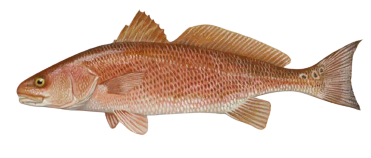
Red drum
Bag limit1
The maximum number of individual fish legally harvested per harvester per day. Bag limits are only for properly licensed anglers actively harvesting the species. People who are not actively harvesting or are not properly licensed (if a license is required) may NOT be counted for the purpose of bag limits.
Min size18" (Total Length)
No person shall harvest any individual fish less than the minimum size limit.
Total length means the straight line distance from the most forward point of the head with the mouth closed, to the farthest tip of the tail with the tail compressed or squeezed, while the fish is lying on its side.
Max size27" (Total Length)
No person shall harvest any individual fish greater than the maximum size except as permitted.
Total length means the straight line distance from the most forward point of the head with the mouth closed, to the farthest tip of the tail with the tail compressed or squeezed, while the fish is lying on its side.
Restrictions & requirements
Gigging
Harvest by gigging prohibited.
Spears
Harvest of this species by "spearing" is prohibited. Spearing includes the catching or taking of a fish by bow hunting, gigging, spearfishing, or by any device used to capture a fish by piercing the body.
Required licenses
Additional information
Edibility
Synonyms


Free trial available