
Top fish species at Cartoogechaye Creek
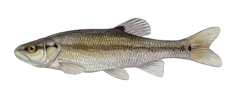

Check which species have trophy potential in Cartoogechaye Creek

Cartoogechaye Creek fishing reports
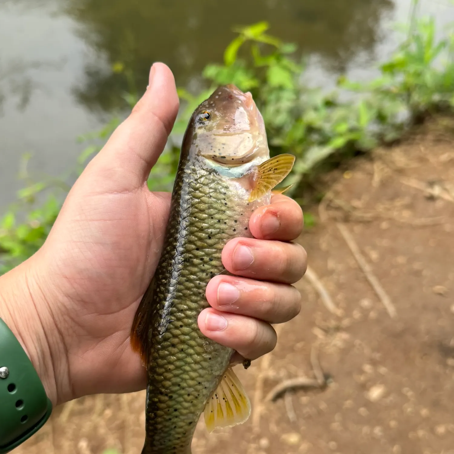
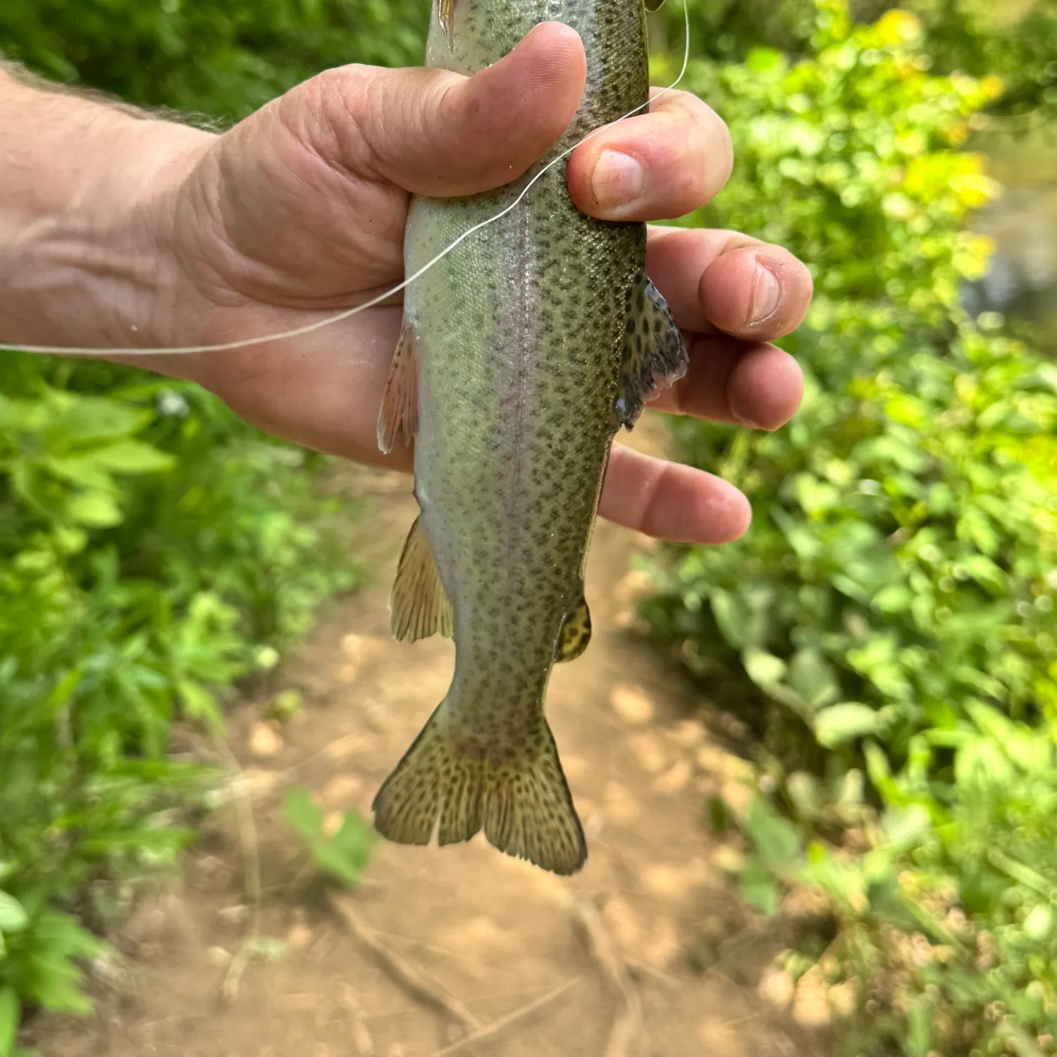
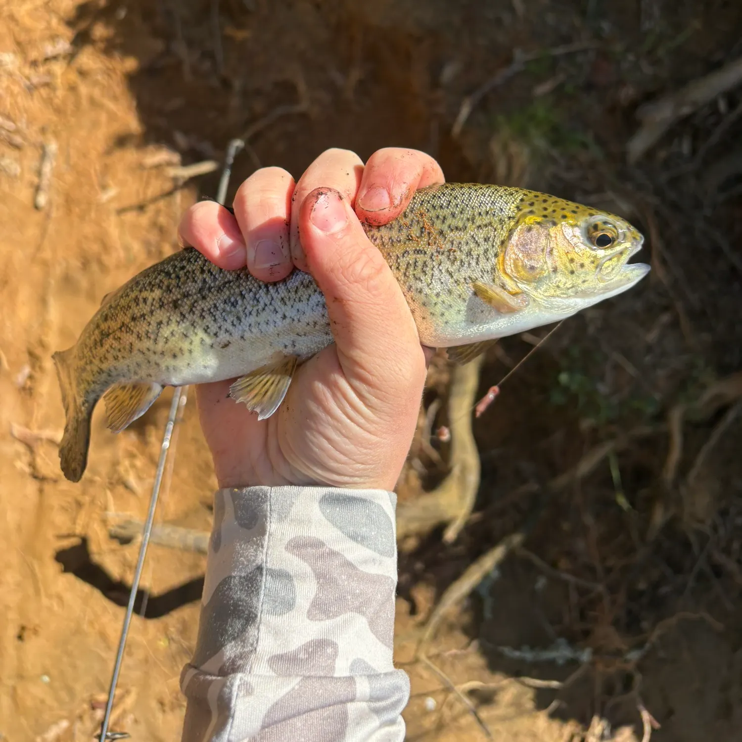
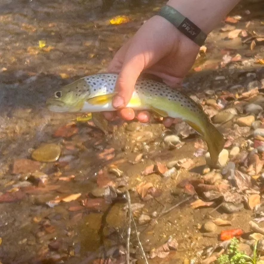
length · weight
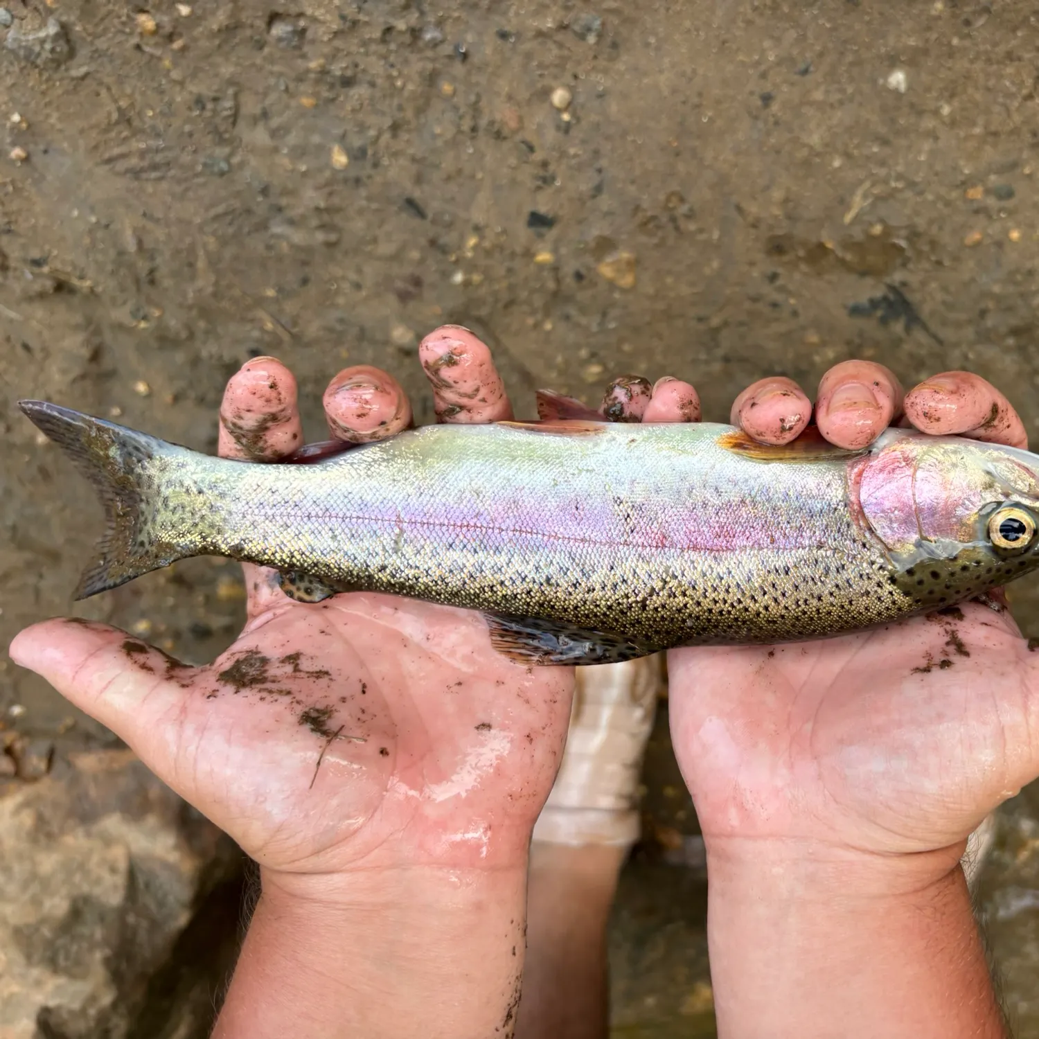


Continue browsing catches and catch locations in the Fishbrain app

Fishing regulations at Cartoogechaye Creek, NC
Disclaimer: Always check local fishing regulations, water access rights and land ownership before fishing, regardless of any catches logged in that area by the Fishbrain community. Fishbrain has mapped millions of acres of government-owned land across the USA to help you identify potential fishing access, but you are responsible for ensuring compliance with all legal requirements.
Fishing regulations in North Carolina can change throughout the year. Make sure to check this page before fishing for the most up to date rules and regulations for the current season. Local regulations govern when you can fish, the max size of the fish you can keep, how many fish you can keep, and more.
Regulations for top species
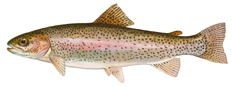
Rainbow trout
Bag limit7
The maximum number of individual fish legally harvested per harvester per day. Bag limits are only for properly licensed anglers actively harvesting the species. People who are not actively harvesting or are not properly licensed (if a license is required) may NOT be counted for the purpose of bag limits.
Aggregate limit7
The maximum number of individual fish across an aggregate group of species legally harvested per harvester per day.
Restrictions & requirements
NC Snagging
It is unlawful to snag fish by pulling or jerking a device equipped with one or more hooks through the water for the purpose of impaling fish. Applies to game and nongame fish.
NC Unlawful Possession
It is unlawful to possess:more than the daily creel limit while fishing, boating or afield; at any place more than three days' creel limit; fish whose size, creel or season restrictions are not in compliance with the regulations on the waters being fished.
NC Altering Fish
It is unlawful, while fishing, to change the appearance of fish subject to size limits or daily creel limits or remove the head and/ or tail from fish that are regulated by a size limit so that they may not be measured and/ or identified.
NC Purchase and Sale of Gamefish
The purchase and sale of inland game fish are unlawful, except from and by licensed commercial trout ponds and fish propagators.
NC Trotlines Set-hooks and Jug-hooks
Trotlines, set-hooks and jug-hooks may be fished under any license that authorizes fishing privileges. It is unlawful to use live bait with trotlines, set-hooks or jug-hooks. Trotlines must be set parallel to the nearest shore in all public waters, where their use is authorized. Each trotline, set-hook and jug-hook shall have attached the user's name and address or the user's NCWRC customer number legibly inscribed. Each trotline shall be conspicuously marked at each end, and each set-hook shall be conspicuously marked at one end with a prominent flag or floating object. Metal cans and glass containers cannot be used as markers. The number of jug-hooks that may be fished is limited to 70 per boat. Trotlines, set-hooks and jug-hooks must be fished daily, and all fish must be removed daily. Exceptions:· No trotlines, set-hooks or jug-hooks may be used in the impounded waters of Sandhills Game Land. · No trotlines, set-hooks or jug-hooks may be used in Public Mountain Trout Waters, except impounded waters of power reservoirs and municipal water supply reservoirs open to the public for fishing. · In Lake Waccamaw, it is unlawful to use trotlines, set-hooks or jug-hooks from May 1–Sept. 30. · No trotlines, jug hooks, and set hooks in the inland fishing waters of the Roanoke River from April 1 to June 30.
NC Single Barbless Hook
In the inland waters of the Roanoke River upstream of the U.S. 258 bridge, only a single barbless circle hook when fishing with live or natural bait or other tackle with a single barbless hook may be used from April 1 to June 30. "Barbless" means that the hook either does not have a barb or that the barb is bent down. Tandem rigs are prohibited.
NC Mountain Trout Waters
Fishing in Public Mountain Trout Waters Fishing is limited to hook and line only.It is unlawful to take fish bait or bait fish from Public Mountain Trout Waters.It is unlawful to possess natural bait while fishing Wild Trout and Catch and Release waters, unless those waters are also specifically classified for use of natural bait. Dropper flies may be used when fishing any Public Mountain Trout Waters.Fishing is not allowed in Hatchery Supported Trout Waters during the closed season except in the Linville River and tributaries within Linville Gorge Wilderness Area and on power reservoirs and municipal water supply reservoirs designated as trout waters (Bear Creek Lake, Buckeye Creek Reservoir, Calderwood Reservoir, Cedar Cliff Lake, Cheoah Reservoir, Cliffside Lake, Tanassee Creek Lake, Queens Creek Lake, and Wolf Lake). Non-trout species may be harvested from Delayed Harvest Trout Waters during the catch-and-release only trout season under applicable size and creel limits.It is unlawful to place hatchery-reared fish into Wild Trout Waters or move wild fish from one stream to another on game lands without prior written authorization.Information and regulations about trout fishing on game lands are listed on Other Trout Fishing Waters.Trout Fishing in Undesignated Waters Some waters that are not designated as Public Mountain Trout Waters contain mountain trout. When fishing in undesignated waters, there is no size limit or bait restrictions and the creel limit is seven trout per day, with no closed season.Public Mountain Trout Waters Some Public Mountain Trout Waters are managed for self-sustaining trout populations, while others have to be stocked periodically to provide a fishery. Public Mountain Trout Waters are as follows:Catch and Release/Artificial Flies and Lures Only Trout WatersDelayed Harvest Trout Waters -excluding tributaries except as noted, may be fished only with artificial lures with one single hook, no natural bait may be possessed, and no trout may be harvested or possessed while fishing these waters between Oct. 1 and 30 minutes after sunset on the Friday before the first Saturday of the following June. At 12 p.m. on the first Saturday of June, these waters open for all anglers under Hatchery Supported Trout Waters regulations. These waters are marked with black-and-white signs.Hatchery Supported Trout Waters - there is no size limit or bait restriction, and the creel limit is seven trout per day. These waters are marked with green-and-white signs.Special Regulation Trout Waters- These portions of Public Mountain Trout Waters, excluding tributaries except as noted, are subject to watercourse-specific, special regulations. These streams are marked with white-and-red signs.Wild Trout Waters- In all Wild Trout Waters, the minimum length limit is seven inches and the creel limit is four trout per day. Only artificial lures with one single hook may be used. All Public Mountain Trout Waters located on game lands are Wild Trout Waters unless classified and posted otherwise. Wild Trout Waters are marked with blue-and-yellow signs.Wild Trout/Natural Bait Waters - These waters and their tributaries, except as noted, may be fished with artificial lures or natural bait, except live fish. Lures and natural baits are restricted to one single hook. The minimum length limit is seven inches, and the daily creel limit is four trout. These streams are marked with brown-and-yellow signs.Some of these public trout waters are also classified as Mountain Heritage Trout Waters and are identified on Other Trout Fishing Waters.
NC Mountain Trout Regulations by County
Mountain Trout Regulations by County Alleghany CountyDELAYED HARVEST TROUT WATERS• Little River (S.R. 1133 bridge to 275 yards downstream of the intersection of S.R. 1128 and S.R. 1129 [marked by a sign on each bank])HATCHERY SUPPORTED TROUT WATERS• Big Pine Creek• Bledsoe Creek• Brush Creek (N.C. 21 bridge to confluence with Little River, except where posted against trespassing)• Cranberry Creek• (Big) Glade Creek• Little River (275 yards downstream of the intersection of S.R. 1128 and S.R. 1129 [marked by a sign on each bank] to McCann Dam) • Meadow Fork• Pine Swamp Creek• Piney Fork• Prathers CreekWILD TROUT WATERS• All waters located on Stone Mountain State Park Ashe CountyCATCH AND RELEASE/ARTIFICIAL FLIES AND LURES ONLY TROUT WATERS• Big Horse Creek (Virginia state line to Mud• Creek at S.R. 1363, excluding tributaries)DELAYED HARVEST TROUT WATERS• Big Horse Creek (S.R. 1324 bridge to North Fork New River)• Helton Creek (900 yards upstream of S.R. 1372 bridge [marked by a sign on each bank] to North Fork New River)• South Fork New River (upstream end of Todd Island to the S.R. 1351 bridge)• Trout LakeHATCHERY SUPPORTED TROUT WATERS• Beaver Creek (N.C. 221 to confluence of Beaver Creek and South Beaver Creek)• Big Horse Creek (Mud Creek at S.R. 1363 to S.R. 1324 bridge)• Big Laurel Creek (S.R. 1315 bridge to confluence with North Fork New River)• Buffalo Creek (S.R. 1133 bridge to N.C. 194- 88 bridge)• Cranberry Creek (Alleghany Co. line to South Fork New River)• Nathans Creek• North Fork New River (Watauga Co. line to Sharp Dam)• Old Fields Creek (N.C. 221 to South Fork New River)• Peak Creek (upstream property boundary of NCDA-NCSU Upper Mountain Research Station to Trout Lake, except Blue Ridge Parkway waters)• Roan Creek• Three Top Creek Avery CountyCATCH AND RELEASE/ARTIFICIAL FLIES AND LURES ONLY TROUT WATERS• Elk River (portion on Lees-McRae College• property, excluding the millpond)• Lost Cove Creek (game land portion, excluding Gragg Prong and Rockhouse Creek) • Wilson Creek (game land portion)HATCHERY SUPPORTED TROUT WATERS• Boyde Coffey Lake• Elk River (S.R. 1305 crossing immediately up-stream of Big Falls to the Tennessee state line)• Linville River (S.R. 1504 to the Blue Ridge Parkway boundary line, except where posted against trespassing)• Milltimber Creek• North Toe River—upper (Watauga St. to Roby• Shoemaker Wetlands and Family Recreational• Park, except where posted against trespassing) • North Toe River—lower (S.R. 1164 to Mitchell Co. line, except where posted against trespassing)• Squirrel Creek • Wildcat LakeWILD TROUT WATERS• Birchfield Creek• Cow Camp Creek• Cranberry Creek (headwaters to U.S.19E/N.C. 194 bridge) • Gragg Prong• Horse Creek• Kentucky Creek• North Harper Creek• Plumtree Creek• Roaring Creek• Rockhouse Creek• Shawneehaw Creek (portion adjacent to Banner Elk Greenway) • South Harper Creek• Webb Prong Buncombe CountyCATCH AND RELEASE/ARTIFICIAL FLIES AND LURES ONLY TROUT WATERS• Carter Creek (game land portion)HATCHERY SUPPORTED TROUT WATERS• Bent Creek (headwaters to N.C. Arboretum boundary line)• Cane Creek (headwaters to S.R. 3138 bridge) • Corner Rock Creek (Little Andy Creek to confluence with Walker Branch)• Dillingham Creek (Corner Rock Creek to Ivy Creek)• Ivy Creek (Ivy River) (Dillingham Creek to U.S. 19-23 bridge)• Lake Powhatan• Reems Creek (Sugar Camp Fork to U.S.19-23 bridge, except where posted against trespassing)• Rich Branch (downstream from the confluence with Rocky Branch)• Stony Creek• Swannanoa River (S.R. 2702 bridge near• Ridgecrest to Wood Avenue bridge [inter- section of N.C. 81 and U.S. 74A in Asheville], except where posted againsttrespassing) Burke CountyCATCH AND RELEASE/ARTIFICIAL FLIES AND LURES ONLY TROUT WATERS• Henry Fork (portion on South Mountains State Park)DELAYED HARVEST TROUT WATERS• Jacob Fork (Shinny Creek to lower South Mountains State Park boundary)HATCHERY SUPPORTED TROUT WATERS• Carroll Creek (portion on game lands above S.R. 1405)• Henry Fork (lower South Mountains State Park line downstream to S.R. 1919 at Ivy Creek)• Linville River (portion within Linville Gorge• Wilderness Area (LGWA) and portion be- low Lake James powerhouse from upstream bridge on S.R. 1223 to Muddy Creek) There is no closed season within LGWA.SPECIAL REGULATION TROUT WATERS• Catawba River (Muddy Creek to City of Mor- ganton water intake dam). The creel limit is two trout per day, and the minimum size limit is 14 inches. No bait restrictions. No closed season.WILD TROUT WATERS• All waters located on South Mountains State Park except Clear Creek Reservoir, the main stream of Jacob Fork between the mouth of Shinny Creek and the lower park boundary, and Henry Fork and its tributaries• Nettle Branch (game land portion) Caldwell CountyDELAYED HARVEST TROUT WATERS• Wilson Creek (game land portion below Lost Cove Creek to Phillips Branch)HATCHERY SUPPORTED TROUT WATERS• Boone Fork Pond• Buffalo Creek (mouth of Joes Creek to Mc-Cloud Branch)• Joes Creek (first falls upstream of S.R. 1574 to confluence with Buffalo Creek)• Wilson Creek (Phillips Branch to Brown Mountain Beach Dam, except where posted against trespassing)• Yadkin River (Happy Valley Ruritan Community• Park to S.R. 1515)WILD TROUT WATERS• Buffalo Creek (Watauga Co. line to Long Ridge Branch including tributaries on game lands) • Joes Creek (Watauga Co. line to first falls upstream of the end of S.R. 1574)• Rockhouse Creek Cherokee CountyHATCHERY SUPPORTED TROUT WATERS• Davis Creek (confluence of Bald and Dockery creeks to Hanging Dog Creek)• Hyatt Creek (Big Dam Branch to Valley River) • Junaluska Creek (Ashturn Creek to Valley River) • Shuler Creek (Joe Brown Hwy. [S.R. 1325] bridge to Tennessee state line)• Valley River (S.R. 1359 to U.S. 19 Business bridge in Murphy)SPECIAL REGULATION TROUT WATERS• Apalachia Reservoir. The creel limit is three trout per day. There is no minimum size limit, but only one trout may be greater than 14 inches. No bait restrictions. No closed season.WILD TROUT/NATURAL BAIT WATERS• Bald Creek (game land portion)• Dockery Creek (game land portion) Clay CountyDELAYED HARVEST TROUT WATERS• Fires Creek (Rockhouse Creek to the foot bridge in the USFS Fires Creek Picnic Area)HATCHERY SUPPORTED TROUT WATERS• Buck Creek (game land portion downstream of U.S. 64 bridge)• Fires Creek (foot bridge in the USFS Fires Creek Picnic Area to S.R. 1300)• Tusquitee Creek (Compass Creek to lower S.R. 1300 bridge) Graham CountyDELAYED HARVEST TROUT WATERS• (Big) Snowbird Creek (USFS footbridge at the old railroad junction to USFS Road 2579)HATCHERY SUPPORTED TROUT WATERS• Calderwood Reservoir (Cheoah Dam to Tennessee state line)• Cheoah Reservoir• Panther Creek (confluence of Stand Creekand Rock Creek to Lake Fontana• Santeetlah Creek (Johns Branch to Lake Santeetlah)• (Big) Snowbird Creek (USFS Road 2579 to S.R. 1127 bridge)• Stecoah Creek (upper game land boundary to Lake Fontana)• Tulula Creek (S.R. 1201 to lower bridge on S.R. 1275)• West Buffalo Creek• Yellow Creek (Lake Santeetlah Hydropower• Pipeline to Cheoah River)WILD TROUT WATERS• Little Buffalo Creek• South Fork Squally Creek • Squally CreekWILD TROUT/NATURAL BAIT WATERS• Long Creek (game land portion) Haywood CountyDELAYED HARVEST TROUT WATERS• West Fork Pigeon River (Queen Creek to the first game land boundary upstream of Lake Logan)HATCHERY SUPPORTED TROUT WATERS• Cold Springs Creek (Fall Branch to Pigeon River)• Jonathan Creek (upstream S.R. 1302 bridge to Pigeon River, except where posted against trespass)• Pigeon River (Stamey Cove Branch to up-stream U.S. 19-23 bridge)• Richland Creek (Russ Avenue [U.S. 276] bridge to U.S. 19 bridge)• West Fork Pigeon River (Tom Creek to• Queen Creek, including portions on game lands, except Middle Prong) Henderson CountyDELAYED HARVEST TROUT WATERS• North Fork Mills River (game land portion below the Hendersonville watershed dam)HATCHERY SUPPORTED TROUT WATERS• (Rocky) Broad River (end of S.R. 1611 to Rutherford Co. line)• Cane Creek (railroad bridge upstream of S.R. 1551 bridge to U.S. 25 bridge)• Clear Creek (Laurel Fork to S.R. 1582)• Green River (Lake Summit powerhouse to• game land boundary)• (Big) Hungry River (S.R. 1885 to Green River) Jackson CountyCATCH AND RELEASE/ARTIFICIAL FLIES AND LURES ONLY TROUT WATERS• Flat Creek• (East Fork) Tuckasegee River (game land portion upstream of Tanasee Creek Lake, including Duke Energy powerline corridor)DELAYED HARVEST TROUT WATERS• Tuckasegee River (downstream N.C. 107 bridge to the falls located 275 yards up- stream of the U.S. 23-441 bridge [marked by a sign on each bank])HATCHERY SUPPORTED TROUT WATERS• Balsam Lake• Bear Creek Lake• Cedar Cliff Lake• Cullowhee Creek (Tilley Creek to Tuckasegee River)• Dark Ridge Creek (Jones Creek to Scott Creek)• Greens Creek (Greens Creek Baptist Church on S.R. 1370 to Savannah Creek)• Savannah Creek (Shell Branch to Cagle Branch)• Scott Creek (Dark Ridge Creek to Tuckasegee River, except where posted against trespassing)• Tanasee Creek Lake• Tuckasegee River—upper (John Brown Branch to the downstream N.C. 107 bridge)• Tuckasegee River—lower (falls located 275 yards upstream of U.S. 23-441 bridge [marked by a sign on each bank] to S.R. 1534 bridge at Wilmot)• Wolf Creek LakeWILD TROUT WATERS• Gage Creek• North Fork Scott Creek• Tanasee Creek• Whitewater River (downstream from Silver Run Creek to South Carolina state line)• Wolf Creek (except Balsam Lake and Wolf Creek Lake)WILD TROUT/NATURAL BAIT WATERS• Chattooga River (S.R. 1100 bridge to South Carolina state line) Macon CountyDELAYED HARVEST TROUT WATERS• Nantahala River (Whiteoak Creek to Nantahala hydropower discharge canal)HATCHERY SUPPORTED TROUT WATERS• Burningtown Creek (Left Prong to Little Tennessee River)• Cartoogechaye Creek (downstream U.S. 64 bridge to Little Tennessee River)• Cliffside Lake• Cullasaja River (Sequoyah Dam to U.S. 64 bridge near junction of S.R. 1672)• Nantahala River—upper (Dicks Creek to Whiteoak Creek)• Nantahala River—lower (Nantahala hydropower discharge canal to Swain Co. line) • Queens Creek LakeWILD TROUT/NATURAL BAIT WATERS• Chattooga River (S.R. 1100 bridge to South Carolina state line)• Kimsey Creek • Park Creek Madison CountyDELAYED HARVEST TROUT WATERS• Big Laurel Creek (N.C. 208 bridge to the U.S. 25-70 bridge)• Shelton Laurel Creek (N.C. 208 bridge at Bel- va to the confluence with Big Laurel Creek)• Spring Creek (N.C. 209 bridge at Hot Springs city limits to iron bridge at end of Andrews Avenue)HATCHERY SUPPORTED TROUT WATERS• Big Laurel Creek (Puncheon Fork to the S.R. 1318 [Big Laurel Road] bridge downstream of Bearpen Branch)• Big Pine Creek (S.R. 1151 bridge to French Broad River)• Little Ivy Creek (confluence of Middle Fork and Paint Fork at • Beech Glen to confluence with Ivy Creek at Forks of Ivy)• Max Patch Pond• Meadow Fork (Meadow Fork Campground to Spring Creek)• Puncheon Fork (Wolf Laurel Branch to Big Laurel Creek)• Roaring Fork (Fall Branch to Meadow Fork) • Shelton Laurel Creek (confluence of Big Creek and Mill Creek to N.C. 208 bridge at Belva) • Shut-in Creek• Spillcorn Creek• Spring Creek (junction of N.C. 209 and N.C. 63 to the confluence with Meadow Fork)• West Fork Shut-in Creek (lower game land boundary to confluence with East Fork Shut-in Creek) McDowell CountyCATCH AND RELEASE/ARTIFICIAL FLIES AND LURES ONLY TROUT WATERS• Newberry Creek (game land portion)DELAYED HARVEST TROUT WATERS• Catawba River (portion adjacent to Marion Greenway)• Curtis Creek (game land portion downstream of the USFS boundary at Deep Branch)• Mill Creek (U.S. 70 bridge to I-40 bridge)HATCHERY SUPPORTED TROUT WATERS• Armstrong Creek (Cato Holler lower line downstream to upper Greenlee line)• Catawba River (Catawba Falls Campground to Old Fort Recreation Park)• Little Buck Creek (game land portion)• North Fork Catawba River (headwaters to North Cove School at S.R. 1569 bridge) Mitchell CountyDELAYED HARVEST TROUT WATERS• Cane Creek (N.C. 226 bridge to S.R. 1189 bridge) • North Toe River (U.S. 19E bridge to N.C.226 bridge)HATCHERY SUPPORTED TROUT WATERS• Big Rock Creek (headwaters to N.C. 226 bridge at S.R. 1307 intersection)• Cane Creek (S.R. 1219 to N.C. 226 bridge)• East Fork Grassy Creek• Grassy Creek (East Fork Grassy Creek to mouth)• Little Rock Creek (Green Creek bridge to Big• Rock Creek, except where posted against trespassing)• North Toe River (Avery Co. line to S.R. 1121 bridge)WILD TROUT WATERS· Green Creek (above Green Creek bridge, except where posted against trespassing)· Little Rock Creek (above Green Creek, in-· cluding all tributaries, except where posted· against trespassing)· Wiles Creek (game land boundary to mouth) Polk CountyDELAYED HARVEST TROUT WATERS • Green River (Fishtop Falls Access Area to the confluence with Cove Creek)HATCHERY SUPPORTED TROUT WATERS • Green River (Mouth of Cove Creek to the natural gas pipeline crossing) • North Pacolet River (Joels Creek to N.C. 108 bridge) Rutherford CountyHATCHERY SUPPORTED TROUT WATERS• (Rocky) Broad River (Henderson Co. line to U.S. 64/74 bridge, except where posted against trespassing) Stokes CountyHATCHERY SUPPORTED TROUT WATERS• Dan River (Virginia state line downstream to a point 200 yards below the end of S.R. 1421) Surry CountyDELAYED HARVEST TROUT WATERS• Ararat River (portion adjacent to Ararat River Greenway)• Mitchell River (0.6 mile upstream of the end of S.R. 1333 to the lowermost bridge on S.R. 1330)HATCHERY SUPPORTED TROUT WATERS• Ararat River (S.R. 1727 bridge downstream to the N.C. 103 bridge)• Big Elkin Creek (Dam 440 yards upstream of N.C. 268 bridge to a point 265 yards downstream of N.C. 268 [marked by a sign on each bank])• Fisher River (Cooper Creek) (Virginia state line to I-77 bridge)• Little Fisher River (Virginia state line to N.C. 89 bridge)• Lovills Creek (U.S. 52 Business bridge to Ararat River)• Pauls Creek (Virginia state line to 0.3 miles below S.R. 1625 bridge) Swain CountyDELAYED HARVEST TROUT WATERS• Tuckasegee River (U.S. 19 bridge to Slope Street bridge)HATCHERY SUPPORTED TROUT WATERS• Alarka Creek (game land boundary to Fon- tana Reservoir)• Calderwood Reservoir (Cheoah Dam to Ten- nessee state line)• Cheoah Reservoir• Connelly Creek (Camp Branch to Tuckasegee River)• DeepCreek(GreatSmokyMountainsNational Park boundary line to Tuckasegee River) • Nantahala River (Macon Co. line to existing• Fontana Reservoir water level) Transylvania CountyCATCH AND RELEASE/ARTIFICIAL FLIES AND LURES ONLY TROUT WATERS• Davidson River (headwaters to Avery Creek,excluding Avery Creek, Looking Glass Creek, Grogan Creek, Cedar Rock Creek, and John Rock Branch)DELAYED HARVEST TROUT WATERS • East Fork French Broad River (East Fork Baptist Church to the downstream S.R. 1107 bridge) • Little River (confluence of Lake Dense to 100 • yards downstream of Hooker Falls)HATCHERY SUPPORTED TROUT WATERS • Davidson River (Avery Creek to lower USFS boundary line) • French Broad River (confluence of North Fork French Broad River and West Fork French Broad River to the Island Ford Rd. [S.R. 1110] Access Area) • Middle Fork French Broad River (upstream U.S. 178 bridge to French Broad River) • West Fork French Broad River (S.R. 1312 to confluence with North Fork French Broad)WILD TROUT WATERS • All waters located on Gorges State Park• Whitewater River (downstream from Silver• Run Creek to South Carolina state line)WILD TROUT/NATURAL BAIT WATERS• North Fork French Broad River (game land portion downstream of S.R. 1326)• Thompson River (S.R. 1152 to South Carolina state line, except where posted against trespassing) Watauga CountyCATCH AND RELEASE/ARTIFICIAL FLIES AND LURES ONLY TROUT WATERS• Laurel Creek (confluence of North and South• Fork Laurel creeks to Elk Creek, excluding tributaries)• Pond Creek (headwaters to Locust Ridge• Road bridge, excluding the pond adjacent to Lake Coffey)DELAYED HARVEST TROUT WATERS• Lake Coffey• Watauga River—upper (S.R. 1114 bridge to• Valle Crucis Community Park lower boundary)• Watauga River—lower (S.R. 1103 bridge confluence with Laurel Creek)HATCHERY SUPPORTED TROUT WATERS• Beaverdam Creek (confluence of Beaverdam Creek and Little Beaverdam Creek to an unnamed tributary adjacent to the intersection of S.R. 1201 and S.R. 1203)• Beech Creek• Buckeye Creek (Buckeye Creek Reservoir dam to Grassy Gap Creek)• Buckeye Creek Reservoir• Cove Creek (S.R. 1233 bridge at Zionville to• S.R. 1214 bridge at Sherwood)• Dutch Creek (S.R. 1136 bridge to the mouth) • Elk Creek (S.R. 1510 bridge at Triplett to• Wilkes Co. line, except where posted against trespassing)• Laurel Creek (S.R. 1123 bridge at S.R. 1157 intersection to Watauga River)• Meat Camp Creek (S.R. 1340 bridge at S.R. 1384 intersection to N.C. 194)• Middle Fork New River (adjacent to inter- section of S.R. 1539 and U.S. 321 to South Fork New River)• Norris Fork Creek• South Fork New River (canoe launch 70 yards upstream of U.S. 421 bridge to lower boundary of Brookshire Park)• Stony Fork (S.R. 1500 bridge at S.R. 1505 intersection to Wilkes Co. line)WILD TROUT WATERS• Dutch Creek (headwaters to S.R. 1136 bridge) • Howard Creek• Maine Branch (headwaters to North Fork New River)• North Fork New River (from confluence with• Maine and Mine branches to Ashe Co. line) • Watauga River (Avery Co. line to S.R. 1580 bridge)• Winkler Creek (lower bridge on S.R. 1549 to confluence with South Fork New River) Wilkes CountyDELAYED HARVEST TROUT WATERS• East Prong Roaring River (Bullhead Creek downstream to Stone Mountain State Park lower boundary) • Elk Creek—upper (Watauga Co. line to lower boundary of Blue Ridge Mountain Club) • Elk Creek—lower (portion on Leatherwood • Mountains Development) • Reddies River (Town of North Wilkesboro water intake dam to confluence with Yadkin River) • Stone Mountain Creek (from falls at Allegh- any Co. line to confluence with East Prong • Roaring River and Bullhead Creek)HATCHERY SUPPORTED TROUT WATERS • Basin Creek (S.R. 1730 bridge to confluence with Lovelace Creek) • Bell Branch Pond • Boundary Line Pond • Cub Creek (0.5 miles upstream of S.R. 2460 bridge to S.R. 1001 bridge) • Darnell Creek (North Prong Reddies River) (downstream ford on S.R. 1569 to confluence with North Fork Reddies River) • East Prong Roaring River (Stone Mountain • State Park lower boundary to S.R. 1002 bridge) • Fall Creek (S.R. 1300 bridge to confluence with South Prong Lewis Fork, except where posted against trespassing) • Middle Fork Reddies River (Clear Prong) headwaters to bridge on S.R. 1580) • Middle Prong Roaring River (headwaters to second bridge on S.R. 1736) • North Fork Reddies River (Vannoy Creek) (headwaters to Union School bridge on S.R. 1559) • Pike Creek • Pike Creek Pond • South Fork Reddies River (S.R. 1355 bridge to· confluence with Middle Fork Reddies River) · South Prong Lewis Fork (Fall Creek to U.S. 421 bridge adjacent to S.R. 1155 intersection)WILD TROUT WATERS• All waters located on Stone Mountain State Park, except East Prong Roaring River from Bullhead Creek downstream to the Stone Mountain State Park lower boundary where Delayed Harvest Trout Waters regulations apply, and Stone Mountain Creek from falls at Alleghany County line to confluence with East Prong Roaring River and Bullhead Creek in Stone Mountain State Park where Delayed Harvest Trout Waters regulations apply. Yancey CountyCATCH AND RELEASE/ARTIFICIAL FLIES AND LURES ONLY TROUT WATERS• South Toe River (headwaters to Upper Creek) • Upper CreekDELAYED HARVEST TROUT WATERS• Cane River (Blackberry Ridge Road to down- stream boundary of Cane River County Park)HATCHERY SUPPORTED TROUT WATERS• Bald Mountain Creek (except where posted against trespassing)• Cane River (Bee Branch [S.R. 1110] to Bowlens Creek)• Price Creek (junction of S.R. 1120 and S.R. 1121 to Indian Creek)• South Toe River (Clear Creek to lower bound- ary line of Yancey Co. recreation park, except where posted against trespassing)WILD TROUT WATERS• Cattail Creek (bridge at Mountain Farm Com- munity Road to N.C. 197 bridge)• Lickskillet Creek• Middle Creek (game land boundary to mouth) Heritage Trout Waters are marked with signs posted conspicuously along the watercourses. A resident or nonresident of this State who served as a member of the Armed Forces and who separated under honorable conditions is exempt from fishing license requirements while fishing in waters designated by the Wildlife Re- sources Commission as Mountain Heritage Trout waters. In order to qualify the individual shall have valid documentation of their service on their person at all times during the fishing activity. Ashe County • Lansing: Big Horse Creek (S.R. 1324 bridge to North Fork New River) [Delayed Harvest Trout Waters regulations apply] • Todd: South Fork New River (upstream end of Todd Island to S.R. 1351 bridge) [Delayed Harvest Trout Waters regulations apply]Avery County • Newland: North Toe River (Watauga St. bridge to Roby Shomaker Wetlands and Fam- ily Recreation Park) [Hatchery Supported Trout Waters regulations apply]Haywood County • Maggie Valley: Jonathan Creek (upstream S.R. 1302 bridge to S.R. 1309 bridge) [Hatch- ery Supported Trout Waters regulations apply] • Waynesville: Richland Creek (Russ Avenue bridge to U.S. 19 bridge) [Hatchery Sup- ported Trout Waters regulations apply]Jackson County • Dillsboro: Scott Creek (Hometown Place Road to Tuckasegee River) [Hatchery Sup- ported Trout Waters regulations apply] • Tuckasegee River (Falls located 275 yards upstream of U.S. 23-441 bridge to Scott Creek) [Hatchery Supported Trout Waters regulations apply] • Tuckasegee River (Savannah Creek to falls located 275 yards upstream of U.S. 23-441 bridge) [Delayed Harvest Trout Waters regulations apply] • Sylva: Scott Creek (Hospital Road to Home- town Place Road) [Hatchery Supported Trout Waters regulations apply] • Webster: Tuckasegee River (downstream N.C. 107 bridge to Savannah Creek) [Delayed Harvest Trout Waters regulations apply]Madison County • Hot Springs: Spring Creek (N.C. 209 bridge at Hot Springs city limits to iron bridge at end of Andrews Avenue) [Delayed Harvest Trout Waters regulations apply]McDowell County • Old Fort: Mill Creek (U.S. 70 bridge to the I-40 bridge) [Delayed Harvest Trout Waters regulations apply]Mitchell County • Bakersville: Cane Creek (N.C. 226 bridge to S.R. 1189 bridge) [Delayed Harvest Trout Waters regulations apply] • Spruce Pine: North Toe River (U.S. 19E bridge to N.C. 226 bridge) [Delayed Harvest Trout Waters regulations apply]Swain County • Bryson City: Tuckasegee River (U.S. 19 bridge to Slope Street bridge) [Delayed Har- vest Trout Waters regulations apply]Watauga County • Beech Mountain: Buckeye Creek (Buckeye Creek Reservoir dam to Grassy Gap Creek) [Hatchery Supported Trout Waters regulations apply] • Buckeye Creek Reservoir [Hatchery Supported Trout Waters regulations apply] Lake Coffey [Delayed Harvest Trout Waters regulations apply] • Pond Creek (headwaters to Locust Ridge • Road bridge, excluding the pond adjacent to Lake Coffey) [Catch and Release/Artificial Flies and Lures Only Trout Waters regulations apply]Wilkes County • North Wilkesboro: Reddies River (Town of North Wilkesboro water intake dam to confluence with Yadkin River) [Delayed Harvest Trout Waters regulations apply] • Wilkesboro: Cub Creek (0.5 miles upstream of S.R. 2460 bridge to S.R. 101 bridge) [Hatchery Supported Trout Waters regulations apply]Yancey County • Burnsville: South Toe River (property bound- aries of the Yancey County Toe River Camp- ground) [Hatchery Supported Trout Waters regulations apply]
NC Game Fish Hook and Line only
Inland game fish may be taken only with a hook and line and landing nets may be used to land fishes caught on a hook and line.
Required licenses
Additional information
Edibility
Synonyms
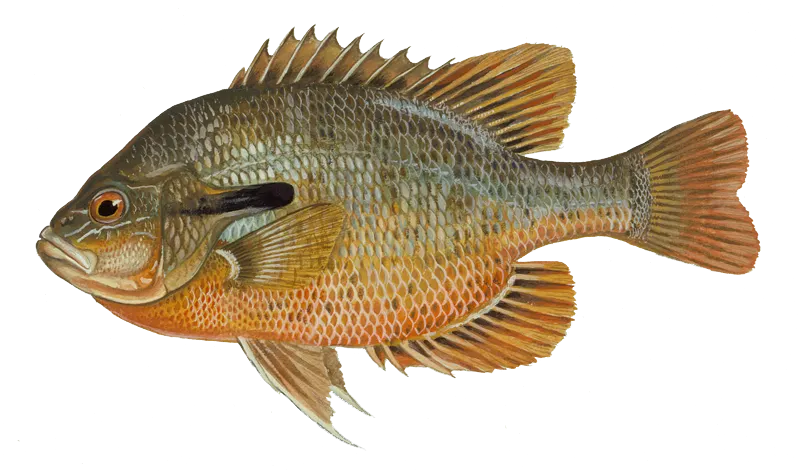
Redbreast sunfish
Restrictions & requirements
NC Snagging
It is unlawful to snag fish by pulling or jerking a device equipped with one or more hooks through the water for the purpose of impaling fish. Applies to game and nongame fish.
NC Unlawful Possession
It is unlawful to possess:more than the daily creel limit while fishing, boating or afield; at any place more than three days' creel limit; fish whose size, creel or season restrictions are not in compliance with the regulations on the waters being fished.
NC Altering Fish
It is unlawful, while fishing, to change the appearance of fish subject to size limits or daily creel limits or remove the head and/ or tail from fish that are regulated by a size limit so that they may not be measured and/ or identified.
NC Purchase and Sale of Gamefish
The purchase and sale of inland game fish are unlawful, except from and by licensed commercial trout ponds and fish propagators.
NC Trotlines Set-hooks and Jug-hooks
Trotlines, set-hooks and jug-hooks may be fished under any license that authorizes fishing privileges. It is unlawful to use live bait with trotlines, set-hooks or jug-hooks. Trotlines must be set parallel to the nearest shore in all public waters, where their use is authorized. Each trotline, set-hook and jug-hook shall have attached the user's name and address or the user's NCWRC customer number legibly inscribed. Each trotline shall be conspicuously marked at each end, and each set-hook shall be conspicuously marked at one end with a prominent flag or floating object. Metal cans and glass containers cannot be used as markers. The number of jug-hooks that may be fished is limited to 70 per boat. Trotlines, set-hooks and jug-hooks must be fished daily, and all fish must be removed daily. Exceptions:· No trotlines, set-hooks or jug-hooks may be used in the impounded waters of Sandhills Game Land. · No trotlines, set-hooks or jug-hooks may be used in Public Mountain Trout Waters, except impounded waters of power reservoirs and municipal water supply reservoirs open to the public for fishing. · In Lake Waccamaw, it is unlawful to use trotlines, set-hooks or jug-hooks from May 1–Sept. 30. · No trotlines, jug hooks, and set hooks in the inland fishing waters of the Roanoke River from April 1 to June 30.
NC Single Barbless Hook
In the inland waters of the Roanoke River upstream of the U.S. 258 bridge, only a single barbless circle hook when fishing with live or natural bait or other tackle with a single barbless hook may be used from April 1 to June 30. "Barbless" means that the hook either does not have a barb or that the barb is bent down. Tandem rigs are prohibited.
NC Game Fish Hook and Line only
Inland game fish may be taken only with a hook and line and landing nets may be used to land fishes caught on a hook and line.
Additional information
Synonyms
Free trial available