
Top fish species at Bear Canyon Reservoir

Check which species have trophy potential in Bear Canyon Reservoir
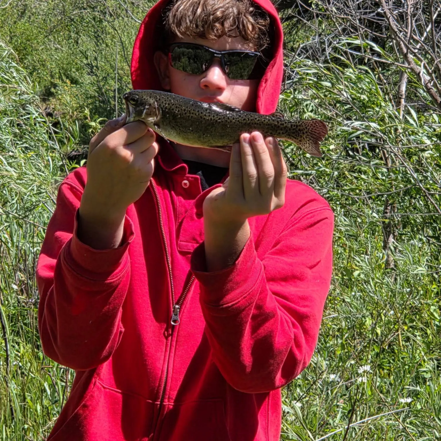
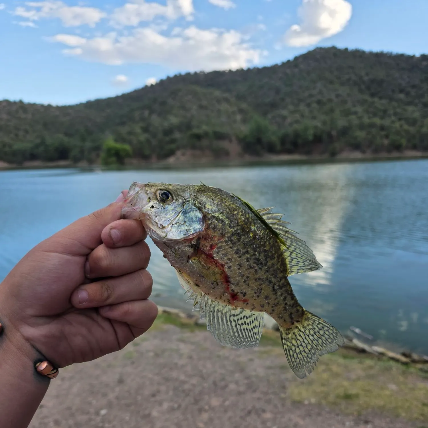
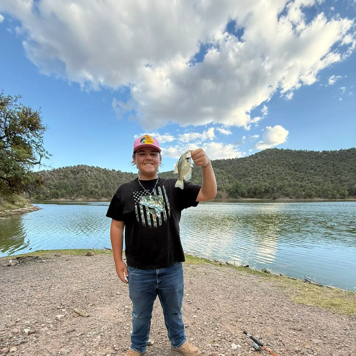
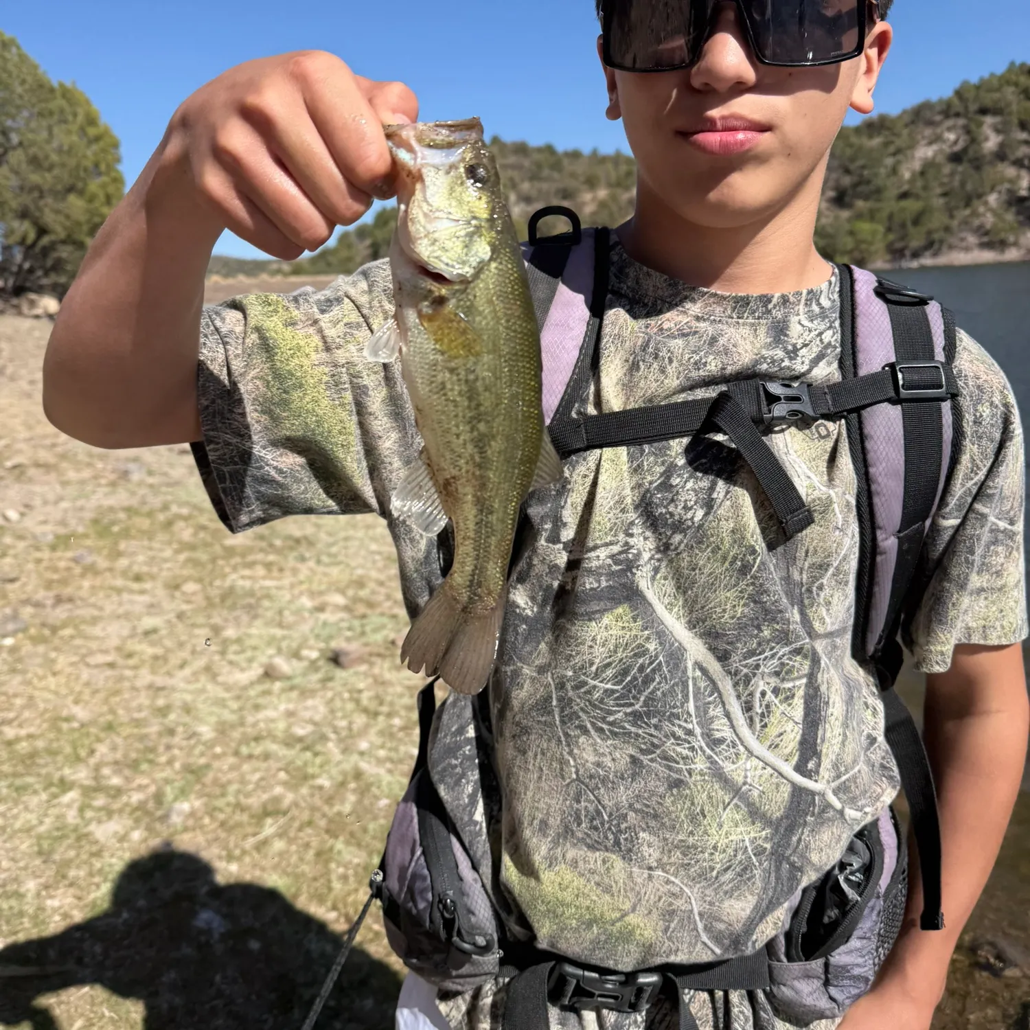
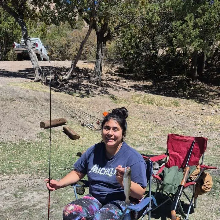
Bear Canyon Reservoir fishing reports


Continue browsing catches and catch locations in the Fishbrain app
When are Largemouth Bass biting on Bear Canyon Reservoir?
Learn what time of year and day to go fishing at Bear Canyon Reservoir. Download Fishbrain today to look for new fishing spots, scout new fishing access, or prep for your next trip.

Fishing regulations at Bear Canyon Reservoir, NM
Disclaimer: Always check local fishing regulations, water access rights and land ownership before fishing, regardless of any catches logged in that area by the Fishbrain community. Fishbrain has mapped millions of acres of government-owned land across the USA to help you identify potential fishing access, but you are responsible for ensuring compliance with all legal requirements.
Fishing regulations in New Mexico can change throughout the year. Make sure to check this page before fishing for the most up to date rules and regulations for the current season. Local regulations govern when you can fish, the max size of the fish you can keep, how many fish you can keep, and more.
Regulations for top species
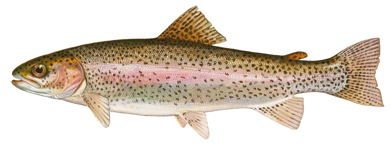
Rainbow trout
Bag limit5
The maximum number of individual fish legally harvested per harvester per day. Bag limits are only for properly licensed anglers actively harvesting the species. People who are not actively harvesting or are not properly licensed (if a license is required) may NOT be counted for the purpose of bag limits.
Aggregate limit5
The maximum number of individual fish across an aggregate group of species legally harvested per harvester per day.
Restrictions & requirements
Snagging
Harvest of this species by snagging (snatch hooking) is prohibited.
NM Mechanical or Electrical Devices
It is illegal to use mechanical or electrical devices capable of catching or killing game fish, except as permitted by regulation.
NM Bow fishing and Spear fishing
Bow fishing and spearfishing are legal means of take for game fish species and unprotected species in lakes and reservoirs open to angling. Bag and size limits for bow fishing and spearfishing are the same as angling. Bow fishing and spearfishing for game fish are not allowed in any river, stream, Special Trout Water or Trophy Bass Water (for largemouth bass). Arrows for bow fishing must be attached by a line, string or rope to enable retrieval of fish. Crossbows can be used for bow fishing. Legal means of take for spearfishing include spears, arrows with barbs and gigs. Spears can be discharged above or below the water surface. Local ordinances and/or prohibitions may apply at specific locations or waters, and the local managing agency should be contacted prior to bow fishing or spearfishing. Snorkelers and SCUBA divers should consult New Mexico State Park regulations prior to spearfishing.
NM Trotline Restriction
A trotline (throw line, limb line, set line, jug line, or "Yo-yo" line) is a line without a rod or reel attached. It does not need to be handheld nor closely attended. Trotlines are limited to 25 hooks. Trotlines belonging to two or more people may not be joined or tied together. Anglers may not fish with more than one trotline. Anglers may not check, pull up, or tamper with the trotline of another person. Any person using a trotline must attend it personally at least once every calendar day and remove or release all game fish that are caught.A person fishing with a trotline must attach an identification tag that is visible above the water line. The identification tag must list the angler's Customer Identification Number (CIN). Anglers 11 years of age and younger must list their Customer Identification Number (CIN) or their name and date of birth on the identification tag.Trotlines may be used to take game fish only in the river reaches and lakes listed by drainage:Rio Grande DrainageRiversRio Grande mainstem from its confluence with the Chama River downstream to New Mexico/Texas state line and Chama River mainstem from the northern boundary of the Monastery of LakesChrist in the Desert downstream to Abiquiu LakeAbiquiu Lake, Cochiti Lake, Elephant Butte Lake, and Caballo LakePecos River DrainageRiversPecos River mainstem downstream of I-25 (excluding Villanueva State Park) to the New Mexico/Texas state line and all tributaries within Chavez, De Baca, Eddy, Guadalupe, and San Miguel (downstream of I-25) CountiesLakesSanta Rosa Lake, Sumner Lake, Lake Avalon, Brantley Lake, Six Mile Lake, Ten Mile Reservoir, and Red Bluff ReservoirCanadian River DrainageRiversCanadian River mainstem and all tributaries downstream and east of I-25 to the New Mexico/ Texas state lineLakesStubblefield Lake, Laguna Madre, Maxwell Lake 14, Springer Lake, Conchas Lake, and Ute LakeSan Juan River DrainageRiversSan Juan River mainstem from U.S. 64 bridge at Blanco downstream to the Navajo Nation boundary at the Hogback canal diversionLakesNavajo LakeGila River and San Francisco River DrainageRiversGila River mainstem from its confluence with the east fork downstream to the New Mexico/Arizona state line and San Francisco River mainstem from U.S. 180 bridge at Alma downstream to the New Mexico/Arizona state lineLakesNone
NM Bait and Baitfish
Possession of and use of any baitfish while fishing is illegal, except as defined below. Baitfish may not be used in Special Trout Waters, Bitter Lake National Wildlife Refuge or Bottomless Lakes State Park. Bluegills and sunfish (genus Lepomis) taken legally by angling may be used as live or dead bait in the water where taken.Commercially packaged and processed dead fish are not considered baitfish and are approved for use in all waters where the use of bait is legal. Roe, viscera, and eyes of game fish taken legally may be used in all waters where the use of bait is legal. Chumming is allowed in all waters, except Special Trout Waters. Goldfish or bullfrogs (including larval stages, i.e. tadpoles) may not be used as live or dead bait in any waters. Salamander larva (waterdogs) may be used in all waters where the use of bait is legal.Approved live and/or dead baitfish locations:Rio Grande Drainage: Fathead minnow, red shiner and shadElephant Butte and Caballo reservoirs: Fathead minnow, red shiner, shad and golden shinerCanadian River Drainage: Fathead minnow, red shiner, white sucker and shadSan Juan River Drainage: Fathead minnow and red shinerGila River and San Francisco River Drainages: Fathead minnow onlyPecos River Drainage (excluding Bitter Lake National Wildlife Refuge and Bottomless Lakes State Park): Fathead minnow and red shinerApproved dead-only baitfish (cutbait) locationsStatewide: Common carpHeron Reservoir: White suckerBaitfish may only be taken for personal use and only by anglers who are currently licensed or 11 years of age or younger. Permitted methods for taking minnows include: angling, dip nets, cast nets, traps and seines. Seines may not be longer than 20 feet, and the mesh size may not be larger than 3/8-inch square. All protected species of fish (including endangered and threatened species) taken with seines, nets, and traps must immediately be returned to the water.
Additional information
Edibility
Synonyms
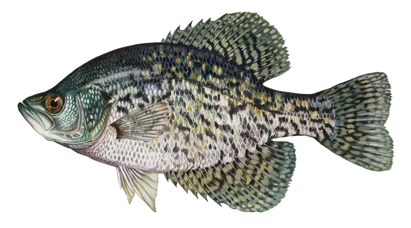
Black crappie
Bag limit20
The maximum number of individual fish legally harvested per harvester per day. Bag limits are only for properly licensed anglers actively harvesting the species. People who are not actively harvesting or are not properly licensed (if a license is required) may NOT be counted for the purpose of bag limits.
Restrictions & requirements
Snagging
Harvest of this species by snagging (snatch hooking) is prohibited.
NM Mechanical or Electrical Devices
It is illegal to use mechanical or electrical devices capable of catching or killing game fish, except as permitted by regulation.
NM Bow fishing and Spear fishing
Bow fishing and spearfishing are legal means of take for game fish species and unprotected species in lakes and reservoirs open to angling. Bag and size limits for bow fishing and spearfishing are the same as angling. Bow fishing and spearfishing for game fish are not allowed in any river, stream, Special Trout Water or Trophy Bass Water (for largemouth bass). Arrows for bow fishing must be attached by a line, string or rope to enable retrieval of fish. Crossbows can be used for bow fishing. Legal means of take for spearfishing include spears, arrows with barbs and gigs. Spears can be discharged above or below the water surface. Local ordinances and/or prohibitions may apply at specific locations or waters, and the local managing agency should be contacted prior to bow fishing or spearfishing. Snorkelers and SCUBA divers should consult New Mexico State Park regulations prior to spearfishing.
NM Trotline Restriction
A trotline (throw line, limb line, set line, jug line, or "Yo-yo" line) is a line without a rod or reel attached. It does not need to be handheld nor closely attended. Trotlines are limited to 25 hooks. Trotlines belonging to two or more people may not be joined or tied together. Anglers may not fish with more than one trotline. Anglers may not check, pull up, or tamper with the trotline of another person. Any person using a trotline must attend it personally at least once every calendar day and remove or release all game fish that are caught.A person fishing with a trotline must attach an identification tag that is visible above the water line. The identification tag must list the angler's Customer Identification Number (CIN). Anglers 11 years of age and younger must list their Customer Identification Number (CIN) or their name and date of birth on the identification tag.Trotlines may be used to take game fish only in the river reaches and lakes listed by drainage:Rio Grande DrainageRiversRio Grande mainstem from its confluence with the Chama River downstream to New Mexico/Texas state line and Chama River mainstem from the northern boundary of the Monastery of LakesChrist in the Desert downstream to Abiquiu LakeAbiquiu Lake, Cochiti Lake, Elephant Butte Lake, and Caballo LakePecos River DrainageRiversPecos River mainstem downstream of I-25 (excluding Villanueva State Park) to the New Mexico/Texas state line and all tributaries within Chavez, De Baca, Eddy, Guadalupe, and San Miguel (downstream of I-25) CountiesLakesSanta Rosa Lake, Sumner Lake, Lake Avalon, Brantley Lake, Six Mile Lake, Ten Mile Reservoir, and Red Bluff ReservoirCanadian River DrainageRiversCanadian River mainstem and all tributaries downstream and east of I-25 to the New Mexico/ Texas state lineLakesStubblefield Lake, Laguna Madre, Maxwell Lake 14, Springer Lake, Conchas Lake, and Ute LakeSan Juan River DrainageRiversSan Juan River mainstem from U.S. 64 bridge at Blanco downstream to the Navajo Nation boundary at the Hogback canal diversionLakesNavajo LakeGila River and San Francisco River DrainageRiversGila River mainstem from its confluence with the east fork downstream to the New Mexico/Arizona state line and San Francisco River mainstem from U.S. 180 bridge at Alma downstream to the New Mexico/Arizona state lineLakesNone
NM Bait and Baitfish
Possession of and use of any baitfish while fishing is illegal, except as defined below. Baitfish may not be used in Special Trout Waters, Bitter Lake National Wildlife Refuge or Bottomless Lakes State Park. Bluegills and sunfish (genus Lepomis) taken legally by angling may be used as live or dead bait in the water where taken.Commercially packaged and processed dead fish are not considered baitfish and are approved for use in all waters where the use of bait is legal. Roe, viscera, and eyes of game fish taken legally may be used in all waters where the use of bait is legal. Chumming is allowed in all waters, except Special Trout Waters. Goldfish or bullfrogs (including larval stages, i.e. tadpoles) may not be used as live or dead bait in any waters. Salamander larva (waterdogs) may be used in all waters where the use of bait is legal.Approved live and/or dead baitfish locations:Rio Grande Drainage: Fathead minnow, red shiner and shadElephant Butte and Caballo reservoirs: Fathead minnow, red shiner, shad and golden shinerCanadian River Drainage: Fathead minnow, red shiner, white sucker and shadSan Juan River Drainage: Fathead minnow and red shinerGila River and San Francisco River Drainages: Fathead minnow onlyPecos River Drainage (excluding Bitter Lake National Wildlife Refuge and Bottomless Lakes State Park): Fathead minnow and red shinerApproved dead-only baitfish (cutbait) locationsStatewide: Common carpHeron Reservoir: White suckerBaitfish may only be taken for personal use and only by anglers who are currently licensed or 11 years of age or younger. Permitted methods for taking minnows include: angling, dip nets, cast nets, traps and seines. Seines may not be longer than 20 feet, and the mesh size may not be larger than 3/8-inch square. All protected species of fish (including endangered and threatened species) taken with seines, nets, and traps must immediately be returned to the water.
Edibility
Synonyms

Largemouth bass
Bag limit5
The maximum number of individual fish legally harvested per harvester per day. Bag limits are only for properly licensed anglers actively harvesting the species. People who are not actively harvesting or are not properly licensed (if a license is required) may NOT be counted for the purpose of bag limits.
Min size14" (Total Length)
No person shall harvest any individual fish less than the minimum size limit.
Total length means the straight line distance from the most forward point of the head with the mouth closed, to the farthest tip of the tail with the tail compressed or squeezed, while the fish is lying on its side.
Aggregate limit5
The maximum number of individual fish across an aggregate group of species legally harvested per harvester per day.
Restrictions & requirements
Snagging
Harvest of this species by snagging (snatch hooking) is prohibited.
NM Mechanical or Electrical Devices
It is illegal to use mechanical or electrical devices capable of catching or killing game fish, except as permitted by regulation.
NM Bow fishing and Spear fishing
Bow fishing and spearfishing are legal means of take for game fish species and unprotected species in lakes and reservoirs open to angling. Bag and size limits for bow fishing and spearfishing are the same as angling. Bow fishing and spearfishing for game fish are not allowed in any river, stream, Special Trout Water or Trophy Bass Water (for largemouth bass). Arrows for bow fishing must be attached by a line, string or rope to enable retrieval of fish. Crossbows can be used for bow fishing. Legal means of take for spearfishing include spears, arrows with barbs and gigs. Spears can be discharged above or below the water surface. Local ordinances and/or prohibitions may apply at specific locations or waters, and the local managing agency should be contacted prior to bow fishing or spearfishing. Snorkelers and SCUBA divers should consult New Mexico State Park regulations prior to spearfishing.
NM Trotline Restriction
A trotline (throw line, limb line, set line, jug line, or "Yo-yo" line) is a line without a rod or reel attached. It does not need to be handheld nor closely attended. Trotlines are limited to 25 hooks. Trotlines belonging to two or more people may not be joined or tied together. Anglers may not fish with more than one trotline. Anglers may not check, pull up, or tamper with the trotline of another person. Any person using a trotline must attend it personally at least once every calendar day and remove or release all game fish that are caught.A person fishing with a trotline must attach an identification tag that is visible above the water line. The identification tag must list the angler's Customer Identification Number (CIN). Anglers 11 years of age and younger must list their Customer Identification Number (CIN) or their name and date of birth on the identification tag.Trotlines may be used to take game fish only in the river reaches and lakes listed by drainage:Rio Grande DrainageRiversRio Grande mainstem from its confluence with the Chama River downstream to New Mexico/Texas state line and Chama River mainstem from the northern boundary of the Monastery of LakesChrist in the Desert downstream to Abiquiu LakeAbiquiu Lake, Cochiti Lake, Elephant Butte Lake, and Caballo LakePecos River DrainageRiversPecos River mainstem downstream of I-25 (excluding Villanueva State Park) to the New Mexico/Texas state line and all tributaries within Chavez, De Baca, Eddy, Guadalupe, and San Miguel (downstream of I-25) CountiesLakesSanta Rosa Lake, Sumner Lake, Lake Avalon, Brantley Lake, Six Mile Lake, Ten Mile Reservoir, and Red Bluff ReservoirCanadian River DrainageRiversCanadian River mainstem and all tributaries downstream and east of I-25 to the New Mexico/ Texas state lineLakesStubblefield Lake, Laguna Madre, Maxwell Lake 14, Springer Lake, Conchas Lake, and Ute LakeSan Juan River DrainageRiversSan Juan River mainstem from U.S. 64 bridge at Blanco downstream to the Navajo Nation boundary at the Hogback canal diversionLakesNavajo LakeGila River and San Francisco River DrainageRiversGila River mainstem from its confluence with the east fork downstream to the New Mexico/Arizona state line and San Francisco River mainstem from U.S. 180 bridge at Alma downstream to the New Mexico/Arizona state lineLakesNone
NM Bait and Baitfish
Possession of and use of any baitfish while fishing is illegal, except as defined below. Baitfish may not be used in Special Trout Waters, Bitter Lake National Wildlife Refuge or Bottomless Lakes State Park. Bluegills and sunfish (genus Lepomis) taken legally by angling may be used as live or dead bait in the water where taken.Commercially packaged and processed dead fish are not considered baitfish and are approved for use in all waters where the use of bait is legal. Roe, viscera, and eyes of game fish taken legally may be used in all waters where the use of bait is legal. Chumming is allowed in all waters, except Special Trout Waters. Goldfish or bullfrogs (including larval stages, i.e. tadpoles) may not be used as live or dead bait in any waters. Salamander larva (waterdogs) may be used in all waters where the use of bait is legal.Approved live and/or dead baitfish locations:Rio Grande Drainage: Fathead minnow, red shiner and shadElephant Butte and Caballo reservoirs: Fathead minnow, red shiner, shad and golden shinerCanadian River Drainage: Fathead minnow, red shiner, white sucker and shadSan Juan River Drainage: Fathead minnow and red shinerGila River and San Francisco River Drainages: Fathead minnow onlyPecos River Drainage (excluding Bitter Lake National Wildlife Refuge and Bottomless Lakes State Park): Fathead minnow and red shinerApproved dead-only baitfish (cutbait) locationsStatewide: Common carpHeron Reservoir: White suckerBaitfish may only be taken for personal use and only by anglers who are currently licensed or 11 years of age or younger. Permitted methods for taking minnows include: angling, dip nets, cast nets, traps and seines. Seines may not be longer than 20 feet, and the mesh size may not be larger than 3/8-inch square. All protected species of fish (including endangered and threatened species) taken with seines, nets, and traps must immediately be returned to the water.
Additional information
Edibility
Synonyms


Free trial available