Getting familiar with Garmin HD Depth Charts
Learn to get an underwater view of whichever water you're fishing with Garmin Depth charts on Fishbrain. Garmin gives you HD sonar depth charts for a detailed view of the bottom of your favorite bodies of water. 🎉 Read on to learn more about how to access and use this new addition to your tackle box.
Share this article

Depth Charts are a staple tool for finding drop offs, shallows and other perfect fish habitats. Knowing the importance of these charts, Fishbrain teamed up with Garmin to provide the most accurate depth charts available.
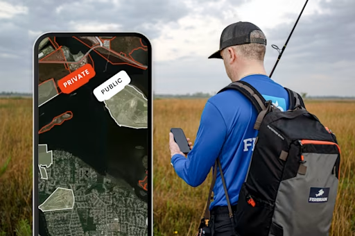
On Fishbrain Pro, you can utilize Garmin HD Bathymetry maps, as a layer on the Fishbrain Map.
Garmin, is the leading name in sonar and bathymetric depth maps for fresh and saltwater. The impressive high definition bottom contour maps are the perfect resource for finding the best fishing spots at any water level. The maps show accuracy to 0.5 meters and are compatible with all Fishbrain map functions like waypoints and catch locations.
The Benefit

Any time you are on the water, knowing the bottom features, deep holding pools, and shallows where baitfish feed, can be all the difference between fishing and catching. The Fishbrain App’s map and Garmin depth charts keep the guesswork out of your trips by showing your location and the bottom features of the body of water you’re on.
This tool not only helps real time navigation on the water, but is the perfect scouting tool pre trip. By scouting the bottom structure of the lake you are planning to fish, you save precious hours of navigating back and forth. Instead, combine waypoints with the depth charts to know exactly where you should be at first light of your fishing trip.

Garmin fills any holes left by other depth charts with a more robust base of contributors adding sonar based depth maps in more bodies of water.
Garmin is especially helpful with the larger bodies of water like lakes and oceans.
The Navionic HD depth contours are also constantly updated as new data is provided by users. The new data will automatically populate on your maps to reflect the constant change in information and the change in lake and sea bottoms.
Keep Satellite Imagery

Knowing what's above the water can be just as important as below. Overhanging trees, bushes, and half submerged logs all make for prime fish habitat and you can see those as well by selecting the "Transparent" option.Transparent Depth Charts will give you precise depths of the water you’re looking to fish, all while providing a realistic birds eye view of where you will be standing when you make your first cast.

To choose transparent depth charts, tap the "layers" icon in the top right corner, then tap "Source" just underneath "Depth Contours.
Pinpoint depths

For the most accurate depth readings, zoom in and drag the crosshairs on your screen over a spot and the depth will appear just above the crosshairs.
How To Access Garmin HD Charts

If you haven't experienced the #1 fishing app worldwide, make sure and check out Fishbrain to see all the fish data, fishing spots, weather conditions you've been missing out on plus much more.

Download the Fishbrain app and access the best fishing spots in your area
Related blog posts
Big news: Fishbrain's Best Baits feature just leveled up. Same tool you trust, now with sharper picks to help you land more bites, faster.

Fishbrain's BiteTime just got a big upgrade. We've sharpened the science behind it, so your bite predictions are more accurate than ever. Same feature, sharper results — fish smarter, starting now.
Introducing BiteGuide — Fishbrain's newest feature combining bite scores, revamped BiteTime and smarter lure tips to help you fish any condition with confidence.